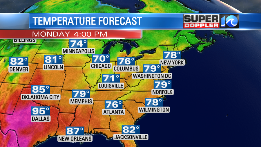
We just finished off a great weather weekend! We had high temps in the 70s and 80s with drying conditions and lots of sunshine. We are going to continue with the nice weather today. High pressure is in the region.
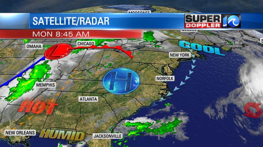
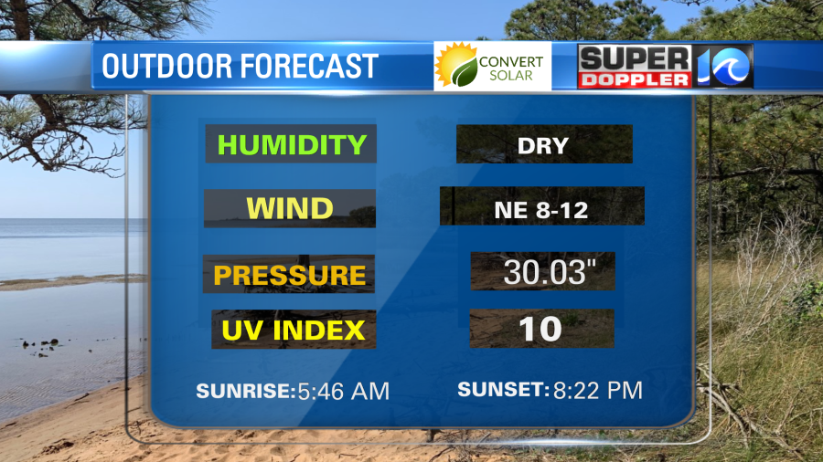
We’ll have a cool northeast breeze through the day. High temps will be in the upper 70s with some 80s inland. This is just a little below average.
The air will be very comfortable with very little pollen and some seasonably dry air in place. Dew points are down in the 50s. So it will be a great day to head outside!
Tomorrow the high pressure area will move around a bit. So we’ll develop a light south wind. We’ll warm up a touch with slightly higher humidity. High temps will be in the low-mid 80s. We’ll have a few more clouds, but still plenty of sun. There will be some isolated showers or storms late late in the day, but the chance is low.
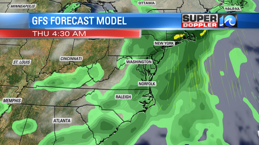
Things will change by mid-week. Humidity will start rising fast as the winds increase out of the south/southwest.
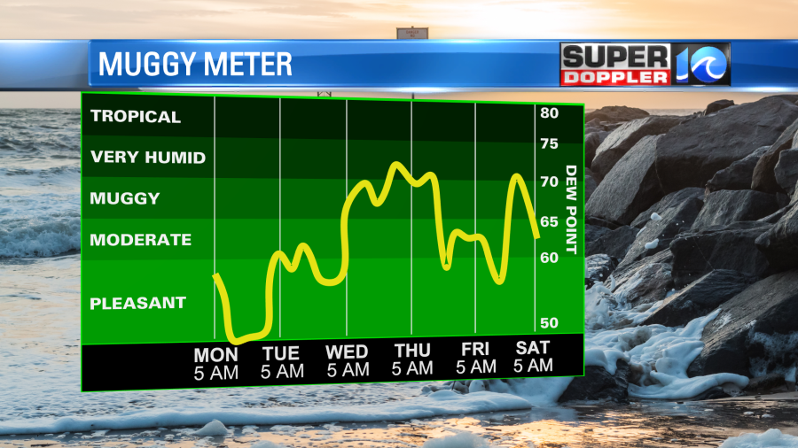
We’ll have lots of clouds, and there will be some scattered showers and storms Wednesday into Thursday. The highest chance for rain in that time will be Wednesday night into Thursday morning.
Meanwhile tropical storm Alex is becoming post-tropical. Almost all of the thunderstorms have blown away from the center.
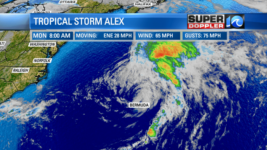
There is still some rotation. However, drier air is working into the system. Also wind shear is increasing, and it is moving over cooler Atlantic waters. So the system is becoming post tropical, and it will stay out to sea.
As forecast, we do have a high threat for rip currents at the local beaches. This is from Virginia Beach down to the outer Banks.
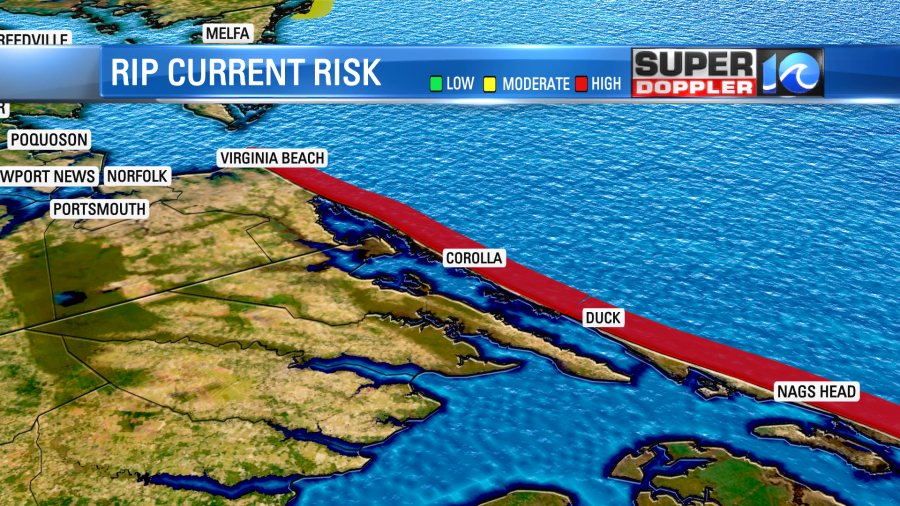
Hopefully, the threat will decrease tomorrow for folks that want to head to the beach.
Meteorologist: Jeremy Wheeler