Today is a mega Monday for 2 reasons. 1…It’s cyber Monday. 2… It’s also the Monday after a big holiday weekend. Luckily as folks head back to work today they will have some nice weather to greet them. I do want to do a quick recap of yesterday before I go into the forecast. It was warm and humid Sunday with high temperatures near 70 degrees. There was a lot of light rain in the area during the morning. Then there were some scattered showers over a small area in the afternoon.
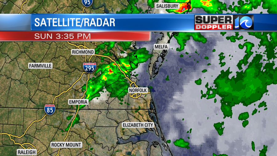
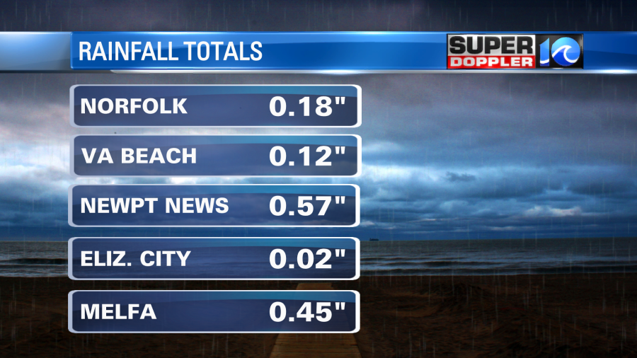
The rain totals varied. I was a little surprised at how low the amounts were in a few locations.
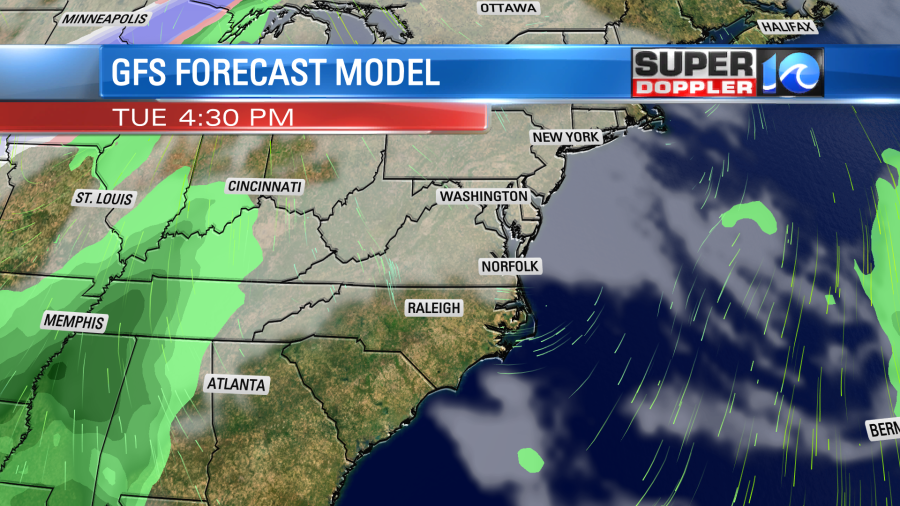
We dried out late yesterday, and then we were mostly clear last night into this morning. One cool front has moved offshore. However, another one is moving in form the west.
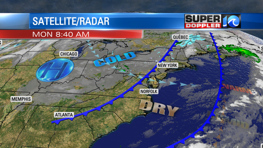
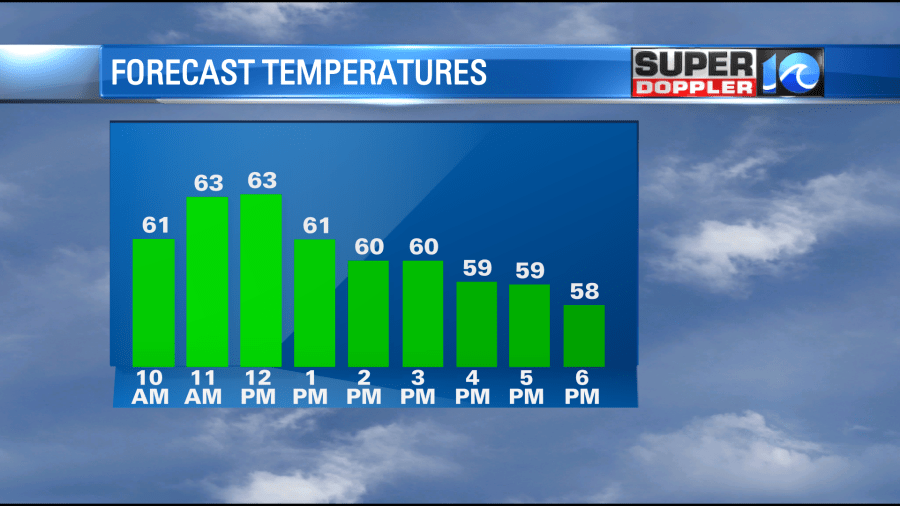
We’ll be cooler and drier today. However, high temps will be a tad tricky. We’ll warm up to the low-mid 60s by midday. Then temps will fall to the upper 50s during the mid-late afternoon after the second front arrives.
Tomorrow is much simpler. We’ll be cooler in the morning and during the afternoon. Low temps will be in the low 40s with some 30s inland/north. High temps will be in the mid 50s. We’ll be mostly sunny through the day.
While we will have some nice weather here tomorrow, there will be some severe storms off to our west.
There is a moderate risk for severe weather over the Tennessee River Valley. There is even a chance for some long-track tornadoes.
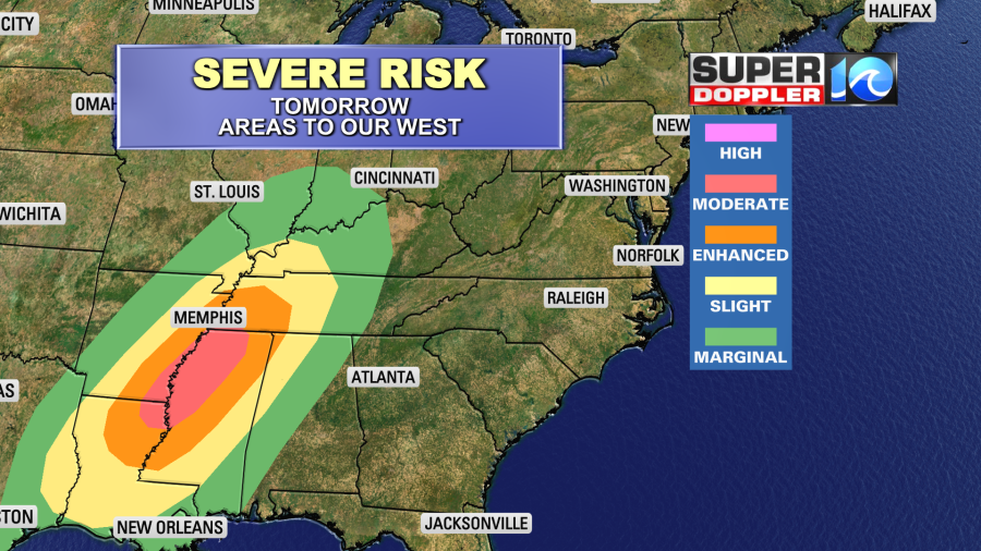
As that system moves east it will lose a lot of its energy. So we will have some rain here, but the chance for thunderstorms should be pretty limited.
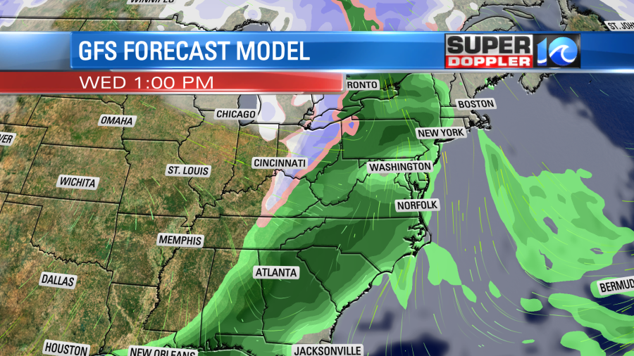
The chance for rain will increase through the day. There will be a warm breeze ahead of that system. So high temps will push up into the upper 60s. That will be ahead of then next cold front. Behind the front high temps will drop to the upper 40s to low 50s for a couple of days. Talk about bouncing temps!
Meteorologist: Jeremy Wheeler