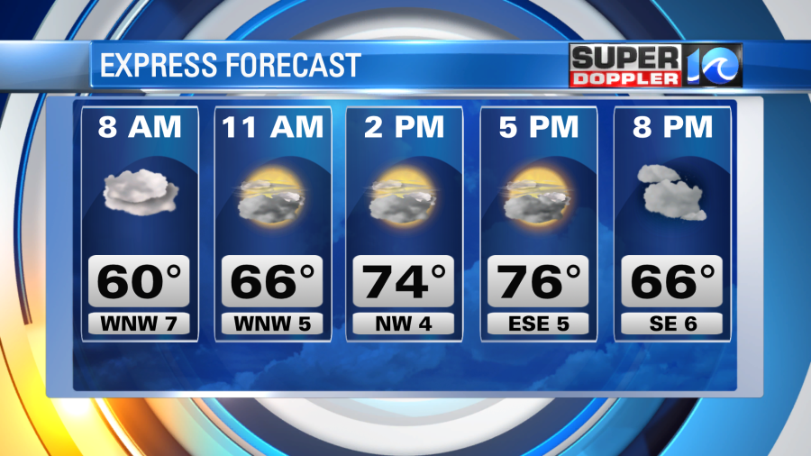
After a rainy Friday which saw many spots picking up over 1″ of rain, we’ll see sunshine return for Saturday with nice temperatures. Highs will be in the mid to upper 70s across the region, slightly cooler at the coast and a little warmer inland. Should be very nice.
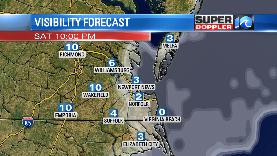
Late this evening into tonight some patchy fog could redevelop especially along the coast. Keep that in mind if you’ll be out late tonight.
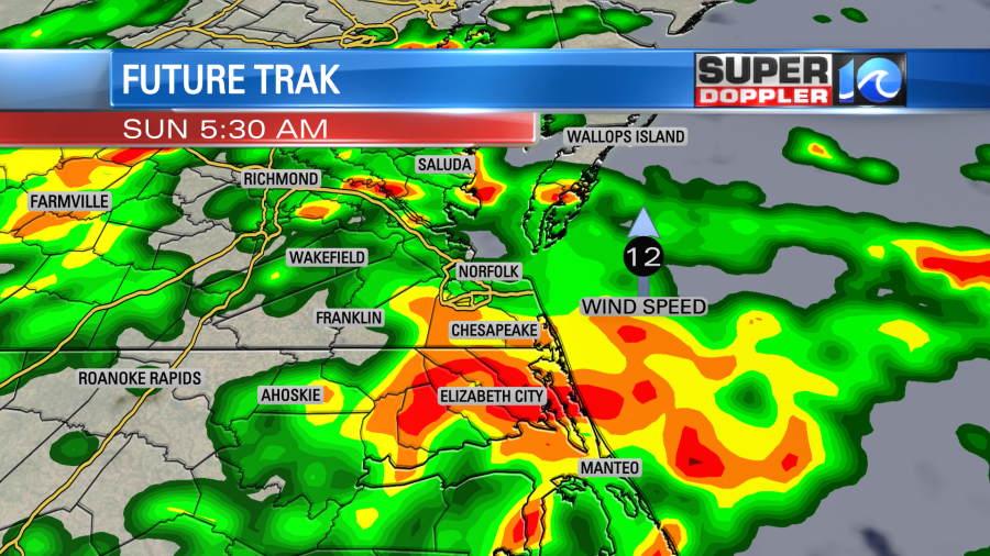
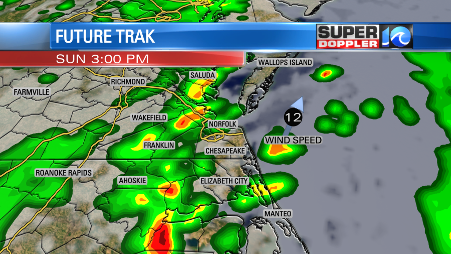
Sunday we turn our attention to an area of low pressure that will move in from the south. This low will transport moisture and a lot of it into our region. Rainfall totals look to be around 0.5 to 1″, perhaps a little more in spots as we go through Sunday.
The main question for Sunday is the timing of showers and storms. Showers will likely be with us around daybreak Sunday, but then the question is when does the main batch of storms move in. One scenario is for a few showers and storms around midday, with another round in the evening. A second scenario is we see a few morning showers, and then a break until late afternoon/evening. Both of these scenarios could bring us some strong to severe storms.
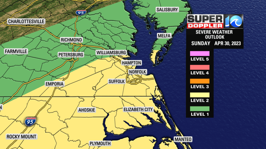
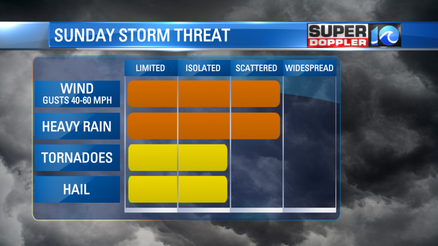
The main concern is for strong gusty winds in a storm or two, but an isolated tornado can’t be ruled out. We’re in a level 2 severe weather risk for Sunday. Make sure you have a way to get weather alerts such as our free WAVY weather app.
Hope you have a great weekend!
Meteorologist Ricky Matthews
Follow Ricky on Facebook and Twitter