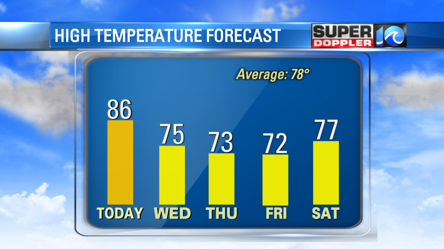
We are still looking at some nice weather today. However, we are going to warm up. High temps today are aiming for the mid-upper 80s. This will be a few degrees warmer and a bit more humid than yesterday. We’ll have a lot of sunshine with a few afternoon clouds. Strong high pressure is still to our south, but a cold front is building off to our northwest.
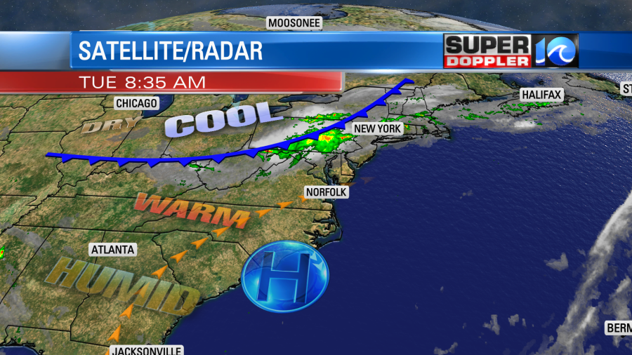
The front won’t make it here today. However, it will move in tonight. It will bring us a few showers and storms, but some of the models have it falling apart as it moves to the south. Here is what our Future Trak model shows during the late evening hours.
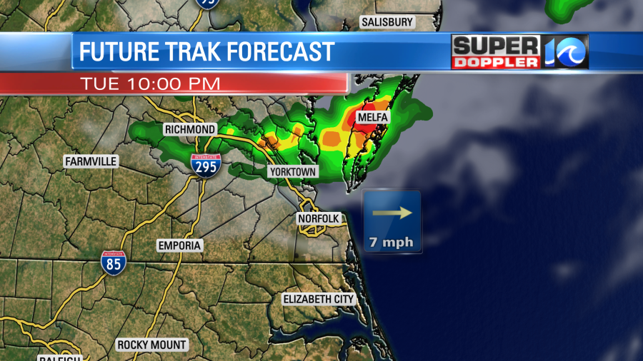
So eventually the showers will fall apart as they drop south. An isolated shower will linger into tomorrow morning. Otherwise, we’ll dry out and have some comfortable weather during the afternoon. High temps will drop to the mid 70s.
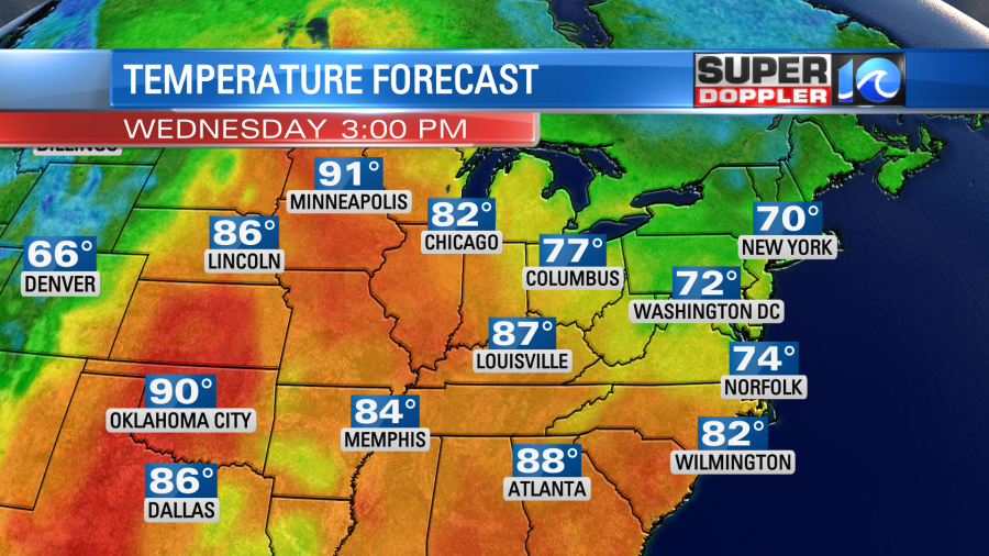
You may notice on the above map that the model is calling for 70s here locally with 90s in Minnesota. Wow! That doesn’t happen too often. Luckily we’ll stay mild and dry from Thursday through Saturday. High temps will stay in the 70s. However, we do need some rain. We have had 2.99″ of rain in Norfolk so far this month. That is 2.08″ below the average. We were doing good for a while, but lately we’ve been trending drier. Especially since we are getting into the Fall planting season. So we’ll have a little better shot at some rain between Sunday and Next Monday.
Meanwhile, hurricane Sam has gained both strength and size since yesterday.
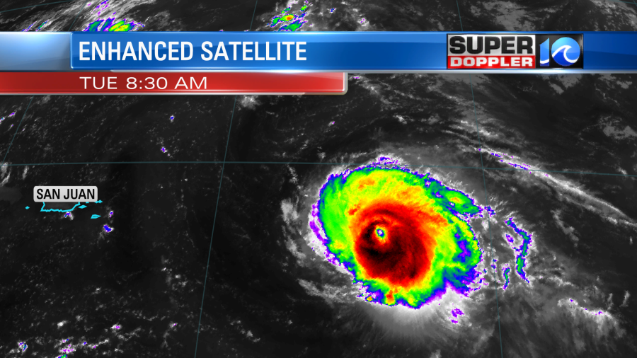
It had weakened slightly Monday as the eyewall went through a replacement cycle. Now the 2 eyewalls (concentric) have combined. This powerful hurricane is moving to the northwest. It should turn and follow the edge of an area of high pressure that is to Sam’s northeast. The latest track takes it east of Bermuda and well east of the United States.
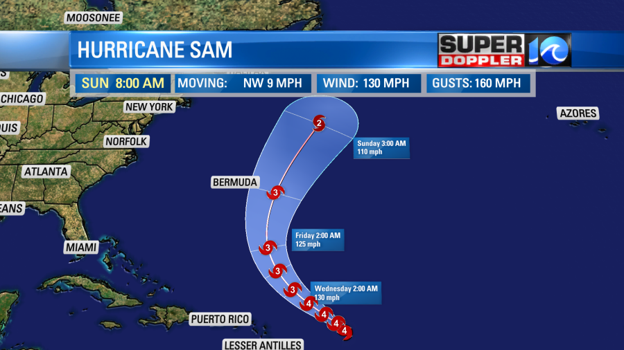
The models are in pretty good agreement now in taking Sam to the east of Bermuda. Regardless, the island will still at least have some high ocean swells. They may also be impacted by some of the hurricane’s outer bands. I do still expect to get some higher waves along the east coast later this week. I’ll have more on that in the next couple of days.
The remnants of Peter still could briefly form, but even if they do they would stay out to sea.

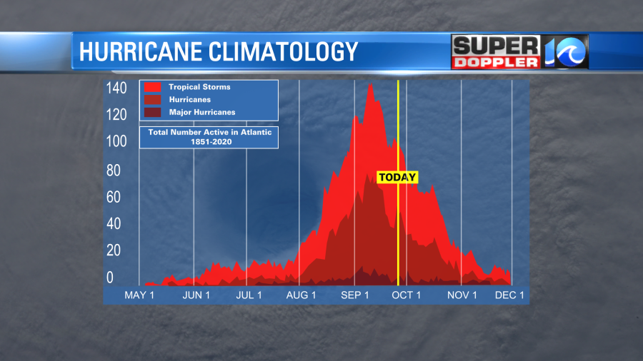
There are two tropical disturbances in the eastern Atlantic that have a high chance of formation in the next 2-4 days. They are moving to the west/northwest. We still have a ways to go before hurricane season ends. We are past the peak, but we are still in the typical busy part of the year.
Here is the list of names so far for the year.
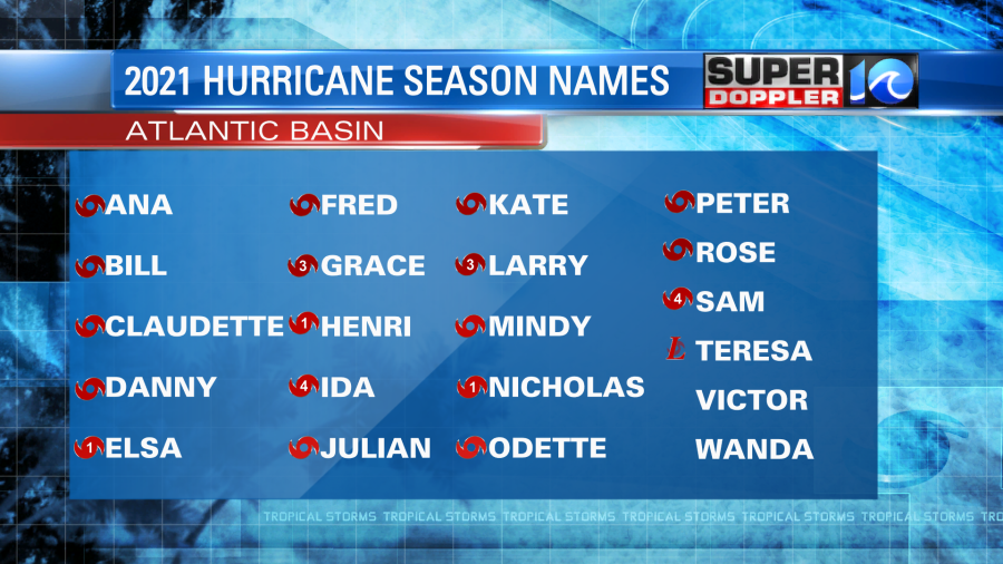
The next two names will be Victor and Wanda. You may have missed Teresa. It was a short-lived subtropical storm last weekend.
Meteorologist: Jeremy Wheeler