Overall, today is looking good. We’ll have some more of that Summertime weather. But the region’s weather is not featureless. We do have a cool front that has stalled out over the region. High pressure is to our southwest.
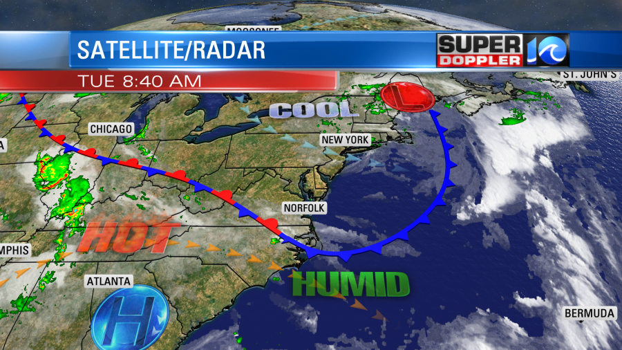
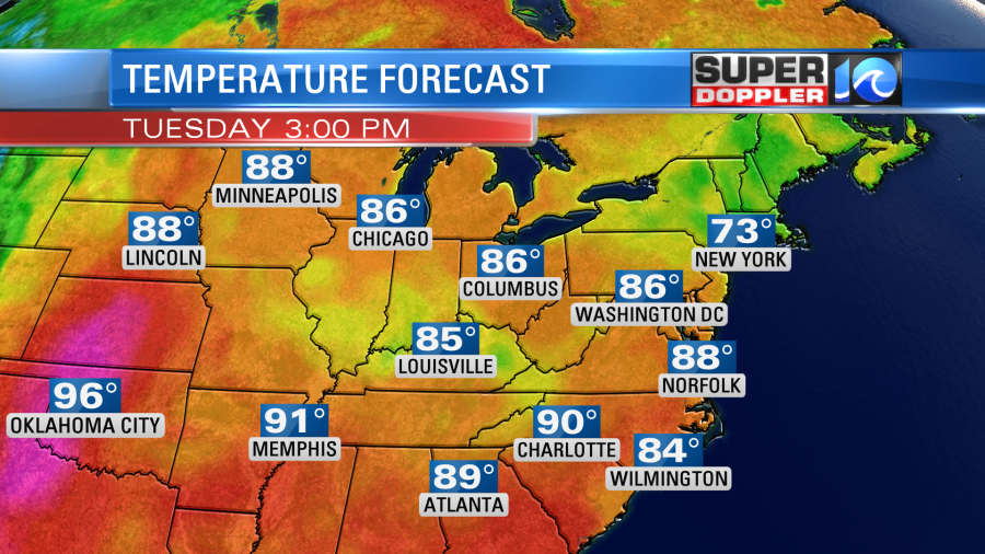
Since the front has stalled out, we will actually be on the edge of the cooler air. Our high temps today will be in the mid-upper 80s with 90s inland and mid 80s near the shore. High temps will be in the 70s in the northeast states. Meanwhile it will be in the 90s and 100s in the central U.S.
We’ll be partly cloudy. There will be some isolated showers and storms this afternoon, but the coverage shouldn’t be too high.
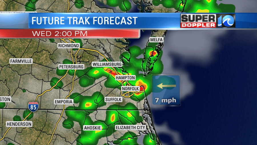
Tomorrow the front will sit over the region, but a weak area of low pressure will move along the boundary. This will increase our clouds. It will also create scattered showers and thunderstorms. Heavy rain will be possible. This could start up as early as the late morning. It will pick up during the afternoon.
With the extra clouds and storms high temps will be in the mid 80s. It will be humid. The low and the front will work their way offshore on Thursday. We’ll have partly cloudy skies with only some isolated showers possible. High temps will be in the mid 80s. Then we’ll be hot and partly cloudy on Friday. High temps will be near 90.

We’ll have pretty good weather for the 4th of July. The current forecast is partly cloudy with a few showers or storms in the afternoon. High temps in the 80s and fairly humid. We’ll have updates on that over the next few days.
Meteorologist: Jeremy Wheeler