Hurricane Delta was still a major hurricane this morning. It still didn’t have an eye on satellite, but the sustained winds were at 120mph.

The storm is forecast to move northward today at a steady pace. It is expected to weaken a bit later this afternoon as it starts to move over some cooler water. Also, the upper level winds (wind shear) should increase a bit. It is expected to be a category 2 hurricane upon landfall this evening.
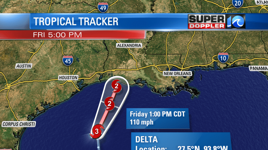
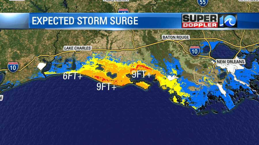
Hopefully it weakens a little more than forecast. The storm surge could be over 9 feet in some areas.
After landfall the storm will move to the north/northeast. It will weaken to a tropical storm by Saturday morning. It should fall apart over central Tennessee on Sunday.

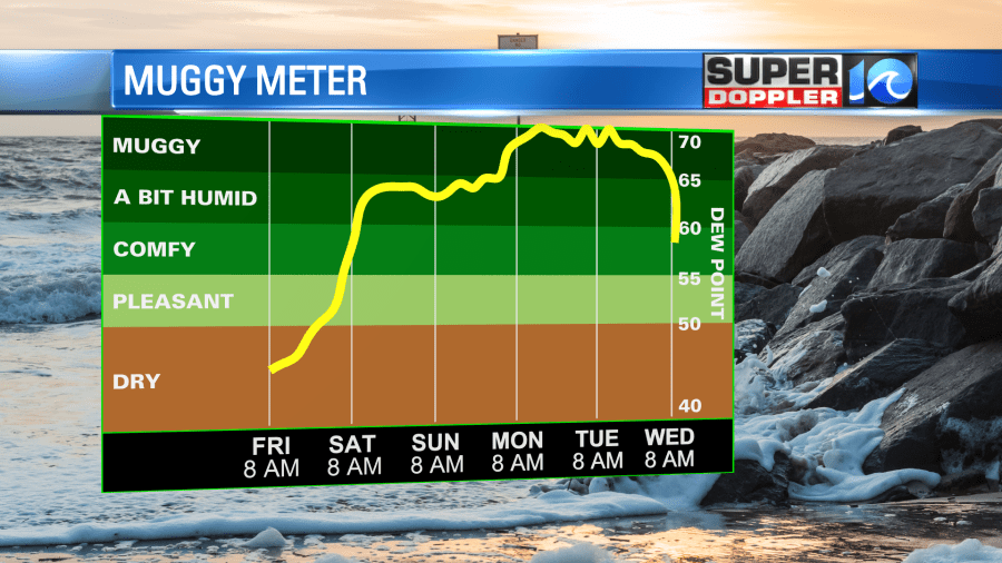
Despite Delta falling apart, the moisture will pour into our region gradually through the weekend.
Today we have high pressure in the area with a light east/northeast wind.
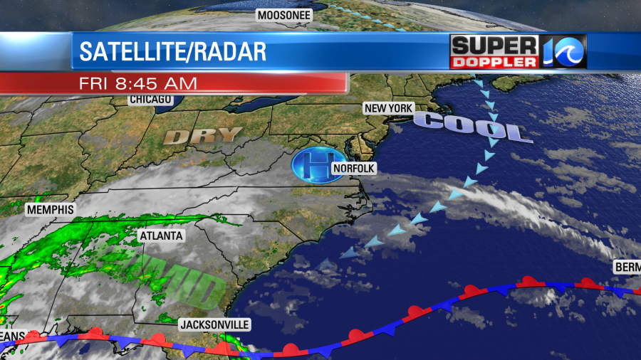
However, some moisture from the system has been picked up by the upper level winds. This has brought us some high/thin clouds. That won’t cause any problems though. It will be very nice out with high temps in the low-mid 70s. However, by tomorrow the clouds will increase. We’ll also have a few showers in the area. I’ve got the chance for rain at 30%. High temps will be in the 70s. By Sunday and Monday the deeper moisture will lead to an increasing chance for rain. There will be scattered showers Sunday afternoon into the evening.
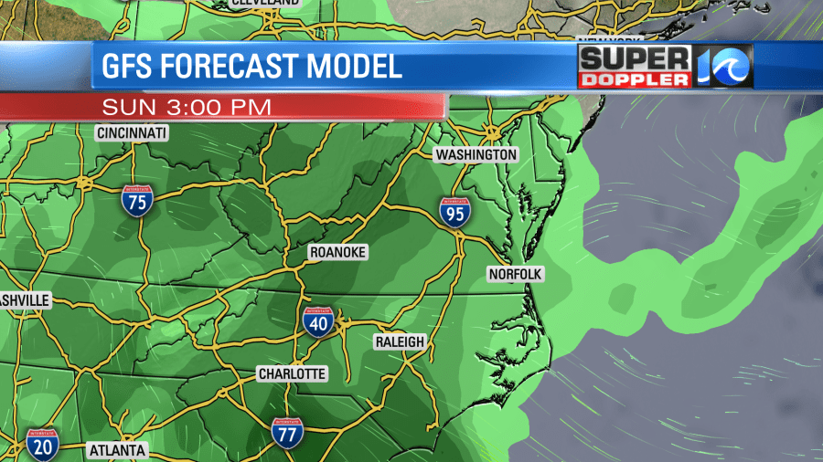
Then it looks like we’ll have widespread rain Sunday night into Monday.
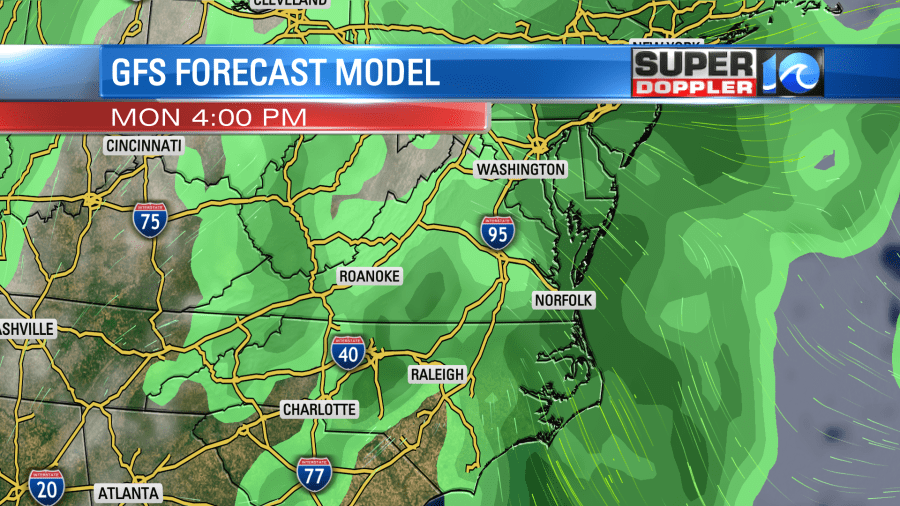
At this time Monday pretty much looks like a washout. The GFS model is calling for about 1-1.5″ of rain for our region through Monday evening.
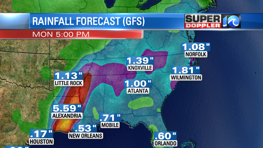
If this pans out, then it won’t be too bad as it will be spread out through time. It won’t be nearly as bad as down south where some locations could see over 10″. I think some folks in viewing area could use a little rain. However, some locations have finally just dried out from the rainfall over the last couple of months.
Stay tuned for updates on the weather this weekend.
Meteorologist: Jeremy Wheeler


