After several days of rain (and a long duration tornado watch), we’ll finally say bye, bye to Debby today as it pulls north. Now, like many goodbyes, this one may take awhile to finally get it out the door and on the road…
Here’s where we stand this morning – as of early Friday morning – A Tornado WATCH remains in effect until 7am this morning. A Flood WATCH remains in effect for the entire day Friday.
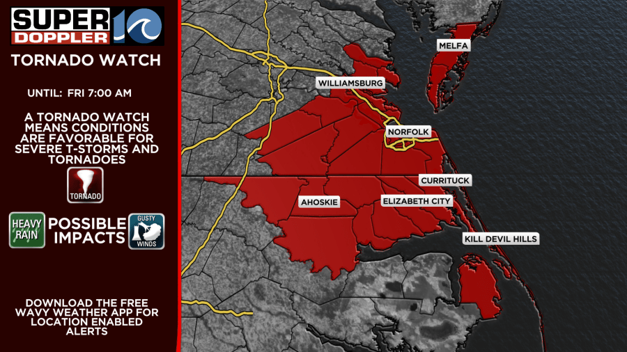
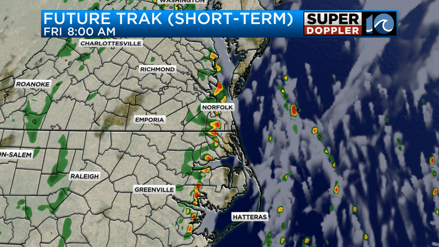
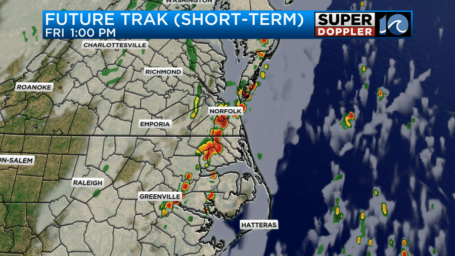
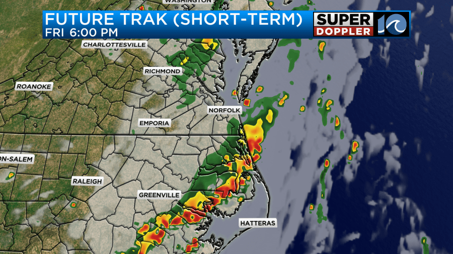
For Friday, we’ll still see a few bands of rain – some heavy at times – as the last of the moisture pulls north through our region. It willl be humid – and breezy from time to time. There’s still a chance we could see a few more strong storms through the morning and possible during the middle of the day across eastern VA. The bands of rain shift south and east with time, and by the afternoon we’ll see some bands of heavier rain in NE NC and the OBX. The most activity should be there as we go into the late afternoon (see maps below). A few lingering showers take us into the overnight region wide, before drier weather prevails for the weekend.
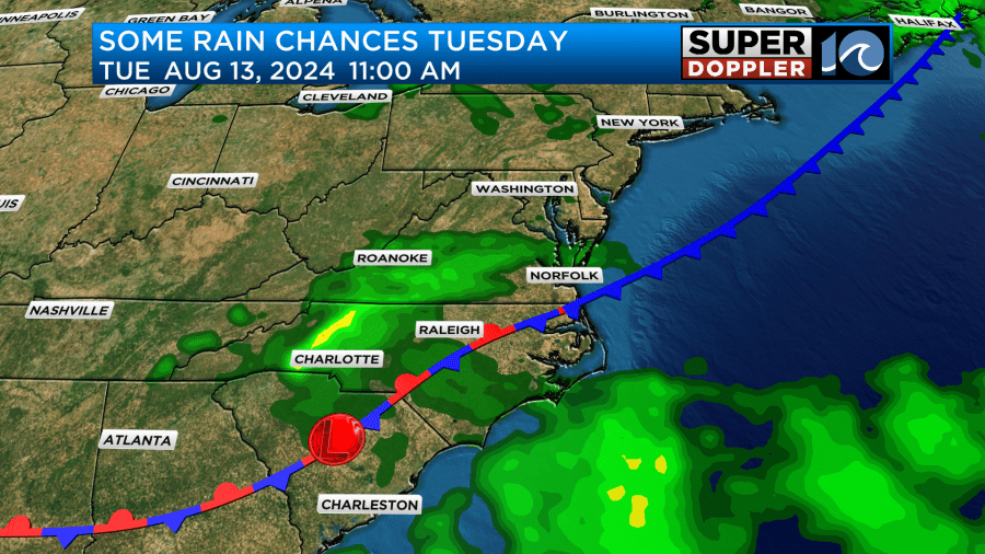
The cold front will move through our area on Saturday which should push in some drier air for most of us. A few lingering showers will be possible for the Outer Banks during the day since it’ll take the front a little longer to make it there and it may stall as it gets close to the southern OBX. More frequent sunny skies will prevail on Sunday with less humid air and a light breeze. There’s a small chance for a rain shower on Sunday, but overall a lot less wet than it has been!

Into early next week, we’ll have a stationary front along the SC/NC coast -which could produce a few showers into late Monday/Tuesday. Best chances in NE NC and the OBX area. Temperatures next week will be in the 80s.
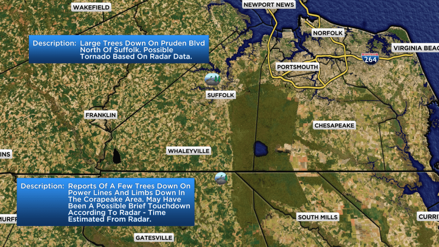
As a little recap of Debby, the storm on Thursday caused several tornado warnings to be issued for our region. We had a few reports of some tree damage and a few power lines down. A tree even fell on a car on Route 58 in Suffolk, resulting in 2 minor injuries. It’s unknown if these damage reports were because of a tornado, or just winds from the t-storm. The NWS may investigate it today, but we have not got confirmation yet.
If you have any pictures of storm damage to share, you can submit there at wavy.com/reportit
Parts of our region have also been under a tornado watch since Wednesday night (OBX Dare) or early Thu morning (most of NE NC/Hampton Roads). We were talking in the weather center – and that timeframe may be the longest we’ve been under a watch that we can remember. Thankfully, many of the hours have been calm, but just an interesting weather note.
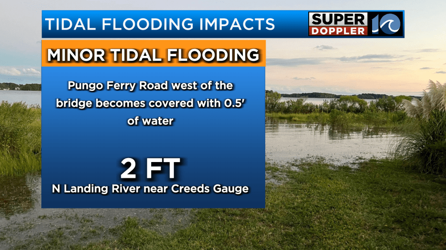
There is some minor tidal flooding occurring in southern Virginia Beach near Sandbridge and Pungo Ferry. As strong S/SSE winds continue, tidal flooding will remain in issue in that region through this morning and early afternoon. Once winds shift SW this evening, the potential for any additional tidal flooding will diminish.
Hope you enjoy your calmer and drier weekend! Have a great Friday!
Meteorologist Ricky Matthews
Follow Ricky on Facebook and Twitter


