The nice weather will continue today. Dry and seasonably cool weather is sticking around for a couple of days. A cool front is sinking to our south with high pressure edging in from the west.
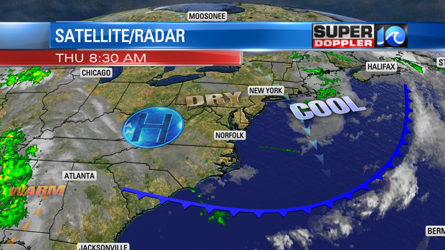
We’ll have a lot of sunshine with high temps in the upper 70s. Winds will be light and out of the northwest. Tomorrow we’ll have a reinforcing shot of cool air as a wind-shift drops in from the north. The wind will turn out of the northeast at 8-12mph. So we’ll still have a lot of sunshine as high pressure hangs on, but high temperatures will drop to the lower 70s. We’ll stay in the 70s with fair skies on Saturday. Then we’ll heat up to the 80s on Sunday and Monday. The Sunday/Monday forecast has dried up since yesterday. Now Sunday looks dry, and I only see some isolated showers in the region on Monday. Even the Tuesday/Wednesday forecast looks drier. That’s not good as I talked about how dry we’ve been trending in yesterday’s weather blog.
There are 2 named tropical systems in the Atlantic, but they won’t be bringing us any rain. Hurricane Sam is still spinning over the middle of the Atlantic. It remains a major hurricane, and it will likely keep its strong winds as it passes east of Bermuda in a couple of days.
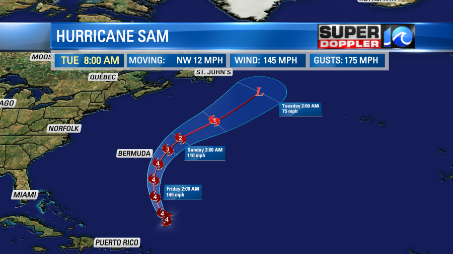
They will have some large swells, and they could be impacted by some of Sam’s rain bands. We will have some higher waves here on the east coast, but it will stay far from here. The higher surf will happen tomorrow through Sunday.
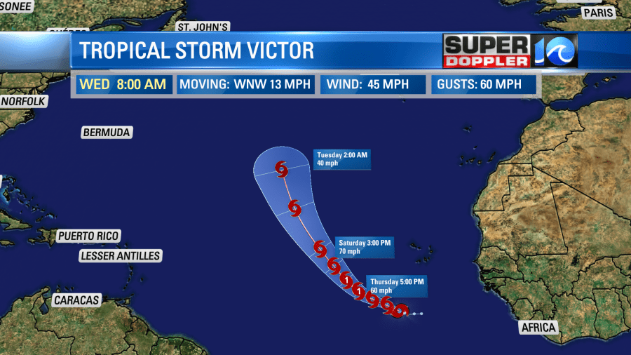
Meanwhile tropical storm Victor formed in the eastern Atlantic yesterday evening. It is on a west/northwest track.
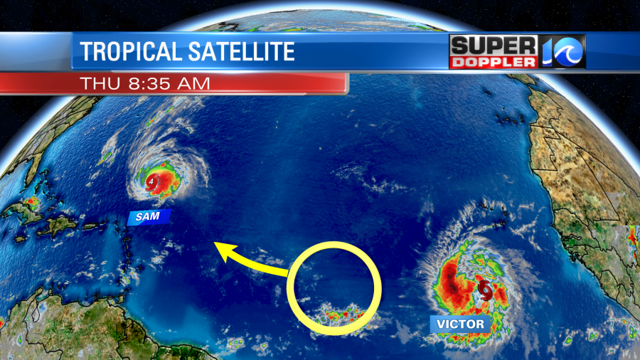
Luckily that storm also looks like it will stay out to sea as it turns more to the northwest then north. It may briefly become a hurricane, but it will probably be a tropical storm for the majority of its lifetime.
Meteorologist: Jeremy Wheeler