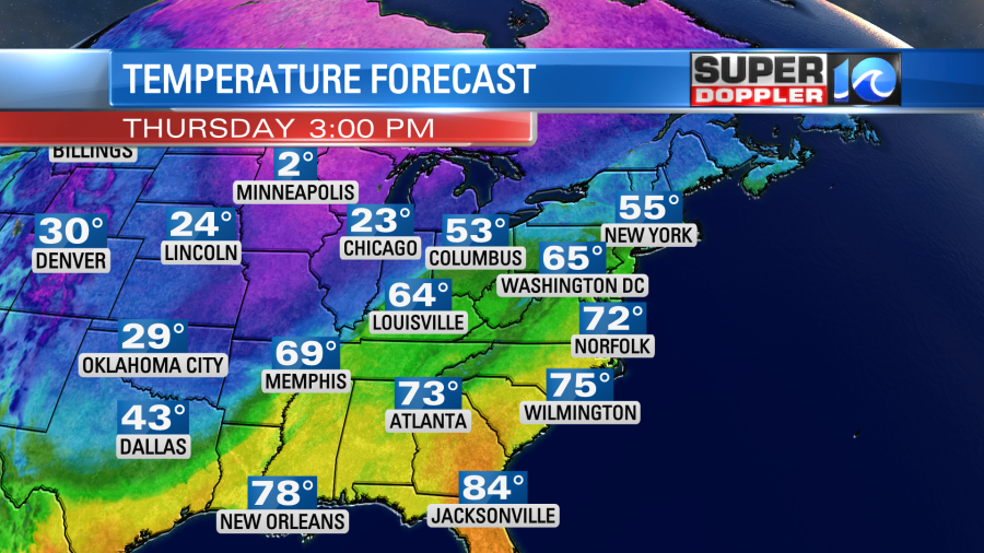
We are going to have an unseasonably warm day today. It will be way above average (low 50s), but we likely won’t break nor tie a record. The record is 80 degrees set back in 1976. High temps will aim for the low 70s this afternoon. We’ll have a breezy south wind with a mix of sun and clouds. Winds will gust up to 25mph later today. This should allow the temps to warm up fast.
We’ll have a mix of sun and clouds across the area High pressure is offshore a bit. It is close enough that it should keep the rain away. However, some isolated showers could sneak in over the Outer banks.
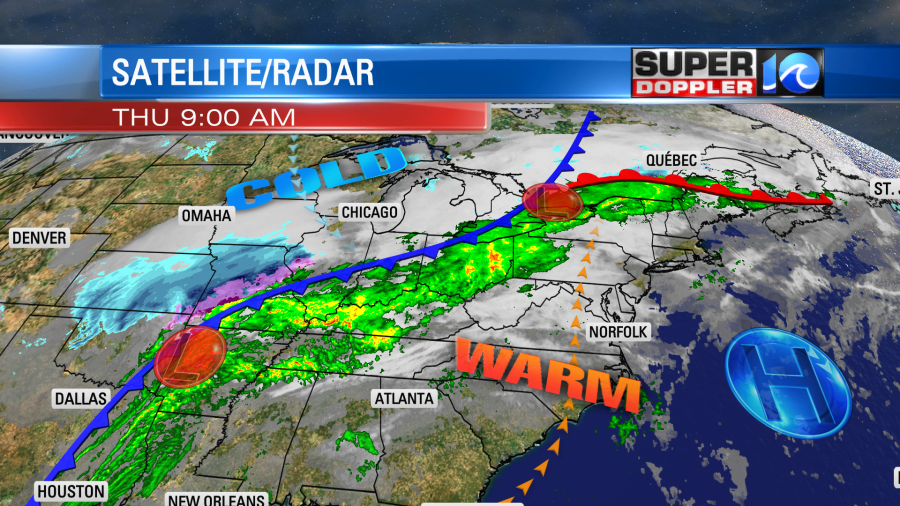
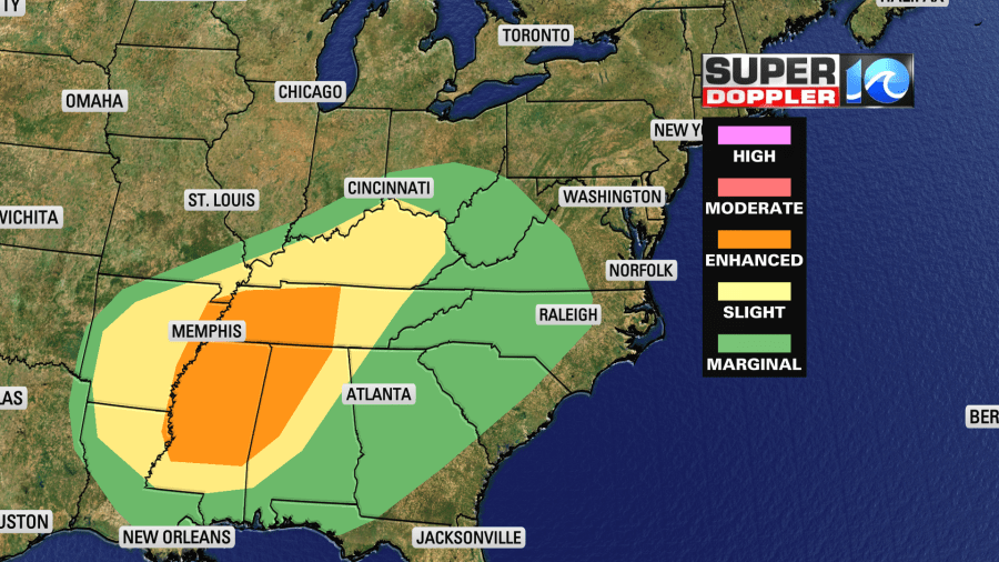
There is a strong cold front over the Midwest. That is going to disrupt a lot of the country today. There will be strong to severe storms over the Tennessee River Valley.
There will also be a band of snow north of the front moving east, and there will be a band of ice near the front as well. Check your plans if you are traveling out that way. Humidity is high to our west, but it should stay low here today. Dew points are in the upper 40s, but they will rise to the low 50s.
Tonight the moisture will increase a little more as high pressure slides farther offshore. So we’ll have increasing clouds with some scattered rain showers.
The cold front will move in tomorrow morning. We’ll have some brief heavy rain and gusty winds in the morning. This could impact the morning commute.
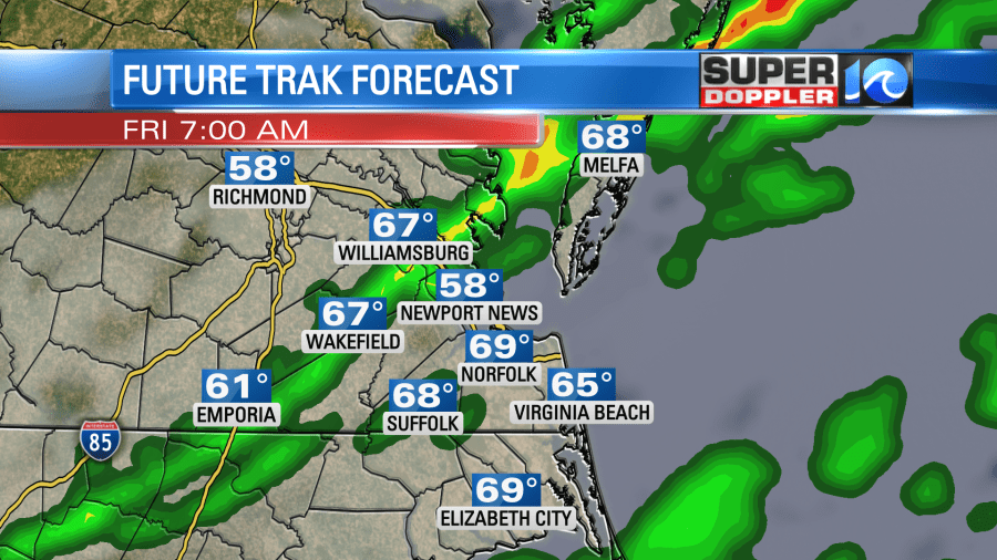
At least the temps will be warm to start the day. We’ll be in the 60s by the early to mid morning. However, temps will fall through the day as the cold front sinks to our south. We’ll drop to the 40s by the late afternoon.
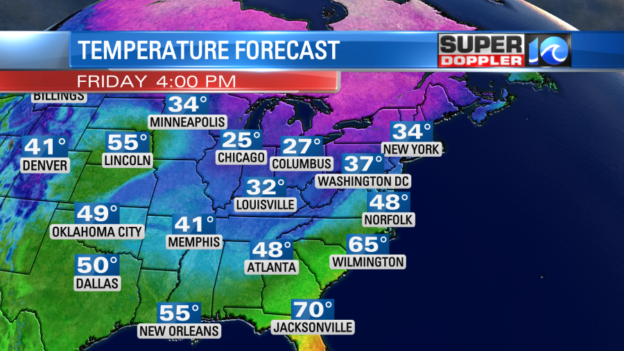
The rain showers will taper off through the late morning. Then we’ll dry out with some clearing in the afternoon.
We’ll be cool and dry over the weekend. High temps will be in the mid-upper 50s on Saturday with partly cloudy skies. Then we’ll have a lot of sunshine on Sunday with high temps in the upper 40s to low 50s. We’ll warm up again to the 60s early next week.
In world news… A new report came out from NOAA that updates the projections for sea level rise. It calls for 10 inches to a foot of water rise between now and 2050 over the coastal U.S.. This was found using tide gauges, satellite observations, and some of the modeling from the from the Sixth Assessment Report of the Intergovernmental Panel on Climate Change (IPCC). Here is the article with more information: Updated sea level predictions. Some locations will see more of a rise than others when you factor in land subsidence.
Meteorologist: Jeremy Wheeler


