Luckily (Irish luck?) we have some fairly quiet weather today in the region. However, it won’t be too rosy! We are in-between systems today. A weak area of low pressure is moving out to sea. However, there is a bigger area of low pressure to our west.
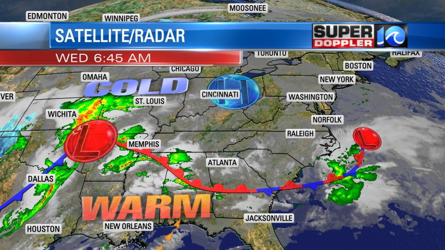
We will have lots of clouds here today with some drizzle this morning. There may be a few peeks of sun late in the day, but I wouldn’t bet on it. High temps will be in the mid 50s with a light north breeze.
Things will be dangerous over parts of the Central/Southeastern U.S. today. Along with the strong low at the surface over Oklahoma, there is also a potent upper level low out there. They also have a lot of warm air in that region today.
There will be a surge of humid air over the Mississippi and Tennessee River Valleys today. All of this is creating an environment that is conducive to severe weather and tornado formation. So there is a high risk for severe weather out there today!
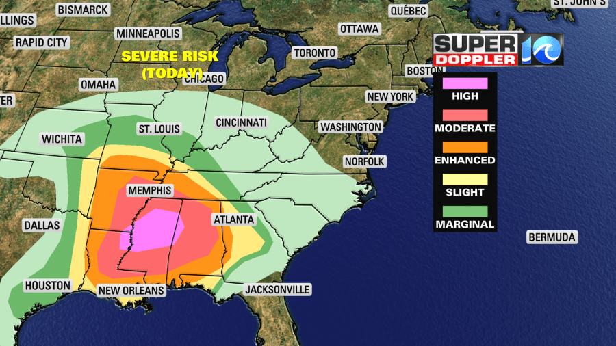
The country only gets about 3-5 high risk events per year. So this could be a big outbreak!
Tomorrow that system will move through here, but late in the day. A warm front will move up from the south in the morning. We’ll have to watch some of the isolated showers and storms that form along that boundary.
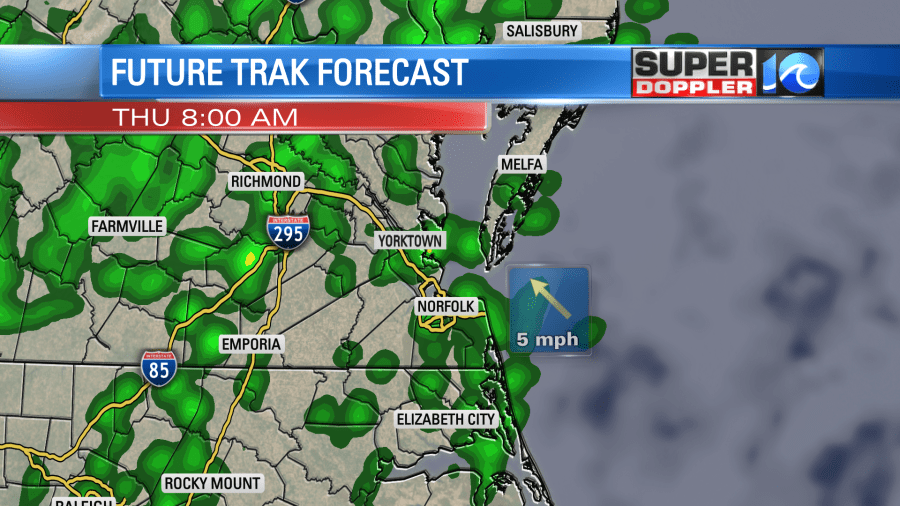
We’ll have mostly cloudy skies with a breezy southeast wind. Some of the gusts could be up to 25mph. This should pump up the heat and humidity over the region. So high temps will be in the mid 70s in North Carolina. I’m going for near 70 degrees for Hampton Roads with high temps closer to 60 north of the metro. This will create a good amount of instability. There will also be some wind shear (a change in wind speed or direction with height) in the area. So we’ll have to watch any isolated to scattered showers and storms that form in the afternoon. Then there will be a couple of clusters of showers and storms tomorrow night. The last one (late) could be the strongest one.
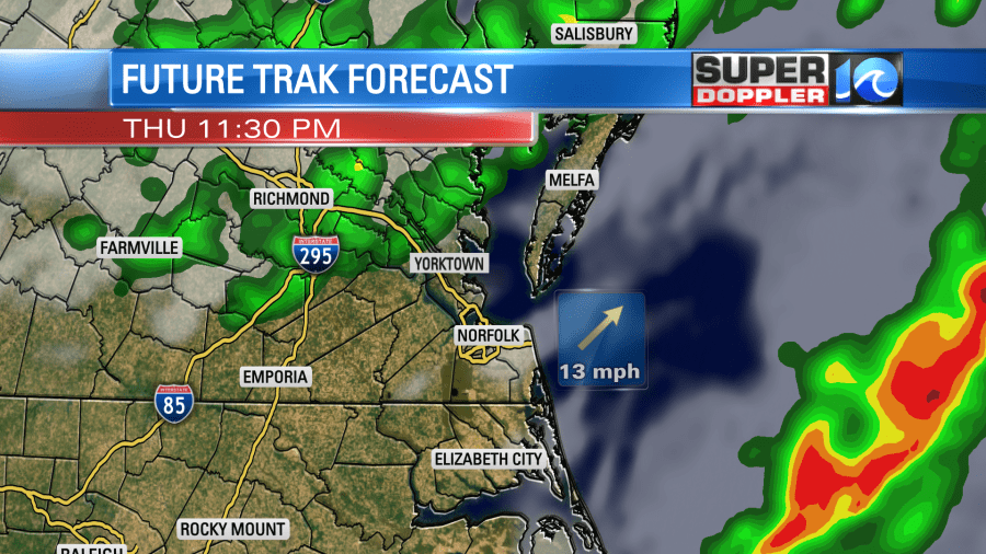
The risk for severe weather is enhanced for most of the region.
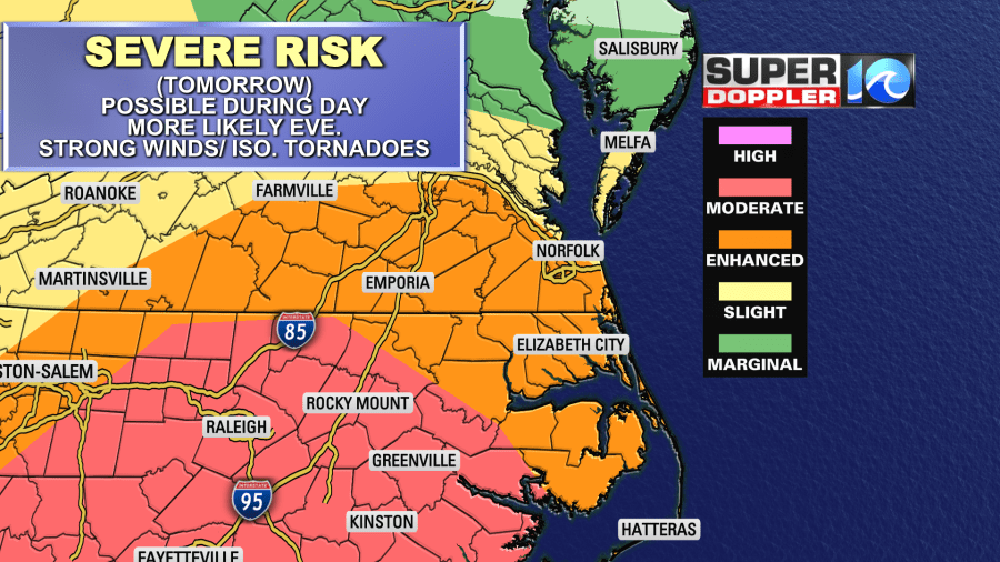
The risk may change later this morning, and will likely change some this afternoon. You can get the latest risk update from the Storm Prediction Center.
Straight lined winds will be the main threat. There could be some isolated tornadoes in the region with a higher threat for that to our west/southwest. There will also be a chance for large hail.
The rain will continue Tomorrow night into Friday. Rain showers will continue through the day Friday. High temps will only be in the upper 40s. The GFS model is hinting at another brief wintry mix Friday night before ending. Let’s get through tomorrow’s storms first before we even talk about that. Either way it should be cool and dry this weekend except for a few showers along the Outer Banks.
Meteorologist: Jeremy Wheeler


