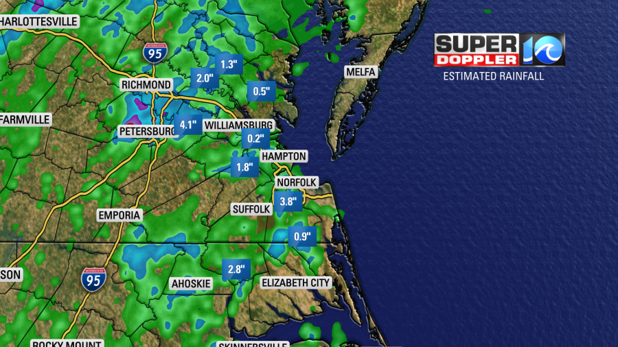
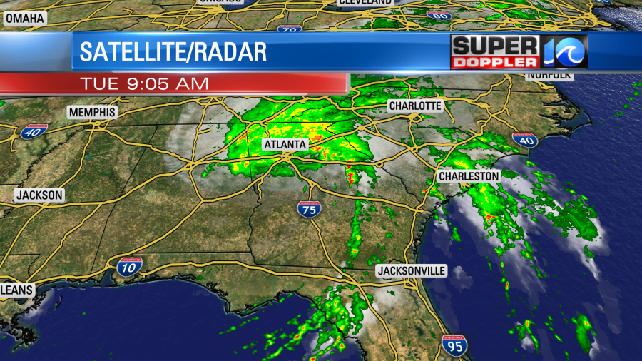
Yesterday, we had several clusters of heavy rain and thunderstorms in the region.
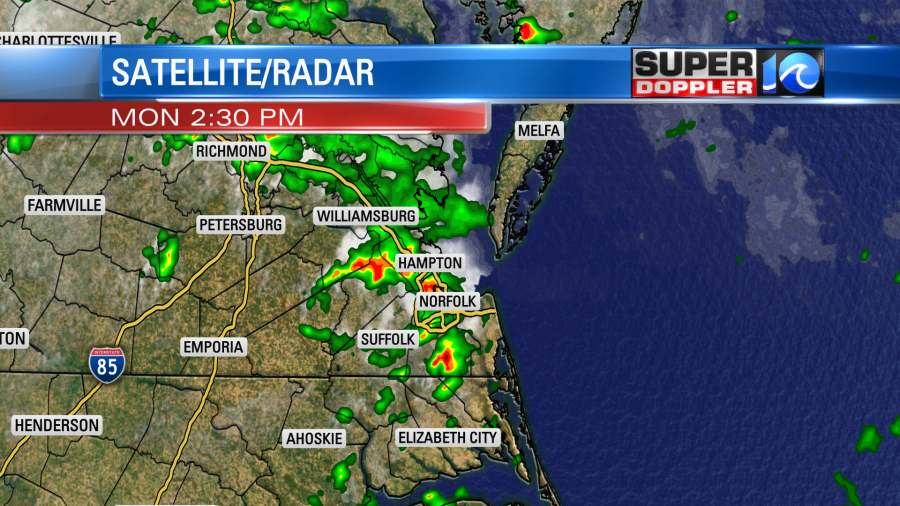
Our radar estimated a couple of inches in some locations with very little in others nearby.
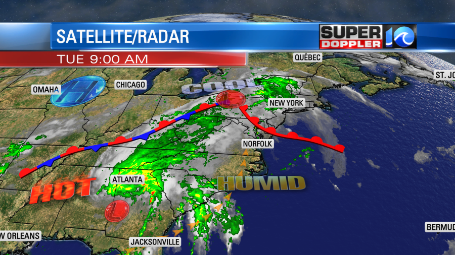
Today we will have quieter weather locally. The front that was over us yesterday has moved north as a warm front.
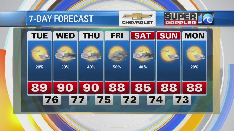
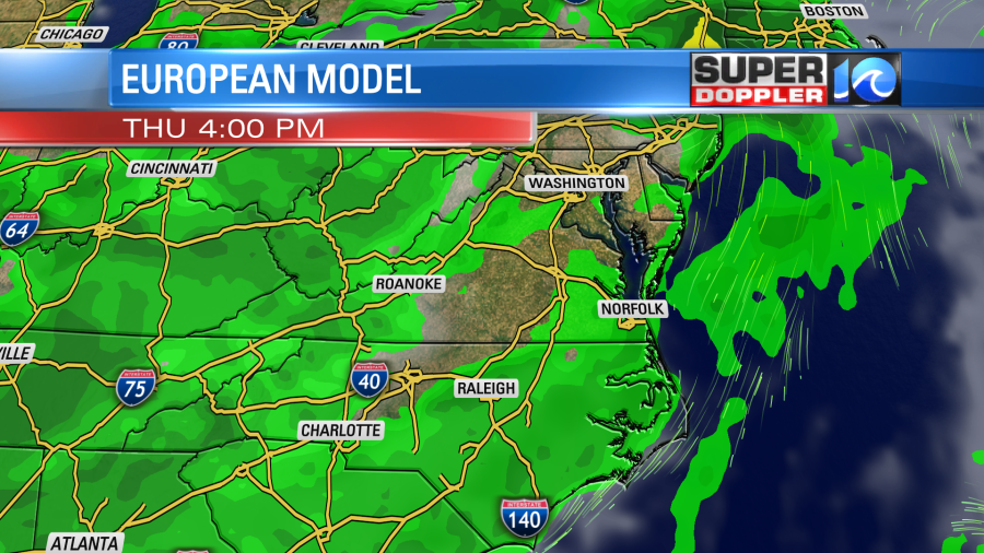
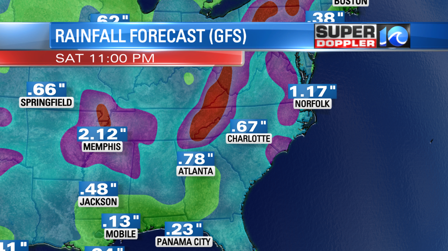
We’ll be partly cloudy today with only some isolated showers or storms. High temps will rise to the upper 80s to low 90s. The heat index will be in the mid-upper 90s. Tomorrow we’ll have a mix of sun and clouds with a few showers and storms. Highs will be near 90 with heat indices in the upper 90s. Then we’ll have more clouds and a higher chance for rain Thursday into Friday. This will be as some deeper moisture moves east from the remnants of Fred.
The tropics are busy. We have 3 simultaneous systems in the Atlantic basin, and it is only August. At this pace we could be on track to tie last year’s record hurricane season. (I hope not!) So as I write this I am tracking Fred, Grace, and Henri.
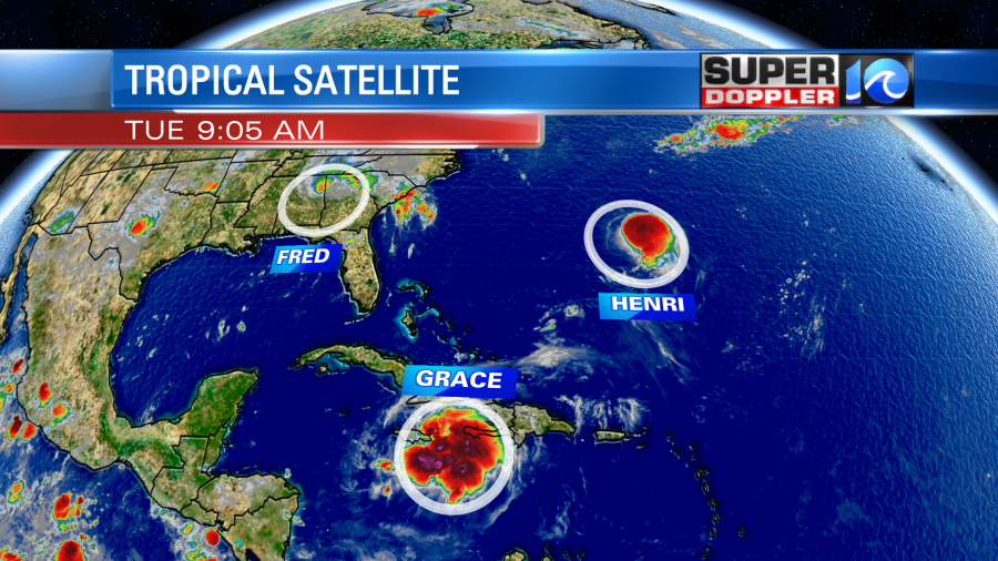
This morning Fred had weakened to a tropical depression. A band of heavy rain was still going to the east/southeast of the center.
Going forward Fred will basically become a rainmaker. The heaviest rain is forecast to move along the Appalachians. However, the deeper moisture from the remnants of Fred will move east over our area Thursday into Friday. So we’ll have a higher chance for rain during that time.
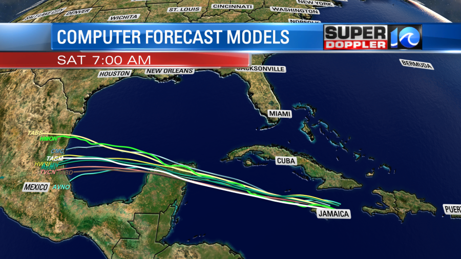
Grace had dumped a lot of rain over Haiti causing flooding and mudslides last night. At least the wind wasn’t too bad. Now it is moving west towards Jamaica. It will move over or close to Jamaica later today. There should be little weakening (if any) as it will have a small amount of time to interact with land. Then it will head west towards the Yucatan Peninsula.
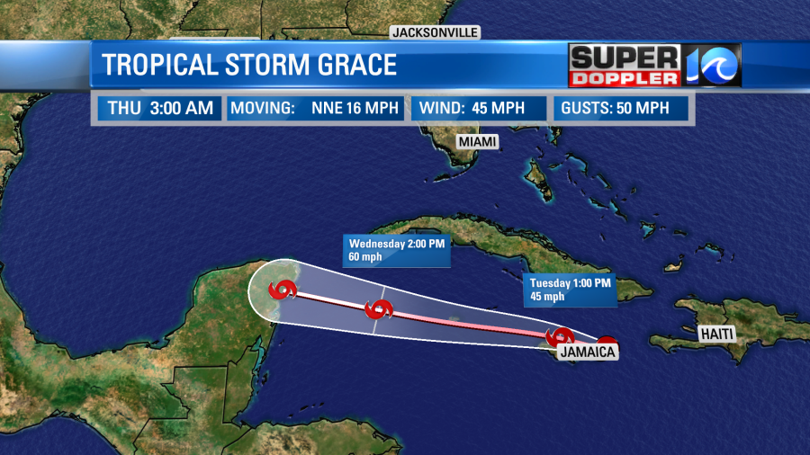
The system is forecast to strengthen before possibly hitting Cozumel, Mexico. There’s a low chance that it could become a hurricane. After crossing the Yucatan and weakening it will then move back over water on the Bay of Campeche. It will likely restrengthen before heading towards eastern Mexico.
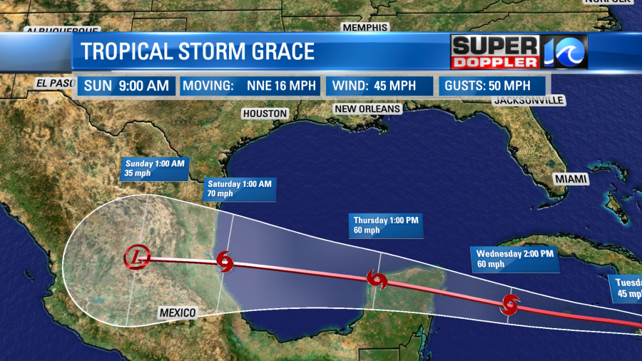
There is pretty good agreement in the models for the track of Grace.
Finally, tropical storm Henri is to the south of Bermuda. It will hook around to the west, northwest, north, and then northeast over the next few days.
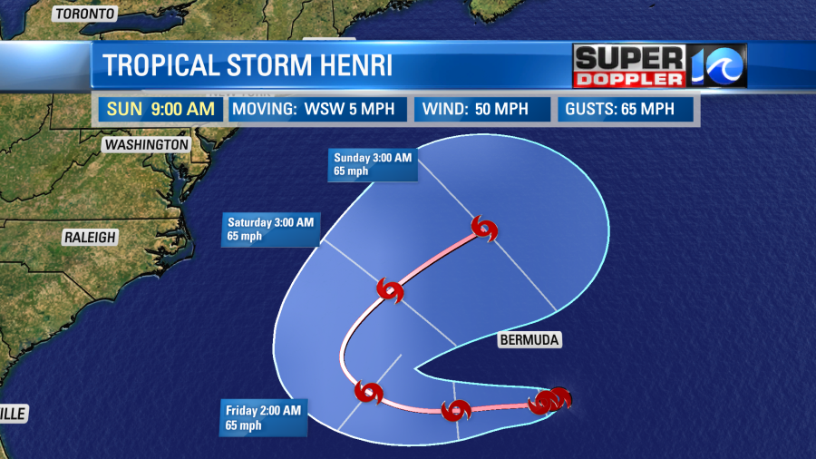
The models all keep Henri offshore. So that is good news for the east coast.
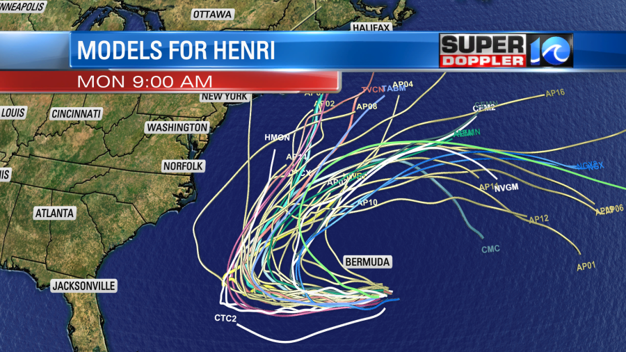
So it will likely send us some waves by the weekend. This will probably be great for surf, but the rip current threat will increase for swimmers.
Meteorologist: Jeremy Wheeler