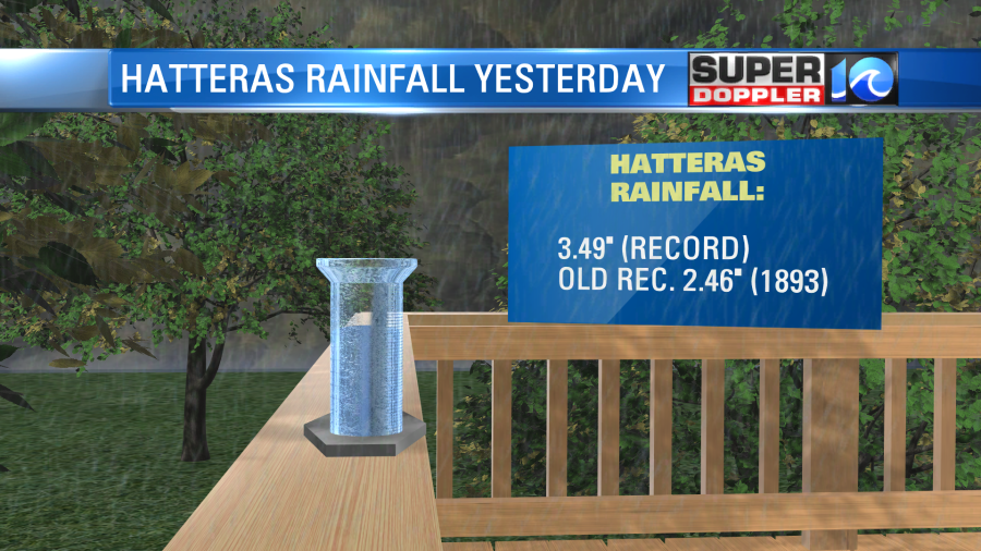
Yesterday the rain came down in buckets over the Eastern Shore. Hatteras had a record rainfall of 3.49″.

Over the last 2 days we’ve had about 1.5″ to 2.5″ of rain. However, there has been less on the Eastern Shore. Melfa has only reported about a tenth of an inch. AJ on the lower Eastern Shore had 0.25″. Barry in Gloucester had a little over an inch since the rain started.
Yesterday a warm front moved close to the Outer Banks, and I think that’s why there was so much heavy rain there. Today that front and a surface low are pushing a bit offshore. Also, some drier air wrapped around the southern edge of the upper level low. So we actually caught a long break in the rain from last night into this morning (for most of the area).

However, the surface low isn’t far away, and the upper level low is still to our west. This means that we’ll still see some scattered rain showers today, but there will be more breaks in-between. The chance for thunderstorms is a little higher inland.

If our model is right, then there may also be a few peeks of sun today. Surface winds will be more out of the east. (They’ve been out of the northeast for the past 3 days). This will allow the temps to warm up a bit. We’ll rise to the upper 70s this afternoon with cooler temps near the shore.

Tomorrow the upper level low will weaken more. Plus, the surface low will move offshore. So we’ll have less rain in the region. There will be scattered showers with a few pm storms, but the chance will drop to 40%. We’ll have a mix of sun and clouds with high temps near 80 degrees. Things will get even better Friday into Saturday. We’ll have partly cloudy to mostly cloudy skies. There will be a 30% chance for scattered showers and isolated t’storms. High temps will rise to the low-mid 80s. I’m hoping we’ll be even drier on Sunday, but we’ll see.
Meteorologist: Jeremy Wheeler