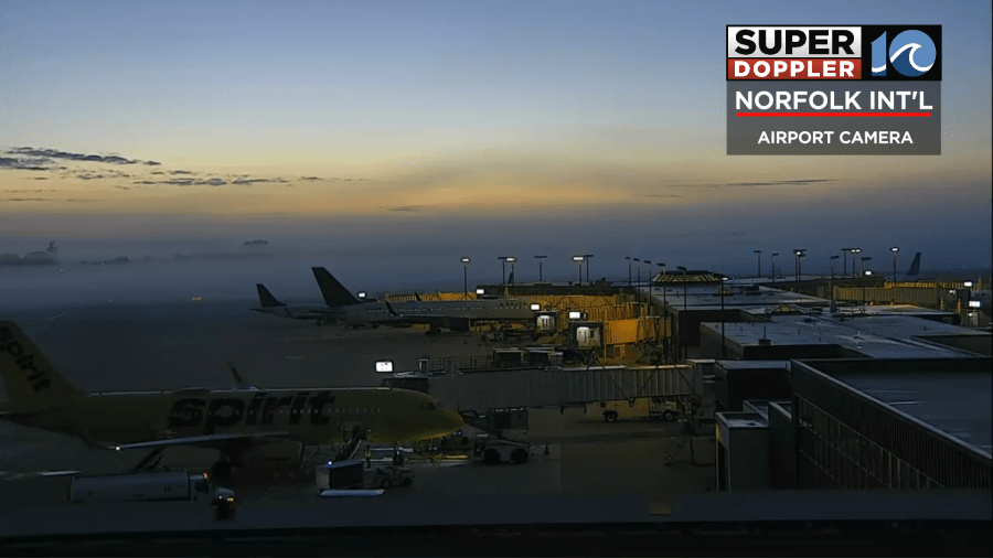
Merry Christmas Eve! We’re starting the day with some fog. I thought this shot from our Norfolk International Airport camera was pretty cool. You can see how shallow the fog is to the surface, with the clear skies above it. Any fog should dissipate by 9-10 am and after that we’ll see a partly to mostly sunny afternoon.
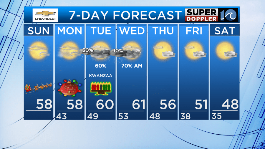
Highs will be in the upper 50s across the area today, with some low 60s inland.

Overall, the weather for both Christmas Eve and Christmas Day will be pretty nice. We’ll start off both days in the low 40s, then warm up in the afternoons.
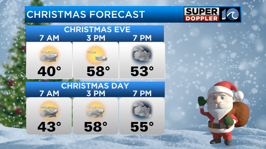
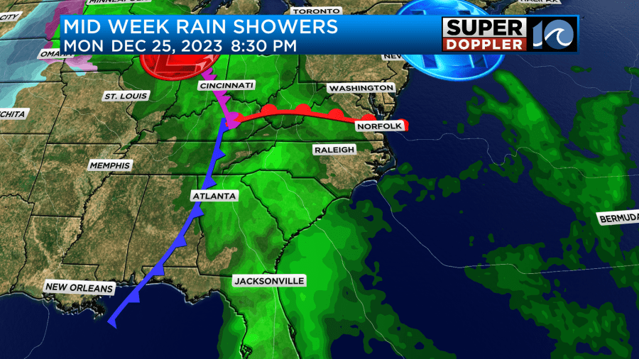
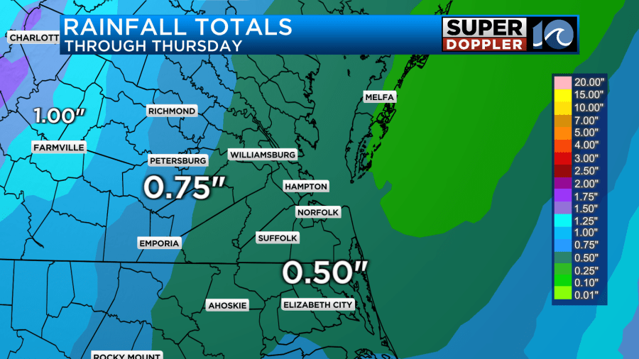
As we approach the end of Christmas Day Monday, a few isolated showers may push in as early at 7pm. Better chances of this the further west you are. We’ll see increasing rain chances overnight and into Tuesday, with some on and off rain showers on Tuesday. The rain could become briefly heavy Tuesday night into Wednsday morning, before tapering off late morning on Wednesday. We will see skies clear out late Wednesday afternoon.
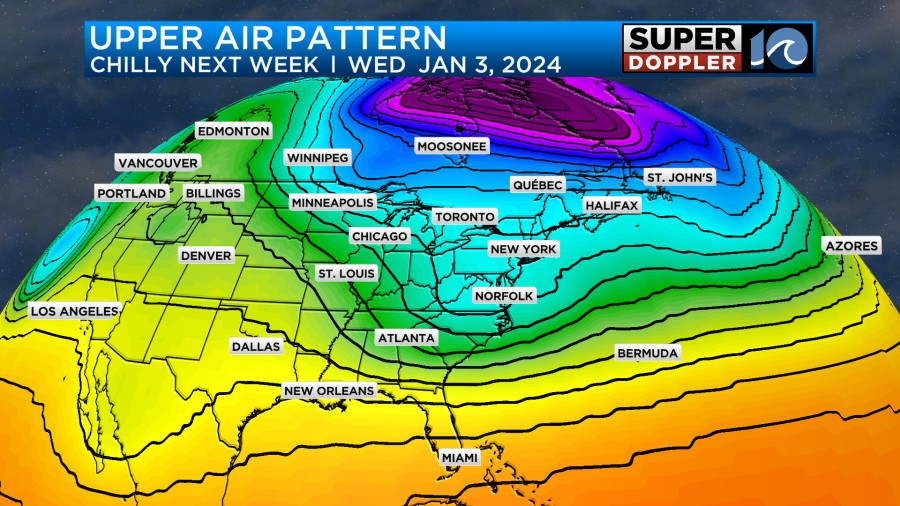
Looking ahead to the end of 2023 as we approach 2024, we’ll be watching for signs of a pattern change in the weather. There are some indications of cooler temperatures moving in and sticking around for a bit. Notice on the upper air chart below for early January the flow lines indicate colder air moving out of Canada. No specifics yet, but if we can get some moisture to sync up with the cold air there could be higher chances for snow in January. Stay tuned!
Hope you and your family have a wonderful holiday!
Meteorologist Ricky Matthews
Follow Ricky on Facebook and Twitter
