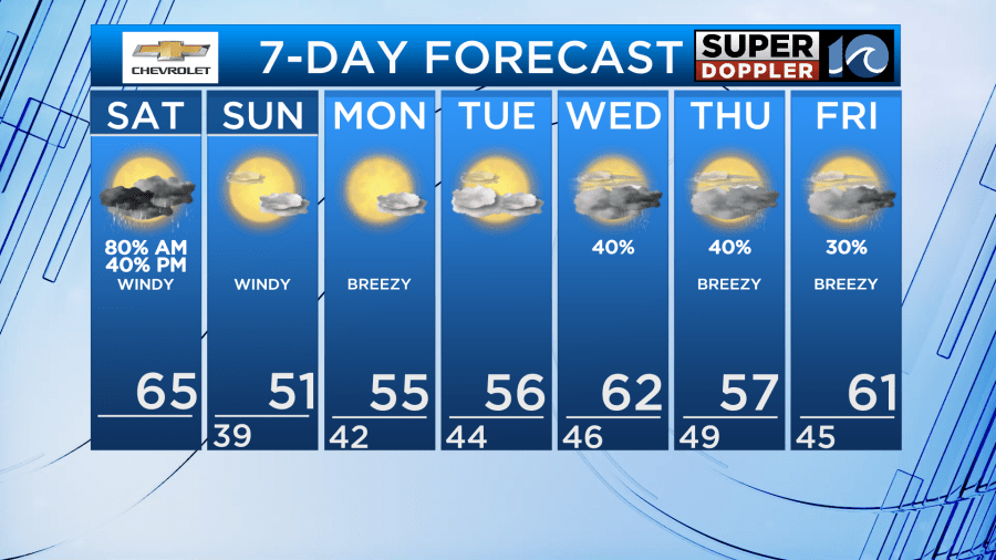
Rain showers will start off our day Saturday. The rain showers will become more scattered in the late morning/early afternoon as the low slides east. There is a chance of a stronger storm or two to pop up with the highest chance in NE NC. Have our WAVY Weather app to get push alert notifications.
It will be mild on Saturday, with highs in the 60s during the morning and early afternoon. Late afternoon, as the wind shifts directions, we’ll see temperatures start to fall into the upper 50s.
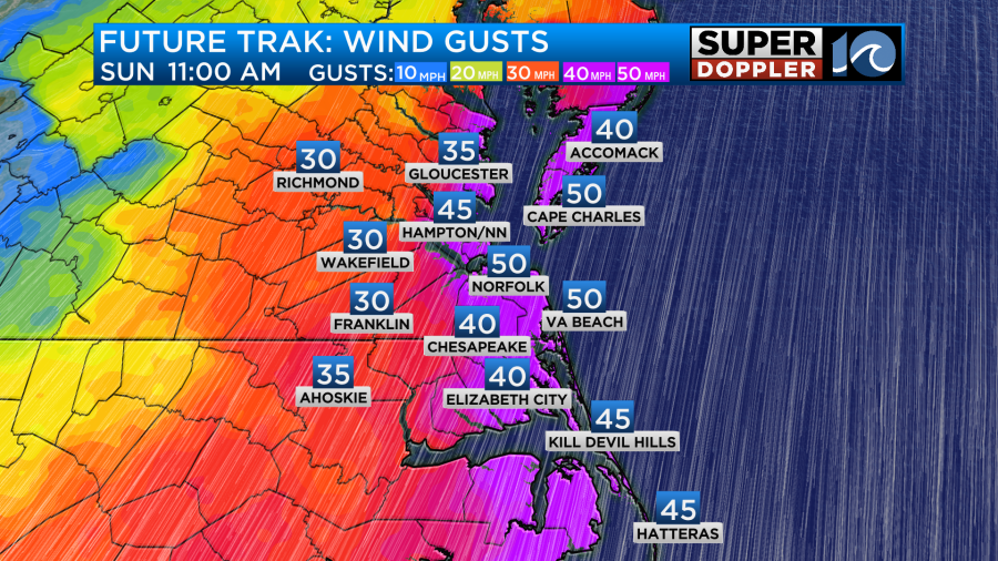
On Saturday, winds will gusts to 35mph with gusts to 45mph near the shore. Winds will be out of the southeast. Then, as the low pulls north, we’ll see a shift to a northwest, then north wind. Gusts may be a little higher on Sunday, with some 35-50 mph gusts along the immediate coast.
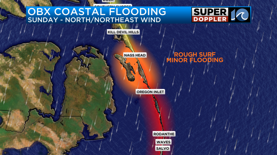
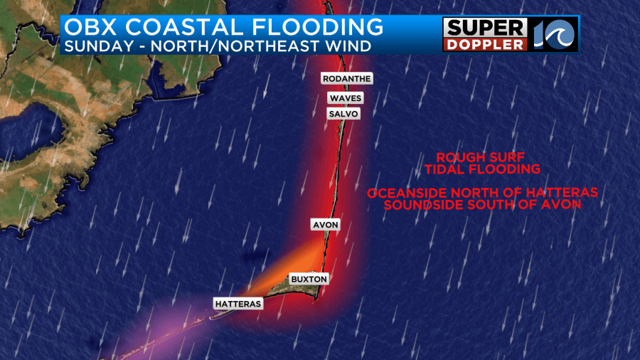
These winds may lead to some minor tidal flooding on Sunday and near moderate tidal flooding Monday, thanks to the combination of wind and the full moon. There may also be some ocean overwash and/or minor tidal flooding over the Outer Banks as the northerly wind begins. The flooding is expected to be oceanside north of Avon and soundside south of Avon into Hatteras.
On Saturday – we could see some flooding along parts of the Currituck Sound/Back Bay area today thanks to the southerly wind. With the wind, a lower water level will occur towards Duck and Southern Shores while a higher water level will occur towards Knotts Island and Back Bay/Dawleys Corner.
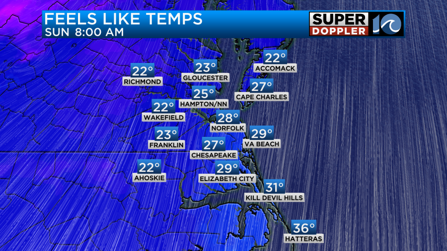
Temperatures Sunday morning will fall into the upper 30s, but once again with the wind it will feel like the 20s early Sunday morning and only around 40 Sunday afternoon!
Things calm down as we head into the work week. We’ll have decreasing wind on Monday (still a bit breezy but not as bad) with dry conditions and highs in the 50s. We’ll be cool and dry on Tuesday with some scattered showers by Wednesday.
Hope you have a great weekend!
Meteorologist Ricky Matthews
Follow Ricky on Facebook and Twitter


