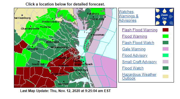
A flash flood warning is in effect for most of the viewing area Thursday until 12 p.m. and a flash flood watch is in effect until the late afternoon.
The heavy rain today is not directly from any tropical systems. Tropical storm Eta did make landfall over Florida this morning near Cedar Key. It is still on a track that will pass well to our south.
However the tropical moisture is pushing far north of the system. It is clashing with a strong cold front that is slowly marching to the southeast.
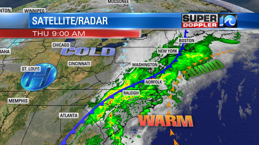
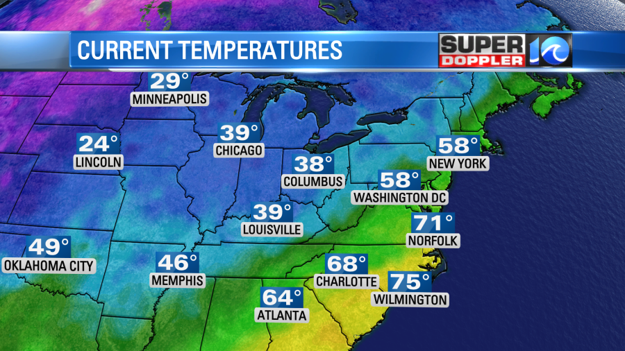
The difference in temperatures north and south of the front is really dramatic today.
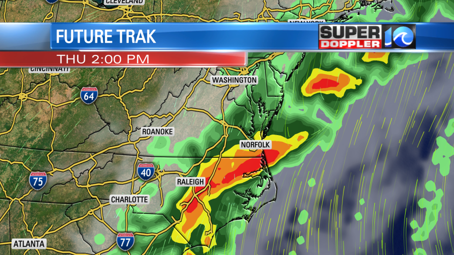
Locally, we will only go up a degree or two before the front sinks south. Then temps will drop to the mid 60s later today. Rain has already been heavy at times. We have had a few Flash Flood Warnings already. We will likely have more of them through the day. The front will be pushing through the metro during the late morning. This will create a line of heavy showers.
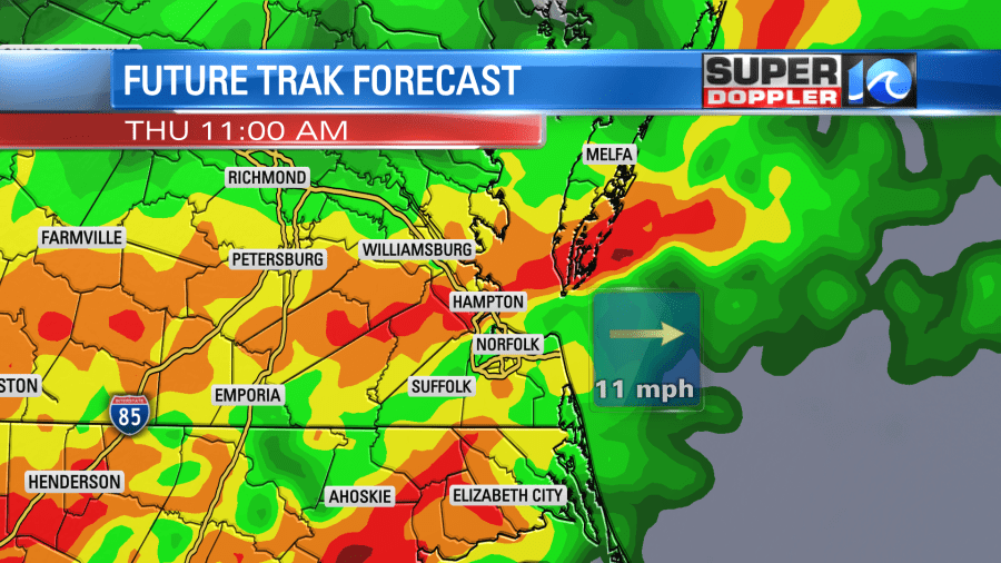
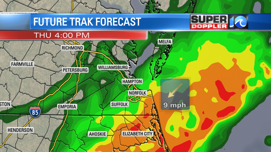
The front and the heavier rain will drop into North Carolina by the late afternoon.
The evening commute won’t be too bad. The showers will be lighter and much more scattered. Then we’ll just have some spotty showers overnight. Tomorrow we’ll start off with a few scattered light showers. Then we’ll dry out through the day. High temps will only be in the mid-upper 60s.
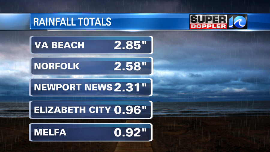
So far the region has had about 1-3″ of rain (as of this writing).
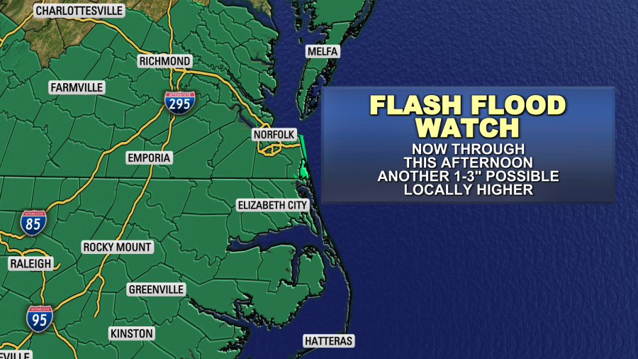
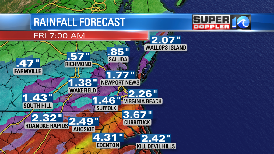
Going forward we could see another 1-3″ of rain in southeast Virginia. We could see 2-5″ in northeast North Carolina and near the state line.
We’ll be much cooler and drier on Saturday. Low temps will be in the 40s. High temps will be in the upper 50s to near 60. We’ll start off cool Sunday morning in the 40s. However, we’ll warm up to near 70 by the afternoon. We’ll likely be dry during the day, but another cold front will bring a few showers to the area Sunday night.
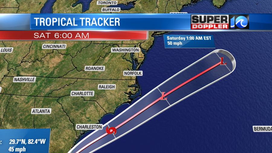
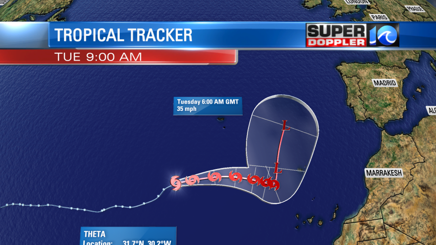
As mentioned…Eta will track to our south. It will get wrapped up into the cold front that is impacting us today, but that will happen well offshore. Meanwhile tropical storm Theta is over the eastern Atlantic. It is moving generally east. It is no threat to the U.S., and now it looks like it will only threaten a few islands.
There is another tropical disturbance that will likely form into a system soon in the central Caribbean. This will move west, and will probably be the next tropical storm. Iota is the next name in the Greek alphabet. Remember, 2020 is already the busiest season on record. Theta became the 29th named storm not too long ago.
Stay tuned for updates!
Meteorologist: Jeremy Wheeler