A lot of the ditches and reservoirs in the region have been pretty full lately. We haven’t had the flooding like they’ve had to our west. However, we have had a lot of rainy days. Our rainfall is actually down about 0.87″ for the month (Norfolk). However, we are 1.82″ above average since March 1st. We are headed for a stretch of wet weather for the next few days. We won’t have much rain today, but we could see a half inch up to an inch tomorrow.
Today we have Bertha to our south. It is newly formed as of this morning. It was a tropical storm, but it is forecast to move over land soon and become a tropical depression.
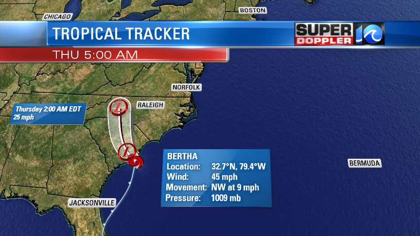
It will have a short life. It should fall apart by tomorrow over the western North Carolina. Regardless of the naming, it should stay weak. However, it is surrounded by a very humid air mass. Our regional dew points have already climbed above 60, and they are increasing. This extra humidity will lead to scattered showers later today. Bertha will move north/northwest, but it will act to lower our local pressure a little too.
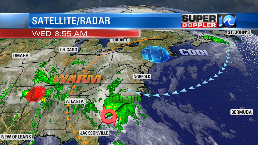
Meanwhile another area of low pressure is forming to our west near Memphis.
So as far as our local forecast….We had a lot of fog this morning. It is already starting to thin out. It will burn off by midday. Then we’ll be mostly cloudy with scattered rain showers. I’ve got the chance for rain as 40%. We’ll have an east/southeast wind as we go into the afternoon. Some of the gusts could be up to 20mph. This will help to boost the afternoon temperatures. Highs will be in the upper 70s with a few 80s inland/south.
Tomorrow we’ll have a lot of the moisture from Bertha in place, but I don’t expect as much fog in the morning. We’ll be mostly cloudy through the day. There will be scattered showers and some thunderstorms in the area. Some of the storms could be strong with heavy rain and some gusty winds.
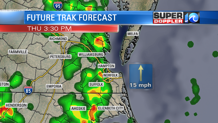
We’ll already have a south wind at 10-15mph with gusts to 25mph outside of any storms that form. This will boost the high temperatures into the low-mid 80s. Again, it will be very muggy.
On Friday we’ll have the low (that is currently over Memphis) move into our region. It will have a lot of warm/humid air to work off of. So we’ll have a lot of rain Friday into Saturday. The low will only slowly move east. High temps will be in the 80s. Then…finally…We’ll dry out on Sunday.
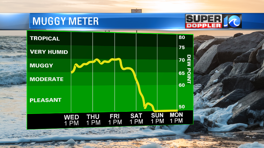
After an early morning shower we’ll dry out in the afternoon. Highs will be in the 70s. Then we should be drier and mild for the first half of next week. Of course the forecast has been changing a lot lately. So I don’t want to get my hopes up too much. Come on sun!
Meteorologist: Jeremy Wheeler


