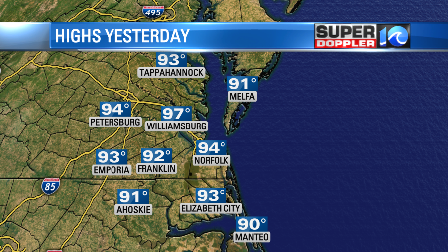
Yesterday high temperatures hit the mid 90s with a few upper 90s inland. We were in the low 90s near the shore.
However, the heat index did make it up into the 100s again. It was pretty rough out there. Especially, if you were out in the sun for a time. There was a breeze at times, but it wasn’t steady. Today will be very similar. We have another heat advisory in the region. It goes until 7pm. However, there aren’t heat alerts to our west today over the Mississippi River Valley.
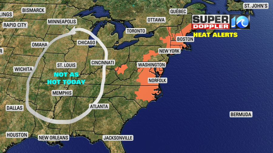
High temps will run up in to the mid 90s this afternoon with a few upper 90s inland. We’ll be in the lower 90s near the shore. The heat index will be between 100 and 106 today with some inland spots probably hitting 107 or higher for a short time.

High pressure is still centered offshore to our southeast. However, today there is a cool front over the Mississippi River Valley.
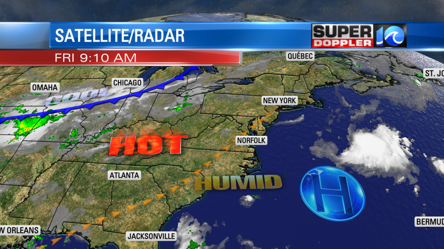
We’ll be partly cloudy today with a light southwest wind. There will be some isolated showers and storms popping up this afternoon. There could be a cluster of showers and storms this evening over parts of the area, but they should be brief.
Tomorrow we’ll have a mix of sun and clouds. The cool front will still be off to our northwest. However, it will be approaching. So there will be some scattered showers and storms in the afternoon and evening.
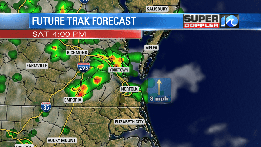
Heavy rain will be possible. We’ll still heat up into the low 90s, but hopefully it won’t be quite as hot as today. Having said that, the heat index will still rise to the upper 90s to around 100. We’ll finally cool down on Sunday. The cool front will drop to our south and stall out. We’ll be mostly cloudy with scattered showers and a few storms. High temps will only be in the lower 80s. That will feel very cool after the heat we just experienced. We’ll be cool again on Monday with highs in the lower 80s. There will be more scattered showers and a few storms.
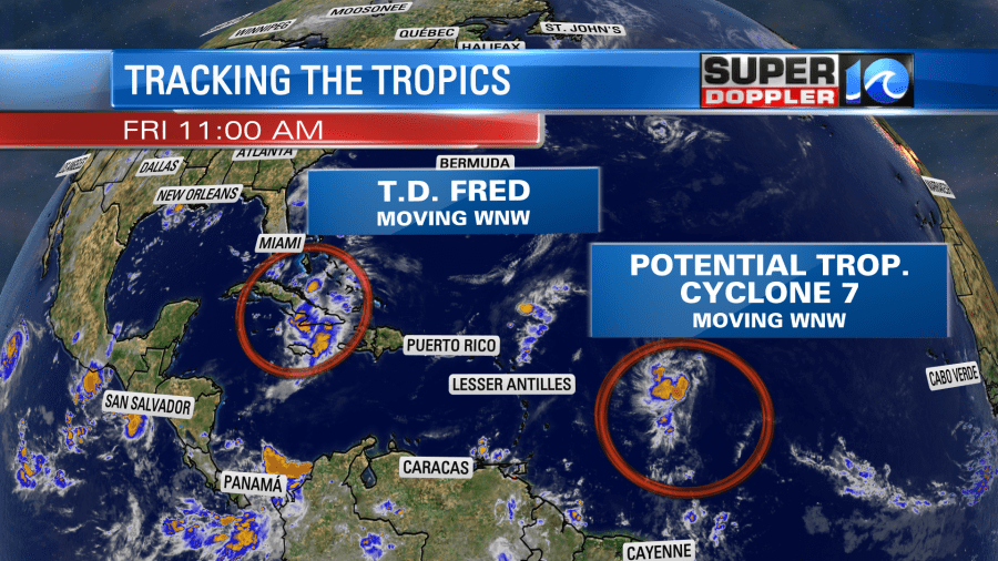
The tropics are picking up. We’ve been following Fred for a little while. This morning it was a weak tropical depression that was moving along the northern coast of Cuba. There is some heavy rain over parts of Cuba.

It hasn’t regained much strength since it almost fell apart yesterday. However, the center is officially over the water. So it may be able to strengthen if it stays over the water for a while. Strength may fluctuate in the short-term, but eventually Fred is expected to regain tropical storm status. There is still a good amount of confidence that it will be near the Florida Keys on Saturday as a tropical storm.
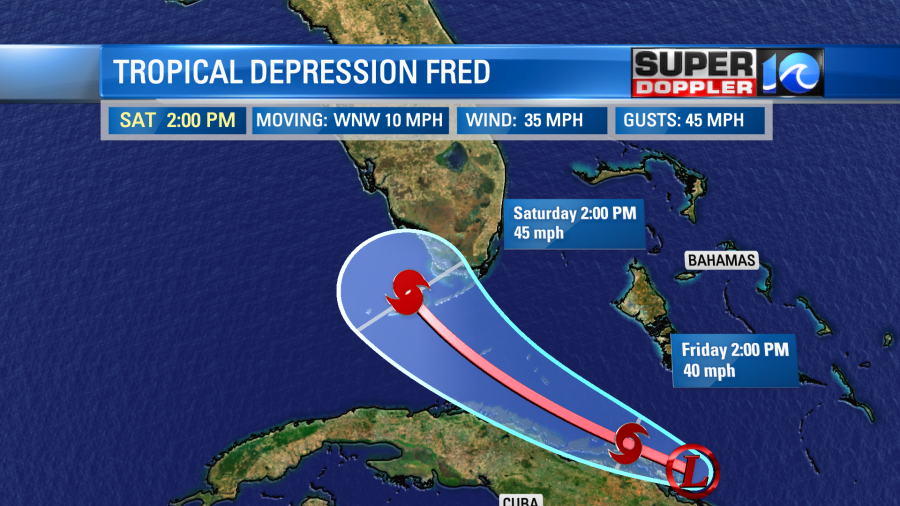
After that it will move more northward around the edge of the Bermuda high. The most likely track takes it offshore of the west coast of Florida. Then it is forecast to make landfall over the Florida panhandle. Afterwards it will likely weaken to a depression again and move into the Southeast.
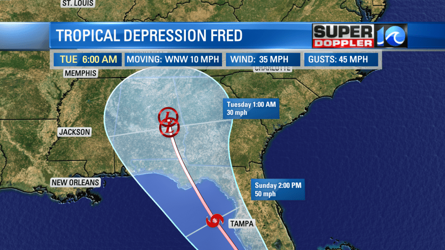
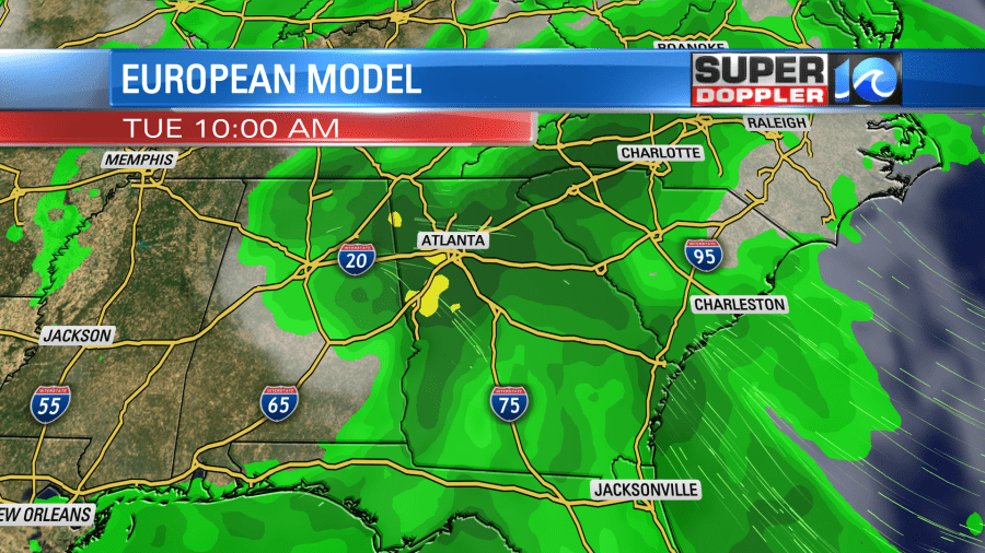
It will then most likely bring heavy rain to parts of Alabama, Georgia, eastern Tennessee and western North Carolina early next week.
The models are in pretty good agreement up until the latitude of Tampa. Then they start to split.
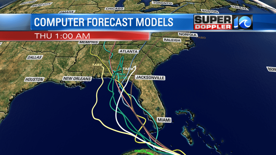
It’s still possible that it will move more over land, and some models do take it closer to the central Gulf of Mexico. However, the models are starting to cluster a bit more than yesterday.
There is also a tropical disturbance that is east of the Lesser Antilles that bears watching. This is moving west/northwest, and it has a high chance of formation in the next 48 hours.
(11am update: The disturbance has become “Potential Tropical Cyclone 7”
Here is the track:
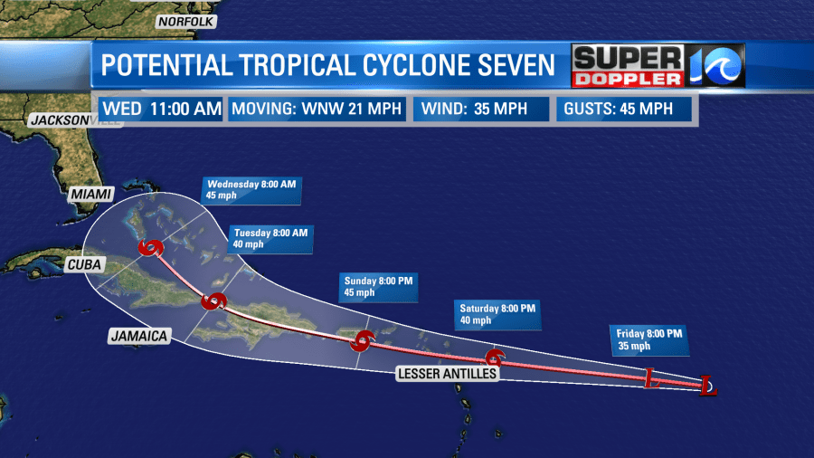
The problem is that many of the models take it well north of Cuba and towards the Bahamas. After that there is a good number that bring it close to the southeastern U.S. coast.
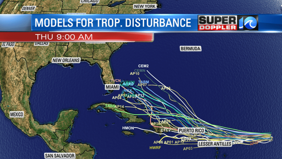
So we need to watch this closely over the weekend. Stay tuned for updates.
Meteorologist: Jeremy Wheeler