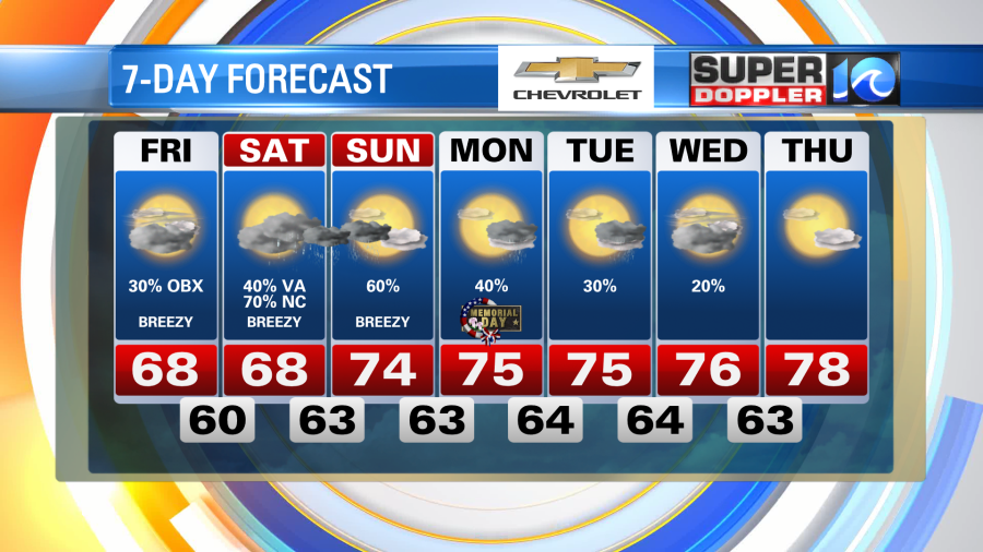
The Memorial Day weekend forecast features several rain chances, but also some dry time. It will not be sunny and 75 all weekend, but it won’t rain all weekend either. We will see some dry time mixed in with scattered rain showers.
Let’s break it down day by day:
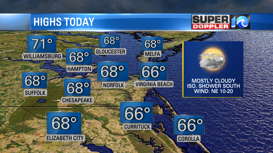
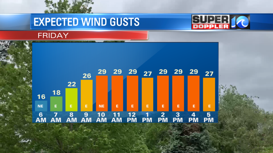
FRIDAY: Clouds increase across the area, but most spots stay dry. Expect scattered showers in the southern OBX towards Hatteras and an isolated shower into NE NC late in the day. Winds will increase today with some gusts of 20-30 along the coast. Temps primarily in the 60s.
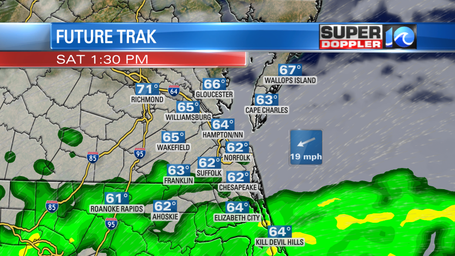
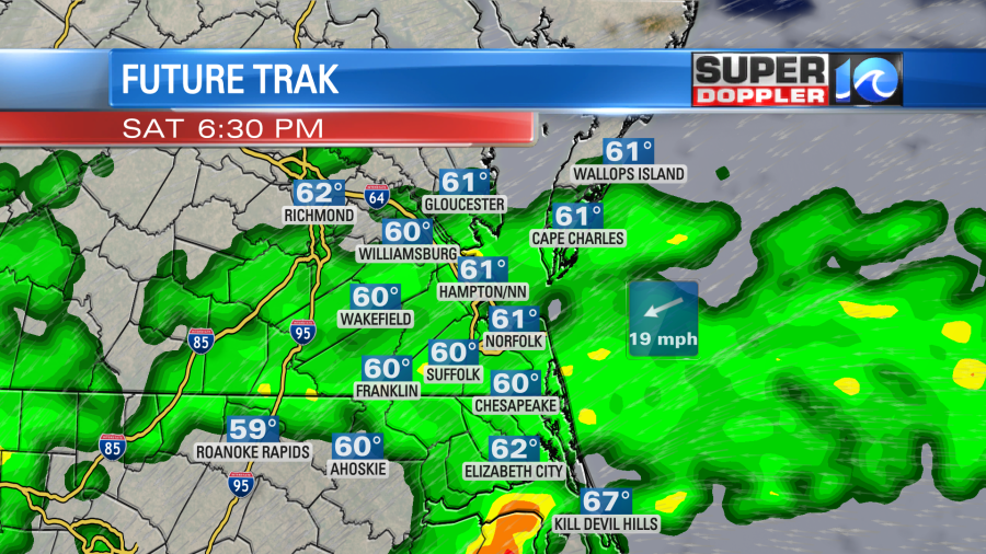
SATURDAY: Expect scattered showers on Saturday, especially in NE NC and the Southside area. We’ll see mostly cloudy skies to start the day. Rain will move in from south to north through the day. By the afternoon and evening, I expect scattered showers across a large part of the Southside and perhaps parts of the Peninsula. Rain chances continue to increase overnight with showers likely and a few downpours in spots. Winds gusty at times, up to 30 in VA/NE NC and 40 in the OBX.
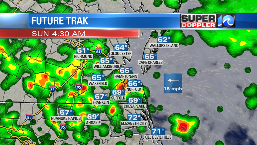
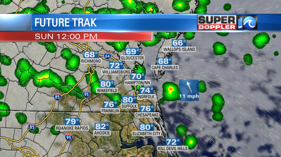
SUNDAY: Sunday is an interesting day. We will start off the day with some rain. Heavier rain possible before daybreak. We will see some scattered showers during the daylight hours, especially in the morning across the area. By the mid afternoon, rain chances will decrease some with the highest chances in areas of the Peninsula and Middle Peninsula. If we see the rain move further north, there is a chance the sun may actually come out across parts of the area. This is most likely in NE NC and the Southside. If this happens, with the late May sun, temperatures could climb quickly into the upper 70s to even near 80 in a few spots. We’ll see. Otherwise, breezy at times, mainly at the coast.
MEMORIAL DAY MONDAY: Expect to see some additional scattered showers and even an isolated t-storm on Memorial Day. However, we should see some dry time too with highs in the mid 70s. Not as much wind Monday.
Through Monday, rainfall totals will generally be around 0.5-1″ in Eastern VA and 1-2″ in NE NC. 2-3″ of rain possible in the southern OBX towards Hatteras. Generally, more rain south and less to the north. Rain chances will gradually decrease into next week, with highs climbing back into the 70s.
BEACH HAZARDS:
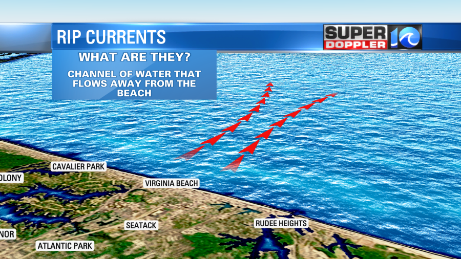
There is a HIGH risk of rip currents along our area beaches this weekend. Red flags are flying at many beaches, which means swimming is prohibitied.
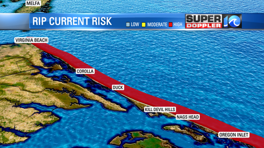
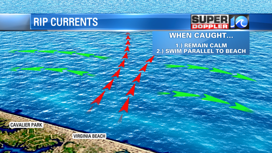
What are rip currents? Simply put ,they are fast moving channels of water that flow away from the coastline. They are often found near jettys and sandbars as the water is channeled through the area. If you’re caught in a rip current, the key is to remain calm. I know – that’s hard- but it’s key to staying safe. Rip currents flow fast, so if you try to fight back against it you can exhaust yourself and risk drowning. The key is to swim parallel to the shoreline to escape the current, then swim back to the coast.
Meteorologist Steve Fundaro, an avid surfer – put together a fantastic visual explainer on what rip currents are and how to escape them. Check out his video and share it with your friends/family who may head to the beach, especially if they’re not from our area. Statistics show that many of the people who get caught in rip currents are not from areas where they have beaches, but from inland states like TN and Kentucky.
Click here to view the explainer video
Have a fun and safe Memorial Day weekend.
Meteorologist Ricky Matthews