If you woke up and looked at your WAVY Weather App this morning you will probably have seen a lot of green on the screen. However, there were really only a few sprinkles and patchy drizzle in the area.
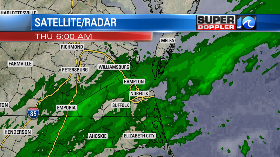
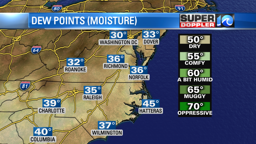
This effect came from 2 things. First, one of the radars in the Super Doppler 10 Network are down. So the other radars are covering, and this limits scans closer to the ground. Second, there is a lot of moisture pushing in overhead, but it is very dry at the surface. Dew points are only in the 30s.
So a lot of precip is drying up before it hits the ground. We have a weak area of low pressure to the southeast. It is moving northeast along a stationary front.
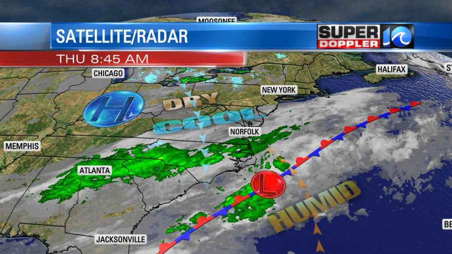
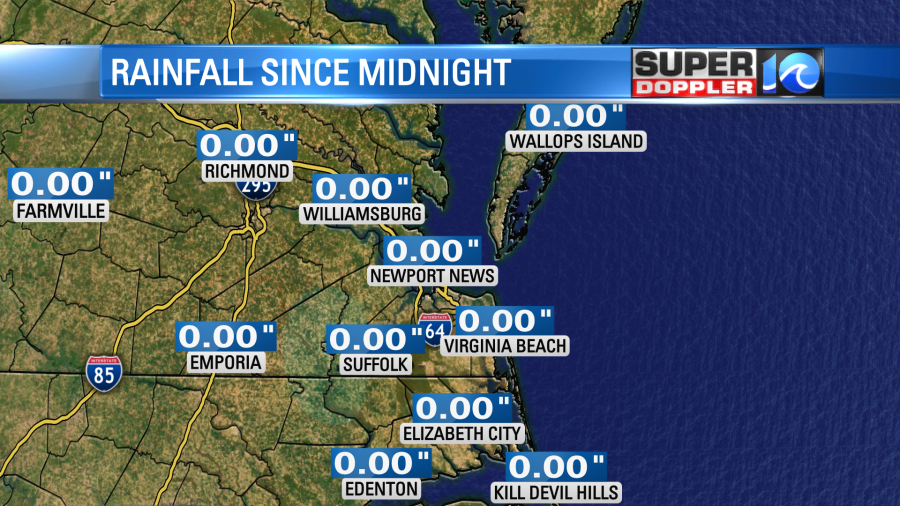
This is helping to push the moisture northward. Plus, an upper level trough lies overhead. So the upper level winds are southerly along the East Coast. While we have had a lot of green on the screen since midnight the rain gauges have all come up with zero rainfall (so far).
Going forward, eventually, the moisture will start to increase. Dew points will rise through the afternoon. Clouds will be thick all day, but the chance for rain showers will increase. So we’ll have scattered rain showers moving from midday onward.
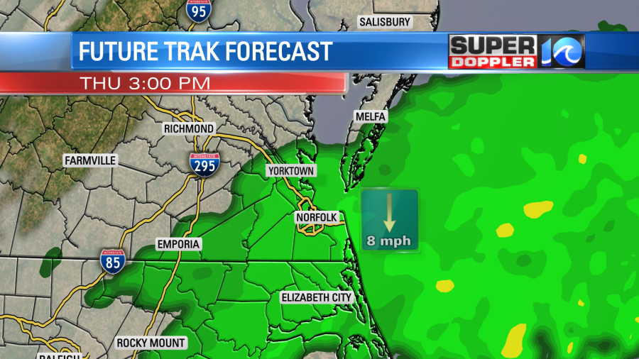
The showers should be light in nature, but it could become steady for some. It will stick around until about 6-8pm. That will impact the evening commute. Winds will be out of the north/northeast at 8-12mph. So high temps will only rise to the low 50s today.
After a few showers this evening we’ll have clearing skies overnight. Winds will be light and out of the north. This will allow for temps to drop fast. So we’ll have low temps in the low 40s in the metro with some upper 30s inland. Some locations inland/west could drop to the mid 30s. It will depend on how fast skies clear there. So there may be some patchy frost.
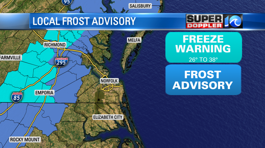
Bring in the potted plants if you live in the frost Advisory area, and maybe even one county east of there just to play it safe.
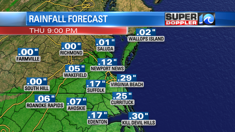
We will pick up about 0.2″ to 0.3″ of rainfall before it wraps up tonight with lesser amounts to the north and west.
Tomorrow the low will kick out to sea, and high pressure will build in. We’ll have lots of sunshine with high temps in the mid 50s. It will be breezy with winds out of the north. Gusts could be up to 25mph. We’ll be dry and cool on Saturday with high temps near 60.
By Sunday another area of low pressure will form to our south (offshore). This low is going to be stronger than today’s system. However, it will probably stay a bit farther offshore. We will have some rain Saturday night into Sunday. The models are actually trending with a drier forecast for southeast Virginia, but they keep things pretty wet over north Carolina. Especially over the Outer Banks.
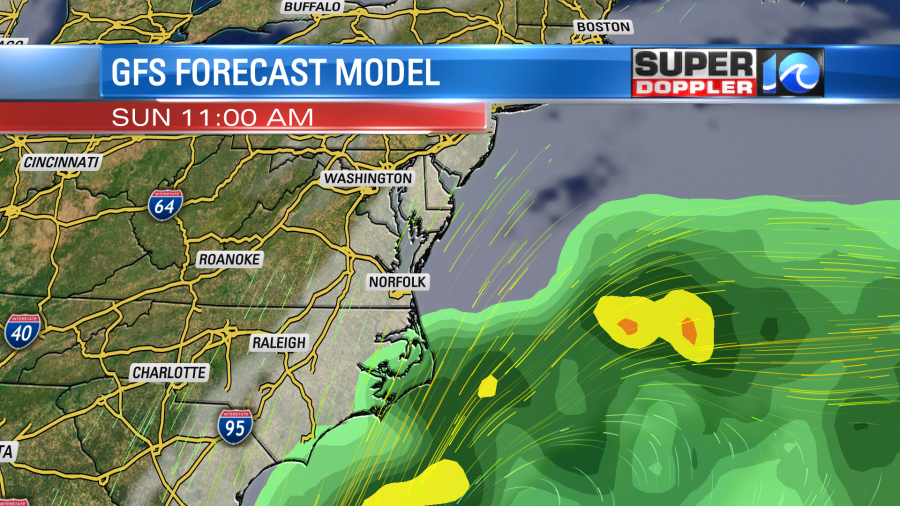

The forecast isn’t set for Sunday yet. A slight change in the track could change the Hampton Roads Forecast considerably. So stay tuned for updates.
With the persistent north/northeast winds over the next few days we may have some minor tidal flooding. It won’t be nearly as bad for areas along the northern Chesapeake Bay. Some areas up there recently had flooding that was similar to some recent tropical storms and hurricanes. Here are some photos and more information about that from the National Weather Service. Recent Tidal Flooding (October 29th).
Meteorologist: Jeremy Wheeler