A damp end to our Sunday is expected across the area as moisture moves in from the west.Areas of rain will be likely by the afternoon and I expect showers to linger into the evening and overnight. Highs will be in the upper 40s this afternoon.
Initially through the morning hours and early afternoon it will be a fight between the dry air and the moisture to see who wins. As the moisture falls, a lot of it may evaporate first. We call this virga in meteorology. Basically the moisture falls from the cloud but then dries up as it falls through the sky and evaporates before reaching the surface. This process also results in evaporative cooling – lowering the temperature of the air and sometimes can result in some sleet/wintry mix too.
I would not be shocked to see some sleet or snowflakes mix in with the rain as it starts to move in around midday. The most likely place for this will be in western areas of Hampton Roads and areas of interior NC/VA where temps are a little cooler this morning. So places like Surry, Sussex, Southampton, Northampton NC, Gates and Hertford will have the best chance.
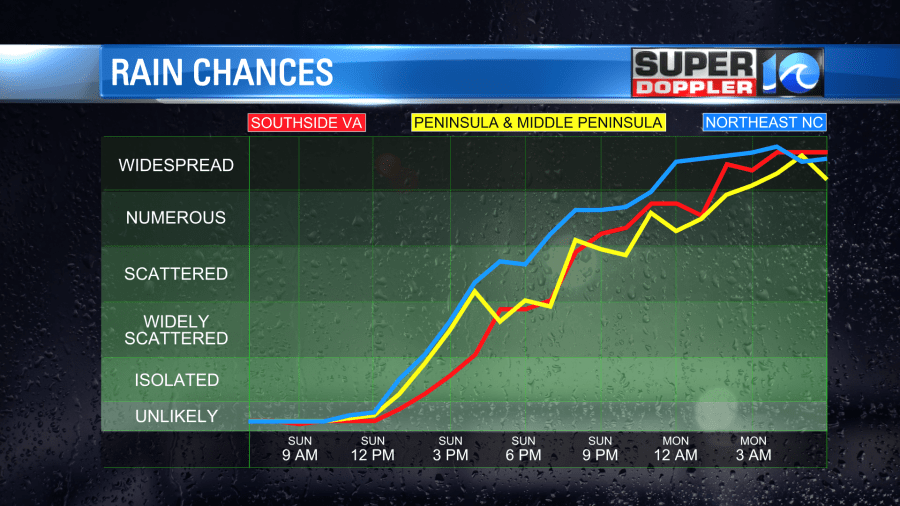
Rain showers will stick around this afternoon with highs in the upper 40s. Overall rainfall totals will be around 0.5″ to 0.75″ with some spots picking up 1″ by Monday afternoon. Wait, more rain Monday?! Yep…
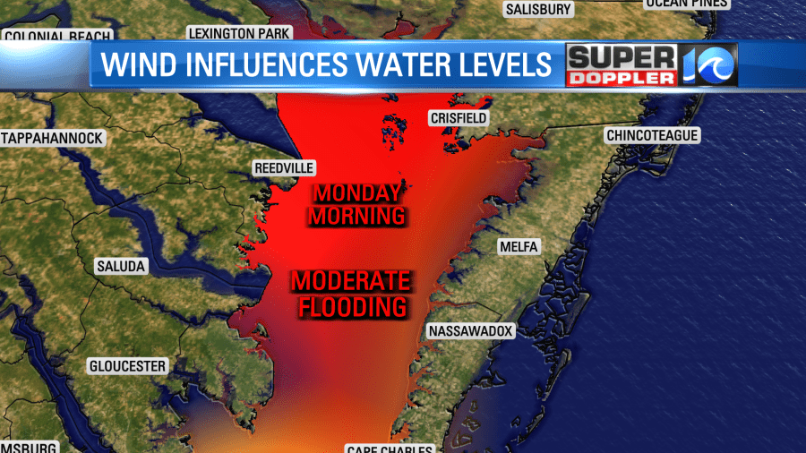
As the area of low pressure slides along our coastline, we’ll see some breezy conditions Monday and some mist/drizzle. Showers at times as well. This wind will also increase the tides along the western side of the Eastern Shore and on the Middle Peninsula where some moderate tidal flooding is possible.
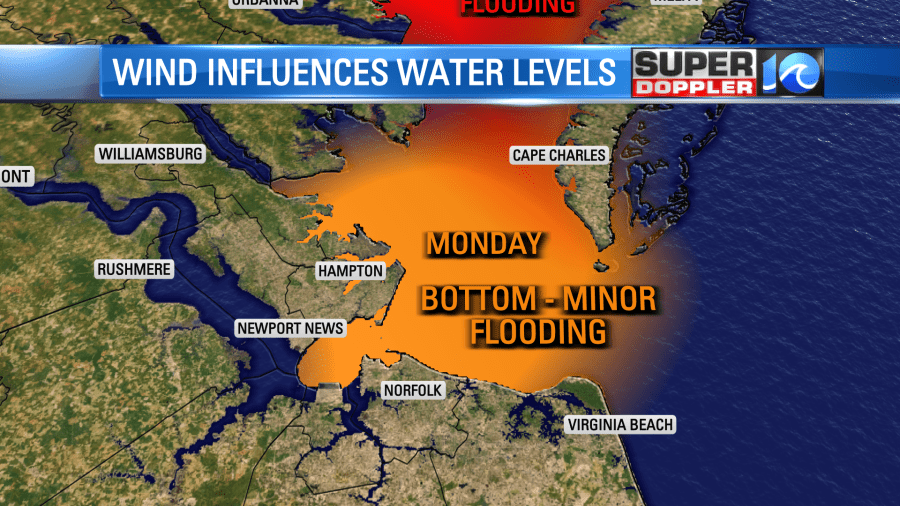
For Hampton Roads, tides are not expected to be a big problem. We could see tide levels approach the bottom of minor flood stage during Sunday afternoon and Monday’s high tide cycles.
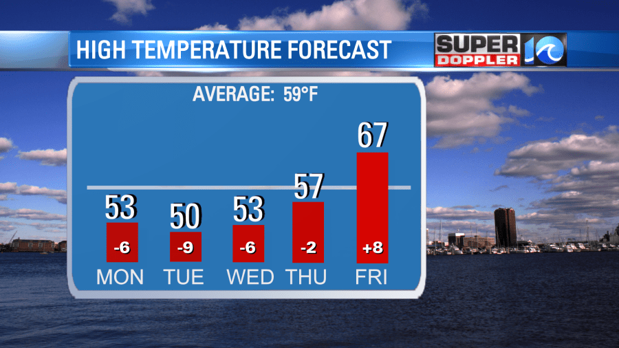
Drier weather returns to the area on Tuesday with breezy conditions expected. Winds will remain breezy on Wednesday. Highs will be in the 50s. By late in the week, highs climb into the upper 50s and we will even see some 60s by Friday!
Late next week a front will approach from the west. Late Friday evening a shower or two will be possible. Expect some scattered showers Saturday. The timing of this front will determine what Saturay’s weather looks like. It could be a day when we see dropping temperatures into the afternoon depending on the timing of when the front comes through. We’ll keep looking at the data and tweaking the forecast as we get closer.
Hope you have a great weekend!
Meteorologist Ricky Matthews
Follow Ricky on Facebook and Twitter


