If you’re heading to the NAS Oceana airshow, expect a good amount of sunshine today. Break out the sunscreen and remember there’s not much shade on the tarmac.
The Blue Angels will fly around 3pm. The last few days, some lower clouds have caused them to perform a variation of their high/low and flat shows. If the clouds are at least 8,000 feet, they can do a high show with all of their looping manuevers. Lower clouds force them to modify it to just rolls so they don’t fly through the clouds. I wouldn’t be surprised if some cumulus clouds pop up again today. The aviation forecast calls for a few clouds at 5,000 feet, which would allow for a low show.
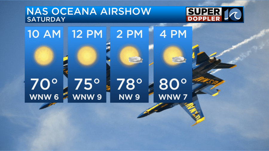
Across the area, highs will be in the upper 70s to low 80s today. We’ll see a fantastic afternoon with low humidity.
Rain chances remain low through the weekend. However, late Sunday night into Monday mornign we’ll see a chance for rain return as a front approaches. Rainfall totals willl be around 0.50 to 1″ across the area. A few higher amounts could occur if a few storms fire up.

Less wind is expected today as Lee continues to move north. The system is now a post-tropical cyclone. Wind, rain and storm surge is still expected across Nova Scotia and parts of Maine.

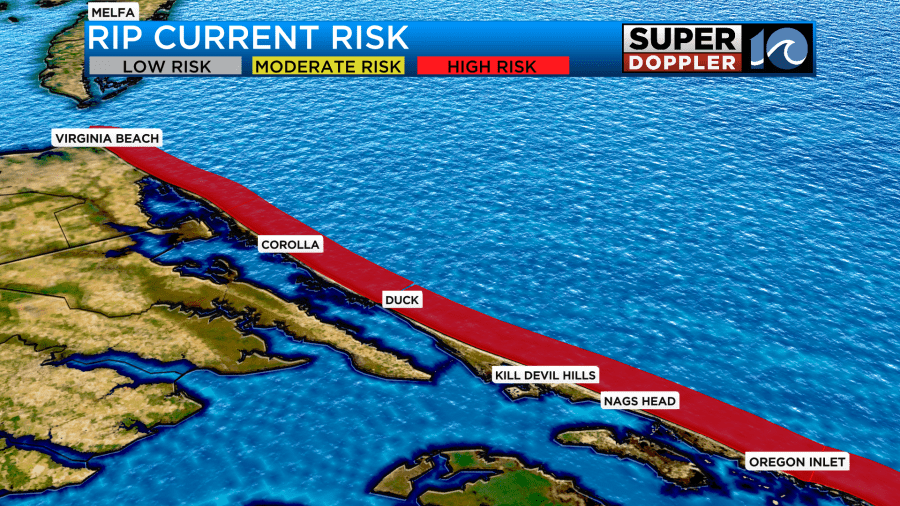
Even though Lee is moving north, a risk for rip currents remains today. Don’t get in the water.
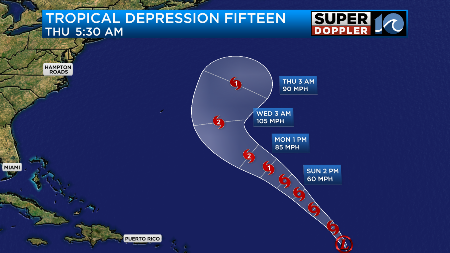
Elsewhere in the tropics, Margot is a TS but won’t impact us at all. TD 15 will become Nigel over the next few days, but is expected to turn right out to sea. It is likely we will see some swell from it as we go into late next week, leading to higher waves and a risk for rip currents again.
Hope you have a great weekend!
Meteorologist Ricky Matthews
Follow Ricky on Facebook and Twitter


