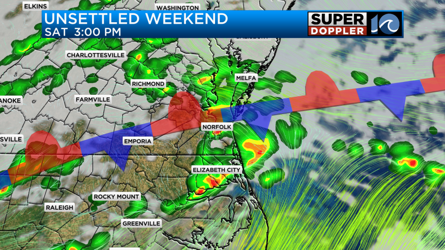
A stationary front near our region will bring some scattered rain chances to the area Saturday. A few downpours and even gusty winds in a strong/severe storm could occur.
A FLOOD WATCH is in effect through this evening. A WATCH means that flooding is possible. Remain alert for Flood Advisories or Flash Flood Warnings that may be issued.

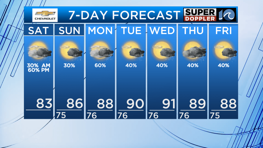
Overall, through the day we’ll be mostly cloudy with scattered showers and storms. Most of the rain will come in the afternoon and evening but a shower or storm will be possible at any time. There will be some dry time and sun mixed in too! High temps will be in the 80s for Saturday.
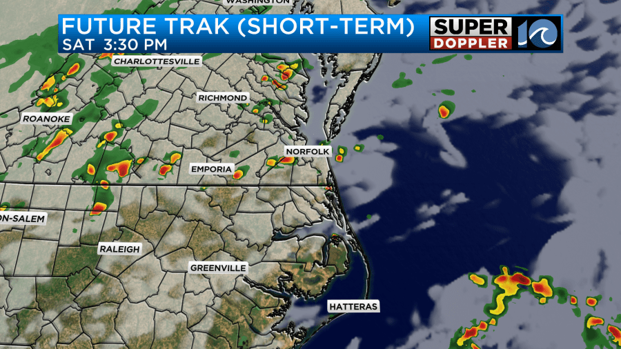
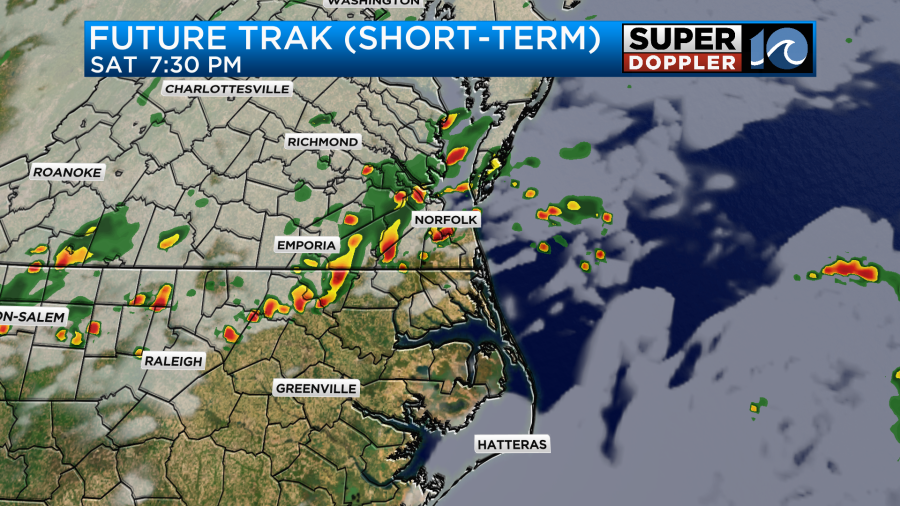
The best chance for any stronger storm will be late evening, especially along the VA/NC border into NE NC. Make sure you have our WAVY Weather App to get alerts.
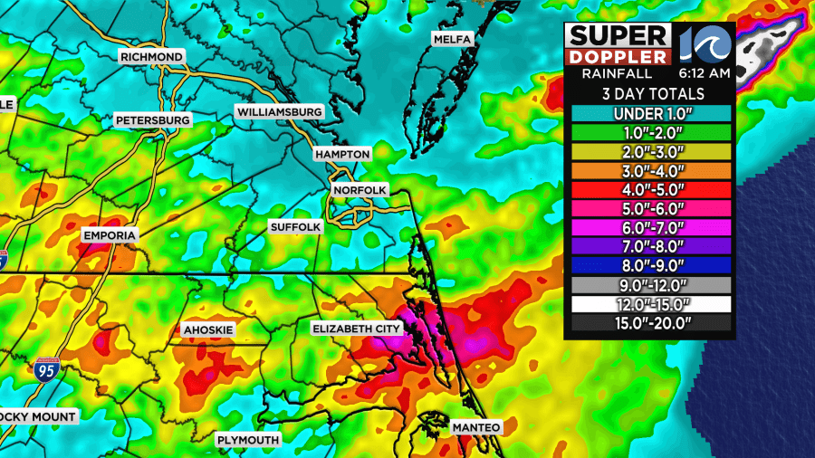
In addition, with high moisture content in the air – we can’t rule out some isolated flooding in spots today. That’s why the watch is in effect. I think personally some flooding could also occur in NE NC, since you’ve had a bunch of heavy rain recently and it won’t take much additional rain to cause flooding.
The front will linger around for Sunday and Monday. We’ll have a lot of clouds with scattered showers and storms possible – once again with the highest chances in the afternoon. High temps will be in the upper 80s to low 90s with high humidity. That high humidity sticks around into the middle part of next week, resulting in heat index values climbing again to over 100 by Tuesday/Wednesday.
The tropics remain quiet for now. Things look unfavorable for development over the next week 2 weeks. 3 weeks from now as we head into early August, things may get more favorable in the Caribbean as more rising motion occurs, helping to produce showers and storms. Enjoy the calm for now!
Hope you have a great weekend!
Meteorologist Ricky Matthews
Follow Ricky on Facebook and Twitter


