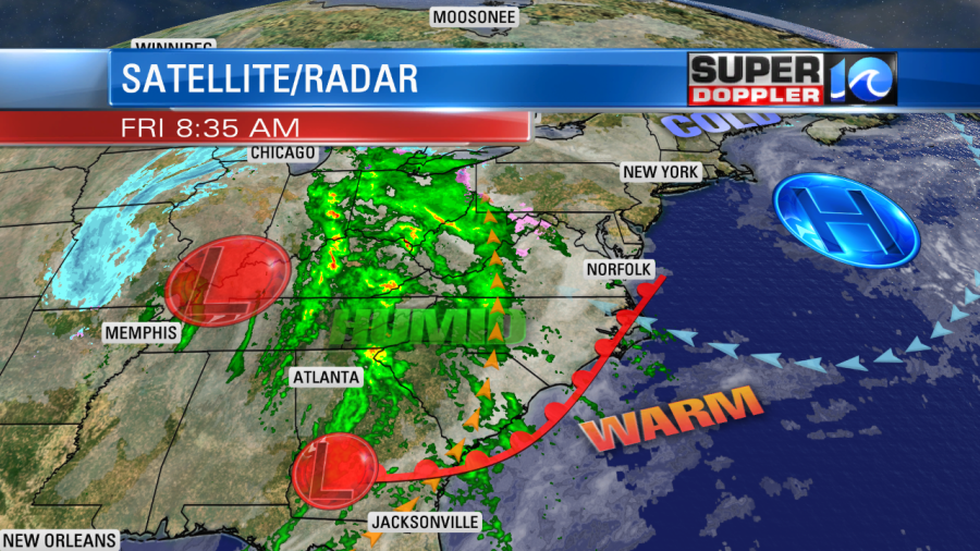
This morning we had a few speed bumps for people heading to work. There was a lot of moisture in the region. So there was thick cloud cover, some patchy fog, and even a few spotty rain showers. The showers were created by a warm front that was coming in from the southeast.

The silver lining is that we’ll warm up nicely today. High temps will be in the upper 50s with some 60s over North Carolina. (Possibly some 60s in Hampton Roads). Skies will be mostly cloudy. There will be some isolated showers possible through the day, but it will be far from a washout.
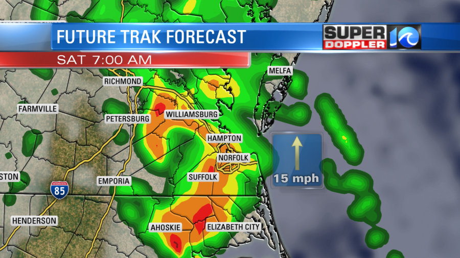
By tonight the 2 areas of low pressure will slide east. The rain will push east ahead of the lows. There will be some scattered showers by late tonight. Then we’ll have a big line of showers by early tomorrow morning.

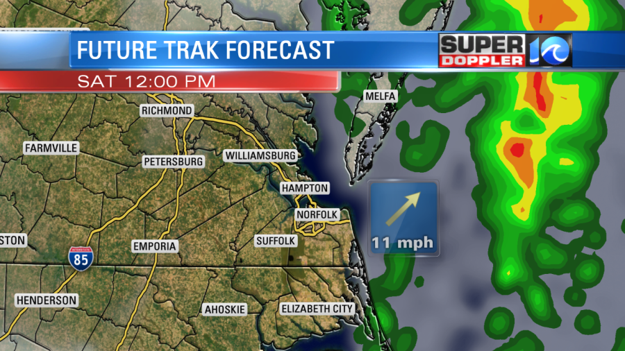
The rain may be heavy at times. We might even have a couple of thunderstorms. By noon the rain showers will push to the coast.

Then we’ll be dry during the afternoon. We could see about a quarter to three-quarters of an inch before it wraps up. High temps will be in the 60s. So we’ll be able to enjoy some of the warmer temps. There will be a dry/westerly breeze. We’ll be dry and cool on Sunday with highs in the 50s.
The models are split over some moisture on Monday and Tuesday. Some models have a lot of moisture with some scattered rain showers during that time. They even suggest a couple of flurries Monday night. Other models are drier. It doesn’t look like there are any big surface features, but it seems more like an upper level disturbance. There’s no super cold air expected, but it will be something to monitor.
Meteorologist: Jeremy Wheeler


