We had quite a bit of clouds move into the area this morning. There is an area of high pressure edging offshore, but there is also a warm front skirting our region.
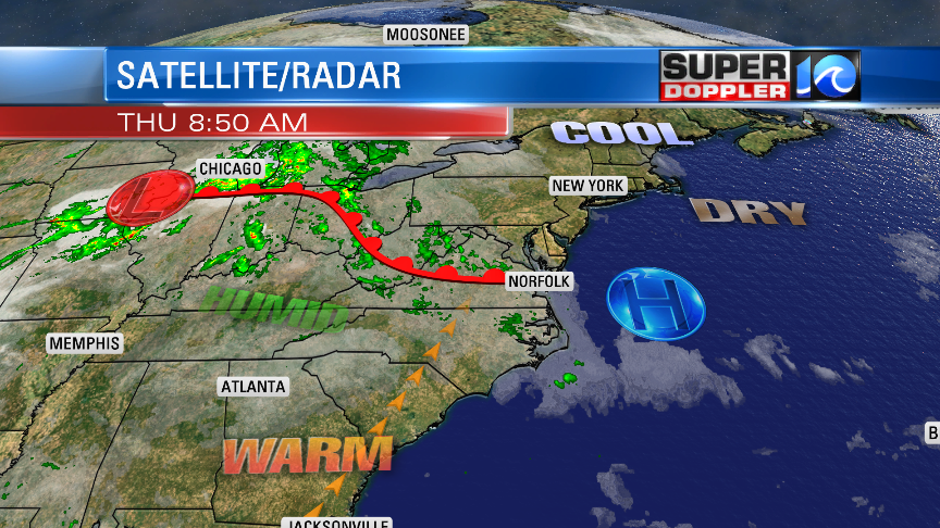
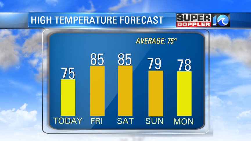
We’ll have quite a bit of clouds for a while, but the models suggest that we’ll have some partial clearing this afternoon as the front moves north. There are some isolated showers in the area as I write this, but hopefully those move north with the front later today. We’ll have a light southwest breeze. That will allow temps to warm up nicely. High temps will be in the mid 70s.
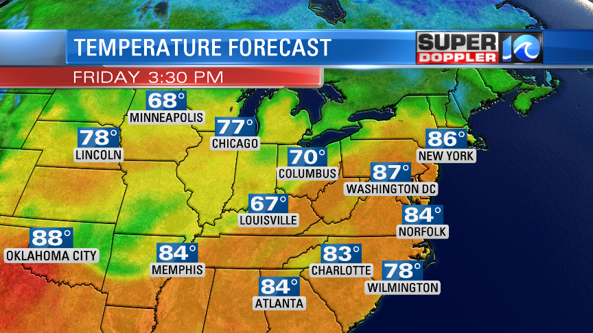
Tomorrow we’ll be deep into the warm zone. Skies will be partly sunny, and we’ll have a southwest breeze. So high temps will rise to the mid 80s.
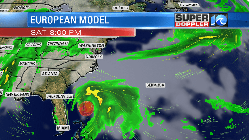
It will be a nice day! We’ll still be warm on Saturday with lows in the 60s and highs in the 80s. Most of the day looks partly cloudy, but some isolated showers may move in late in the day. We’ll have more clouds and a few scattered showers on Sunday. A cool front will move-in and stall out over the area. High temps will be in the mid-upper 70s. It looks like we’ll see a lot of rain for the first half of next week. This will partly depend on what happens in the tropics…
Over the weekend the computer models are still forecasting an area of low pressure to form near the Bahamas. The National Hurricane Center suggests that it would be a subtropical system, and I agree. Remember, a subtropical system’s thunderstorms can spread out a bit more from the center. Plus, it can interact with cooler air. The models have it moving north Sunday into Monday.
At that point it would be offshore, but not too far from the southeast coast.
The models then predict that the system would move more to the northeast Monday into Wednesday. A 2nd low is forecast to form over land and move into our region. Some of the models even hint at the 2 two lows merging a bit, but becoming more broad (which is a good thing in terms of wind). However, we could get quite a bit of rain from the 2 systems. Mainly from the second one.
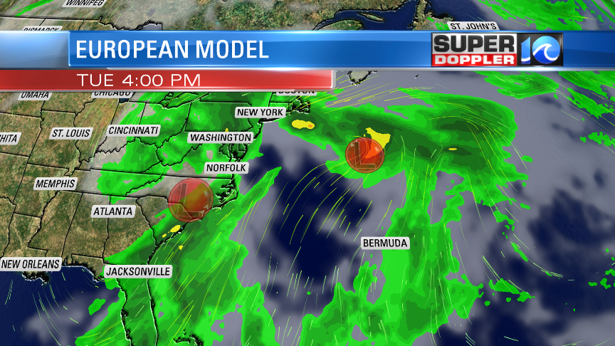
It’s still fairly early, and this thing hasn’t even formed yet. So stay tuned for updates about it over the next couple of days.
Meteorologist: Jeremy Wheeler