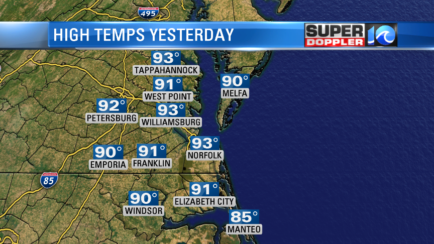
It was hot and humid yesterday as expected. High temps were in the low-mid 90s over the region.
My family decided to go to the beach. It was a good beach day. Folks did a decent job of social distancing. The water was cold though. It took a while to get used to it. Ocean temps are in the mid-upper 60s, but it’s in the low 70s on the Chesapeake Bay. It was also very breezy. We’ll still have a southwest wind today, but it won’t be as strong as yesterday. High pressure is offshore.
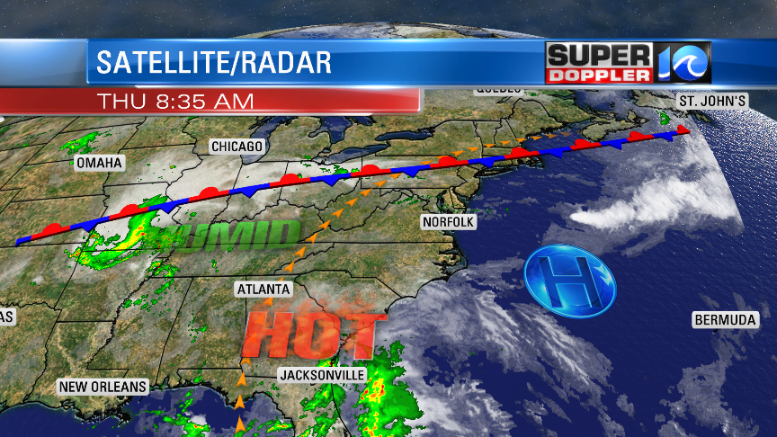
It’s a typical Summertime pattern. Even though Summer doesn’t start for a couple more weeks. We are going to be hot and humid again today. High temps will rise to the low-mid 90s. The heat index will be in the mid-upper 90s. So be sure to drink plenty of water/fluids if you are doing any outdoor activities. Skies will be partly sunny for a while. Towards the afternoon there will be some isolated showers and storms popping up. There will probably be a few more storms in the region around the evening.
Tomorrow the big surface features will be about the same, but there will be more clouds in the region. There will also be scattered showers and storms during the afternoon.
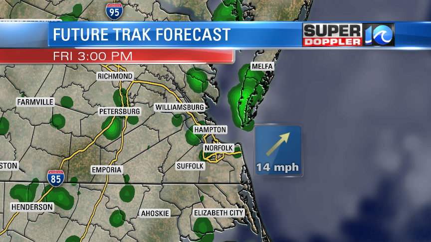
So high temperatures will come down slightly. They will be in the mid-upper 80s. However, it will still feel like the 90s with the heat index, and we may still hit 90 inland. We’ll be pretty hot and humid again on Saturday with high temps in the upper 80s to near 90. There will be a mix of sun and clouds with scattered showers and storms. This will be ahead of a cold front that will arrive by the evening. We’ll have cooler/drier weather then from Sunday into early next week. High temps will return to the 70s.
In the tropics…Cristobal was a tropical storm this morning, but it was moving over land. It wasn’t looking too strong on the satellite as of the mid-morning.
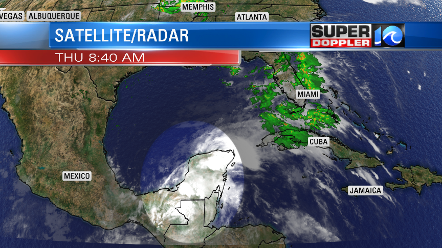
It will move over land for a bit longer. So it is forecast to briefly become a tropical depression in the short-term. However, it will eventually move back north over the open waters of the Gulf of Mexico. It will likely strengthen back into a tropical storm. There’s a low chance that it could become a hurricane before landfall. Many of the models keep it as a tropical storm. However, many systems that follow a south-to-north track over the Gulf waters usually end up stronger than forecast. Regardless, the model consensus and the latest track have it moving towards the Louisiana coast over the next few days.
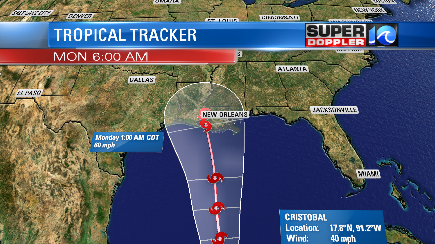
We’ll see how much Cristobal bounces back after being over land. Stay tuned for updates.
Meteorologist: Jeremy Wheeler


