As expected the brief mix yesterday morning changed into a rain and wind event for our area, but the snow stacked up over western parts of North Carolina and Virginia.
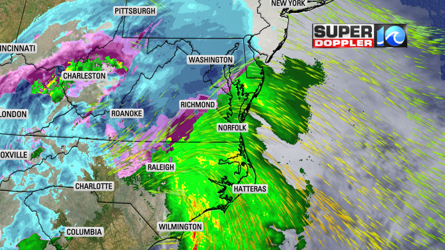
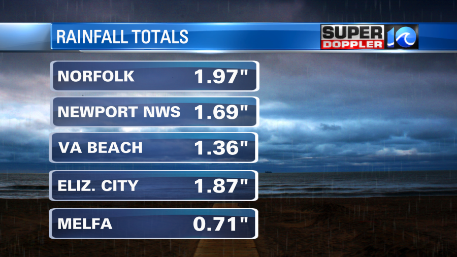
Some areas out west had about a foot of snow. Meanwhile, we ended up with 1-2″ of rain in our region.
This will help out with the ongoing drought in the area. In fact I think that will end the drought for some.
Today the area of low pressure will move into the northeast states. They will continue to get rain and snow there through the day.
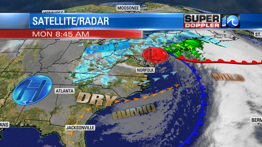
We have already pulled in some dry air from the southwest. So we won’t have any more precip today (except for a possible flurry on the Eastern Shore this evening). We’ll have a mix of sun and clouds. However, the wind will be strong through the day. It will run out of the southwest then west at 10-20mph with gusts up to 35mph.

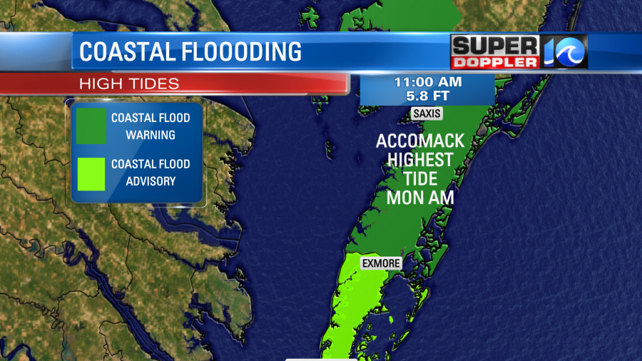
The winds will trim back a little this afternoon, but it will still be breezy. Most of the area will be fine in terms of tidal flooding. There was some minor to moderate tidal flooding along the sound-side of the Outer Banks this morning, but that should go down. However, there may be some minor to moderate tidal flooding on the Eastern Shore. It is forecast to be moderate around Saxis, VA by the late morning.
By tomorrow things should settle down. High pressure will build into the region and the wind will drop. High temps will be in the 40s. We’ll rise to the 50s on Wednesday with partly cloudy skies. That should be pretty nice. However, things will get messy as we go into Thursday and Friday. We’ll have a strong cold front drop into the region during the day Thursday. Precip will probably start as rain, but could transition to a mix or some snow later in the day.
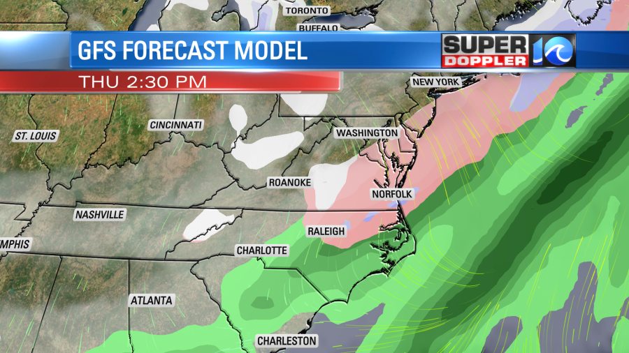
The front will drop to the south. It will stall out to our south/southeast on Friday. However, an area of low pressure will form along the front (offshore). Also a potent piece of upper level energy could swing through the region. So it’s possible that we could have a wintry mix again on Friday.
The models disagree on how much precip makes it to our region on Friday.
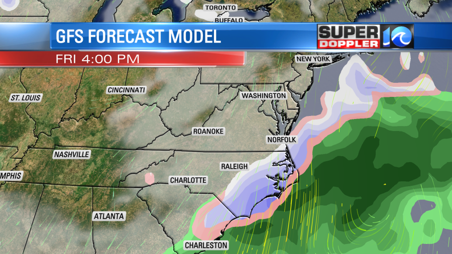
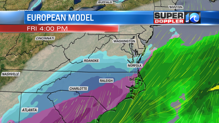
The European model has more mix and snow on Saturday too, but the latest GFS dried that out. At the time of this writing they are very different, but the GFS did flip since last night. So we’ll see. Let’s just say that the forecast for Thursday through Saturday could be very changeable between now and then. Two differences will be how strong the low is offshore, and how far offshore it stays. There’s still plenty of time to watch the forecast. Just keep in mind that this could be the first chance a getting some accumulating snow in the metro. We’ll see. I’ll have more on this in tomorrow’s weather blog.
Meteorologist: Jeremy wheeler