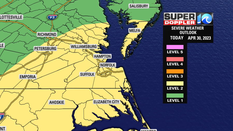
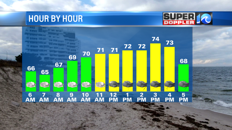
We will see some scattered showers through the morning hours, with heavier rain possible around midday and in the afternoon. Some of the showers and storms this afternoon could be severe, with strong winds the main concern.
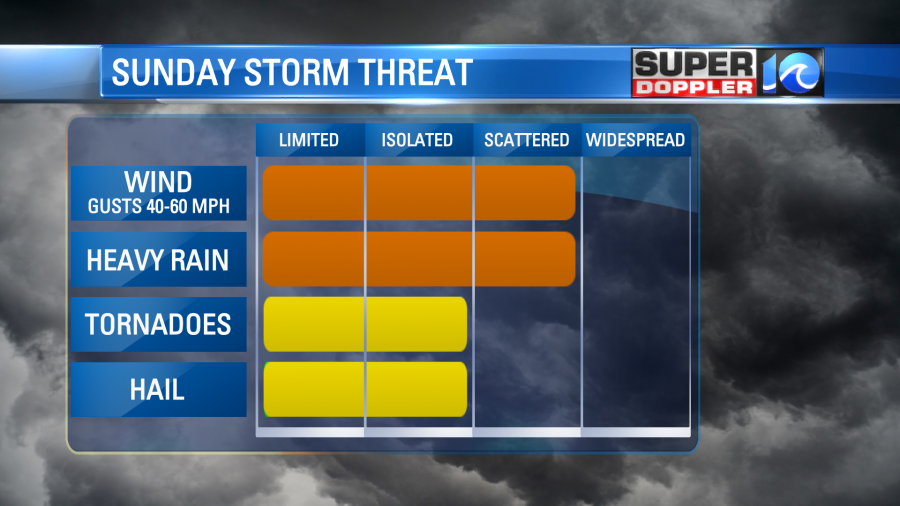
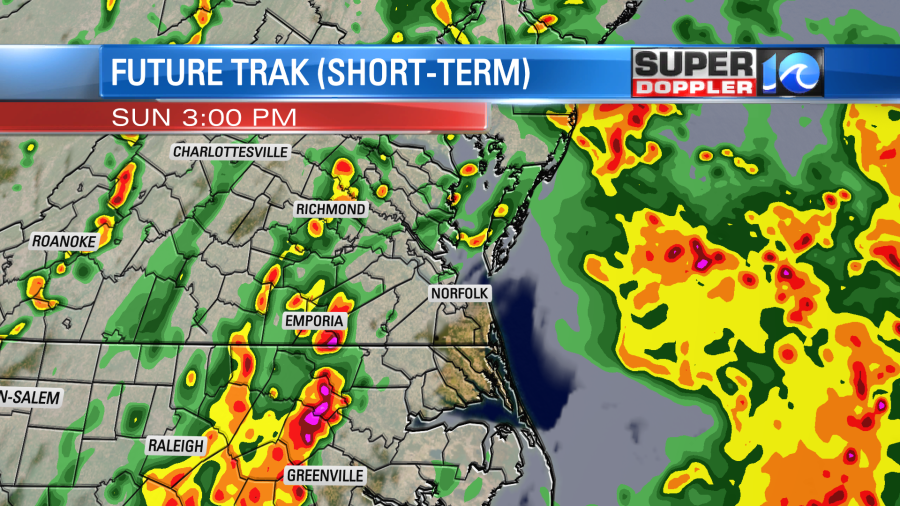
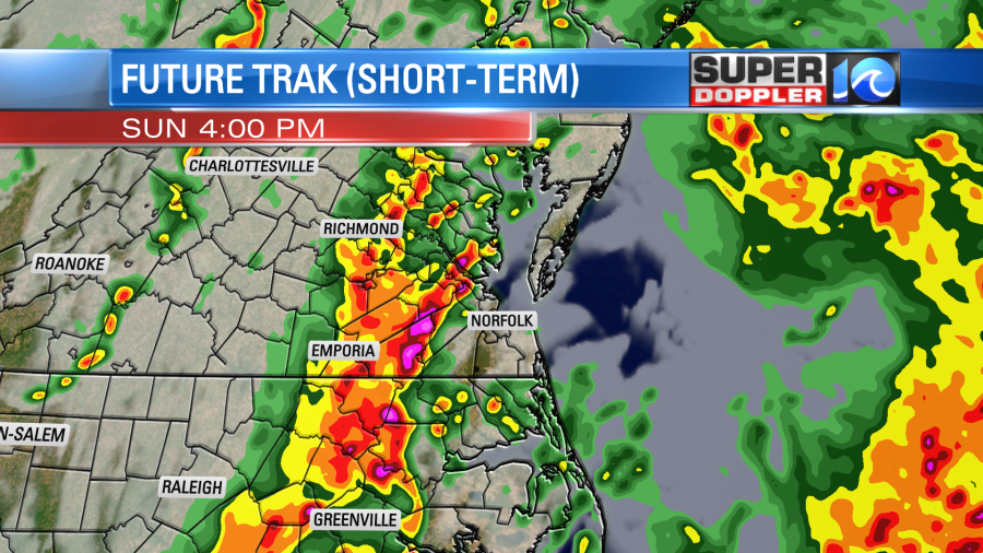
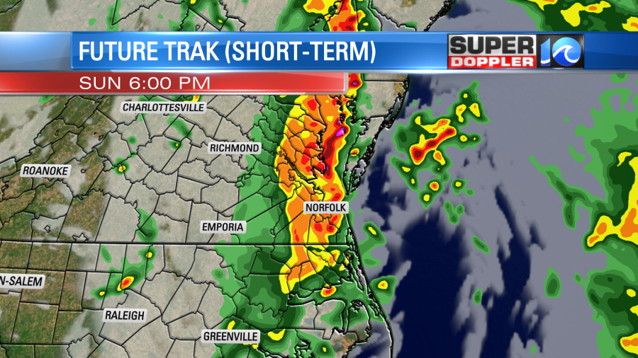
The main question for today will be how much instability do we see. With some rain and clouds this morning, the amount of available instability or t-storm fuel may be lower. However, if we can see just a little bit of sun, the risk will go up. That’s what our FutureTrak model shows. I think it is doing a good job of showing the storm risk, if we have enough instability. Notice the line of storms approaching western portions of our area around 1-3 pm and then the metro around 3-4pm.
Make sure you have a way to get weather alerts. Our FREE WAVY Weather app will use the GPS in your phone to make sure you get alerts – no matter where you are. It’s a good app to have if you’re going to be out and about today.
Winds will become breezy this afternoon and tonight – lasting into Monday/Tuesday. Some gusts of 20-25 mph will be possible.
We will see mainly dry conditions for much of the week. A shower is possible by mid to late week, but overall, a nice stretch of weather is ahead for a few days.
Hope you have a good Sunday!
Meteorologist Ricky Matthews
Follow Ricky on Facebook and Twitter