After the chill this morning we are going to warm up quickly today, and we’ll keep warming up into tomorrow. Winds may even cause some problems tomorrow, as there may be some power outages in the region. Here’s the setup:
Today high pressure is rolling offshore. There is a strengthening area of low pressure over the Midwest. There is a warm south/southwest wind increasing in between.

These winds are pushing a warm front to our north today. The winds will gust up to 25mph with a few gusts to 30mph by the end of the day.
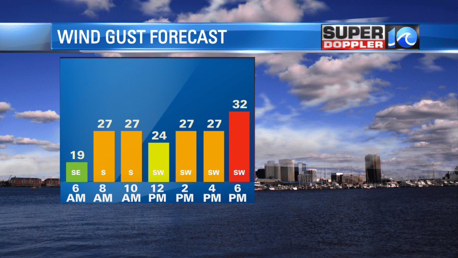
These winds won’t be enough to cause power outages today, but it will be able to push our high temperatures up to the low-mid 70s this afternoon.

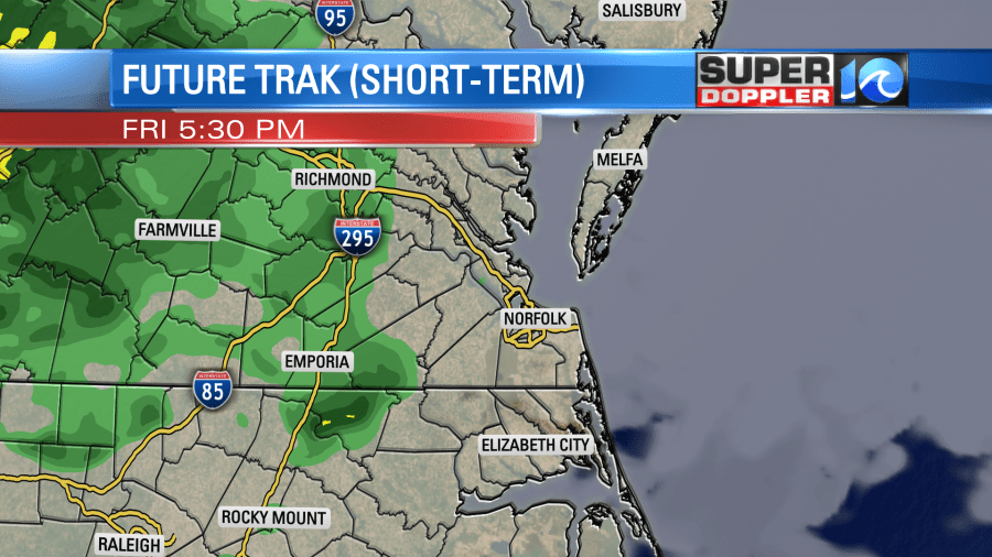
Skies will be partly to mostly cloudy with more clouds than sun late in the afternoon. We’ll be dry for the first half of the day for sure. There may be some isolated showers later in the afternoon, but a few scattered showers will move in from the west by the early evening.
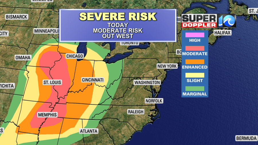
The low will create some severe weather out to our west today. There is moderate risk (level 4 out of 5) over parts of the Mississippi River Valley.
Winds will stay strong out of the southwest overnight. After the scattered showers in the evening we’ll still hold on to some clouds overnight. Low temps will only bottom out near 60 degrees.
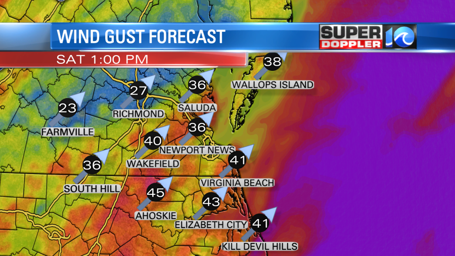
Tomorrow the winds, temperatures, and humidity will all increase. The low and the high will both strengthen. Plus the cold front will get a little closer to our area. (It won’t come through though until the evening). So the surface winds will pick up tomorrow. Winds will gust up to 40-45mph at times.
We’ll have another mix of sun and clouds tomorrow. However, there will be some scattered showers and storms moving in from the west. Now the latest models currently disagree on the coverage for tomorrow. It may be a matter of how much instability can form and overcome the strong winds at all levels. Wind shear (increasing wind with height) is needed for severe thunderstorms. However, sometimes if you have strong winds at all levels, then it can make it tough for storms to build and grow. That may be why our model doesn’t have too much coverage for tomorrow afternoon.
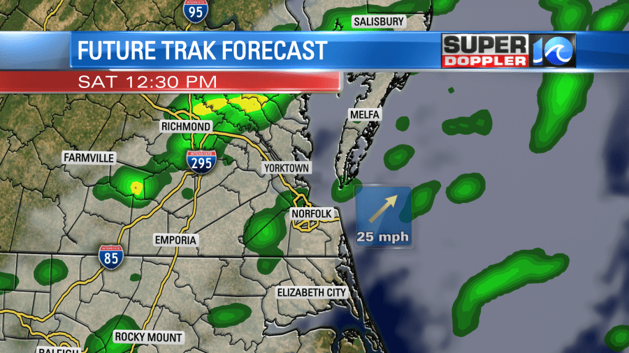
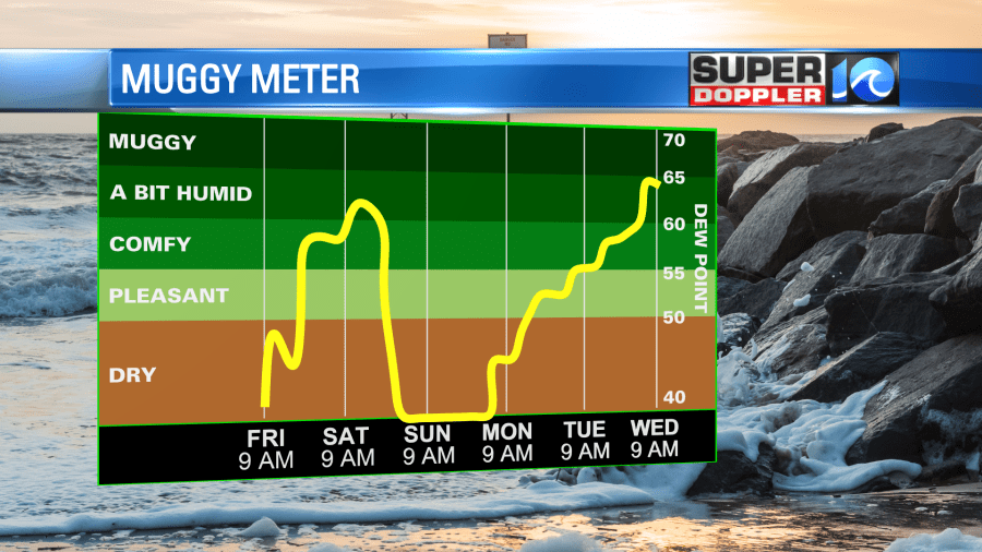
It could also be some dry air coming in from the west at the mid-levels. There will be plenty of humidity at the surface though. Dew points will be above 60.
Either way I’m calling for a broken line of showers and storms between noon and 4pm. There may be some severe weather, but we’ll see. Strong/gusty winds will be the main threat with isolated large hail possible.
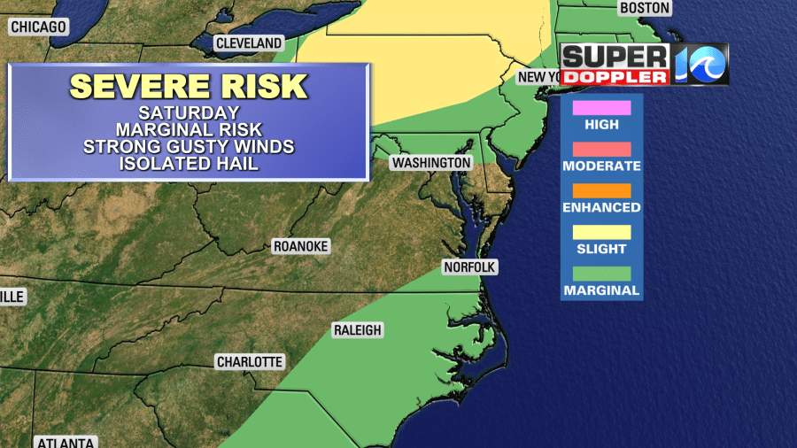
Remember the general winds will already be strong. So it won’t take much more strength for it some storms to become severe. High temps will rise to near 80 degrees in the afternoon.
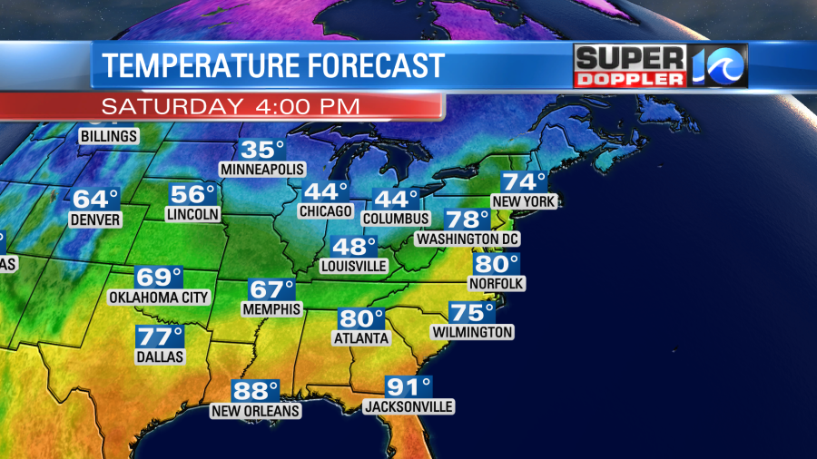
We’ll have a few more showers and storms in the evening as the cold front arrives. Then we’ll dry out and cool down. We’ll have partly cloudy skies on Sunday with high temps only in the upper 50s. The wind will decrease quite a bit. So it should be nice, but it will be a bit on the cool side. Don’t worry…We’ll warm up to near 70 by Monday with fair skies. We’ll be in the upper 70s by Tuesday.
We aren’t expecting much rain from this system. We’ll likely only get a couple tenths of an inch between this afternoon and Saturday evening.

This is not good news. The U.S. Drought monitor just updated yesterday. A decent portion of the area is now in a moderate drought.

A large portion of the area is abnormally dry (level 1 out of 5). Hopefully, we’ll get some rain over the next 7-10 days. If not, then this region may return to drought conditions, and that would be right as we go into the heart of the growing season. We’ll see.
Meteorologist: Jeremy Wheeler


