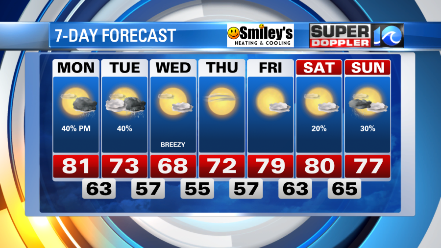
We’ll cap off a beautiful weekend of weather here in Hampton Roads with some Sunday night rainfall. A draping front will park itself over the region for the next few days and provide some unsettled weather – meaning it remains warm with showers & thunderstorm chances.
Sunday showers and downpours will slide in around sunset or thereafter. Skies should then generally clear out with temperatures holding in the 60s overnight.
Monday with be dry for a good portion of the day with a mix of sun and clouds, so this will allow things to warm up again. Highs should reach the low 80s like they did today. By the late afternoon and evening we’ll likely spark some showers and a few thunderstorms.
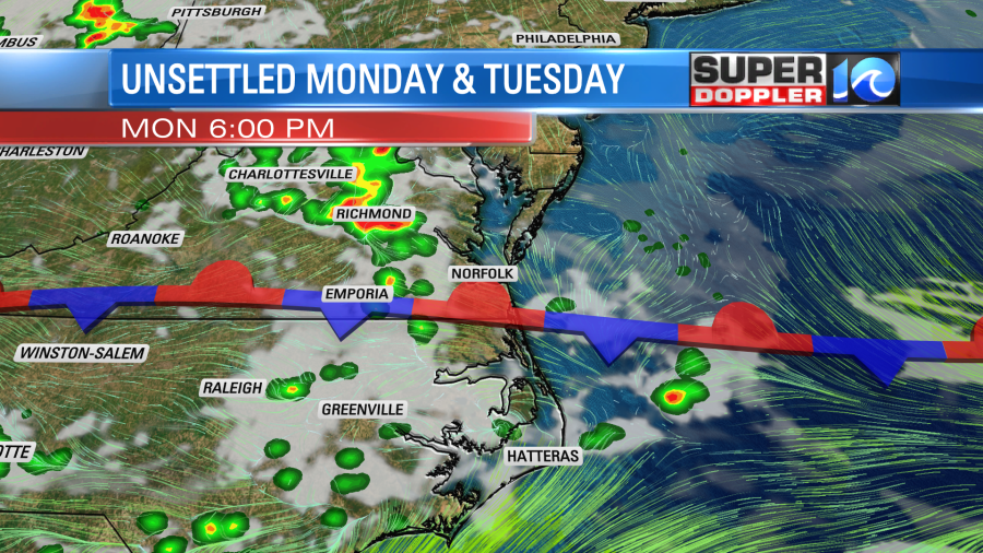
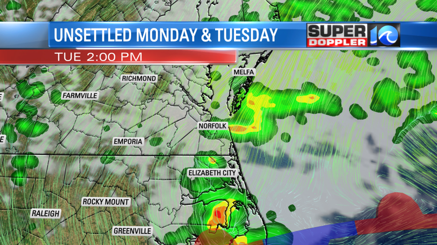
The front will continue to sag south across the region throughout Tuesday so we’ll get another round of afternoon and evening showers and thunderstorms. Some of these could be strong to severe, be sure to remain weather aware Tuesday (Monday as well). The breeze by the afternoon will flip out of the northeast, and in combination with the added rainfall, our high temperatures will be in the low to mid 70s.
By midweek as the system pulls away, we’ll pull in a northerly breeze to cool us off. The refreshing breeze will likely pin our temperatures in the upper 60s and low 70s both Wednesday and Thursday. It should come with plenty of sunshine, which will guide us through late week.
Meteorologist Steve Fundaro