This morning we had some pretty widespread fog in the region, but we also had a lot of sunshine.

We will finally have a good amount of sunshine today. Skies will be partly sunny through the afternoon. The lingering area of weak low pressure has finally moved far enough out to sea to lose its influence on our weather. High pressure has edged closer to our region.
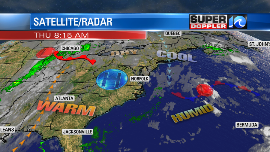
High temps will rise to the upper 70s this afternoon. There will be a few 80s inland and south. Winds will be light and out of the north.
Tomorrow we’ll have lots of sunshine through the day. There won’t be much wind at all. So high temps will rise to near 80 or the low 80s.
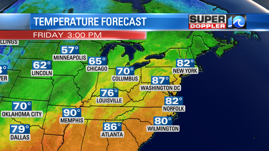
It will be pretty warm in the sun, specially for mid-October. The average high is in the low 70s this time of year. Well… we’ll be even warmer on Saturday. High temps will be in the low to mid 80s.
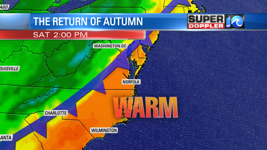
We’ll be partly cloudy for a long time. Then late in the afternoon we’ll have increasing clouds and a few showers and storms. A line of showers and storms will move through Saturday night. That will be along a strong cold front. Temps will drop from the low 80s Saturday afternoon to the low 50s Sunday morning. High temps on Sunday will only be near 70 degrees. The really nice thing about that time-frame is that the humidity will drop big-time.
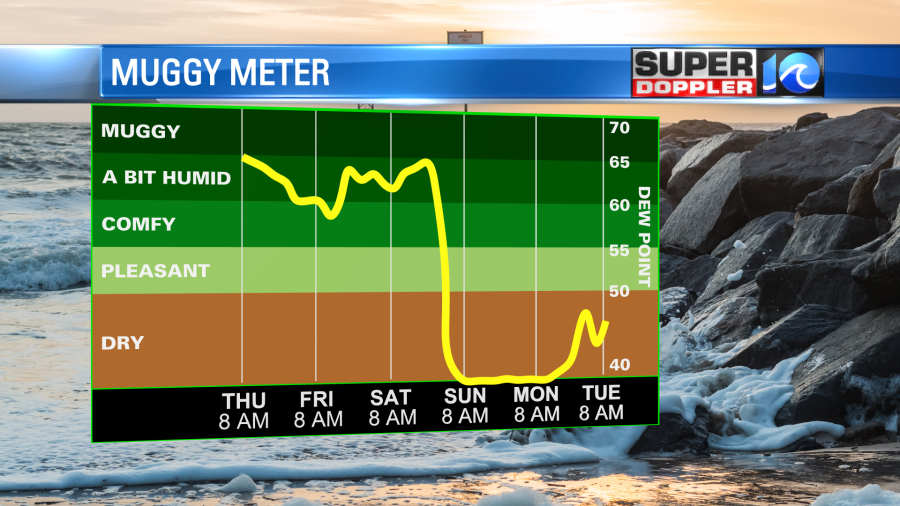
We’ll be cool and dry going into early next week.
Meteorologist: Jeremy Wheeler