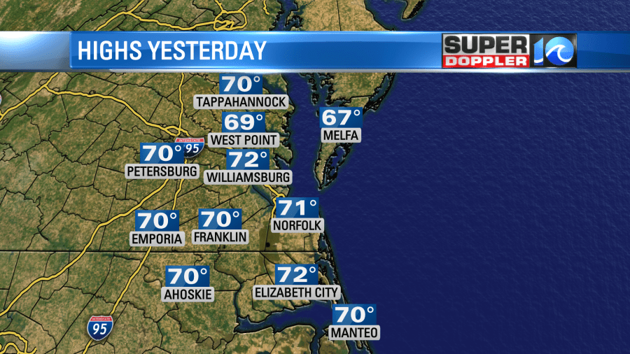
Yesterday’s weather was awesome! High temps made it up into the low 70s over most of the region.

It was dry and breezy. I worked out with the garage door open. The air had a really fresh feel to it. Course the dang breeze kept blowing leaves into my garage. : (
Today is a different day! A strong cold front moved through last night, and started dropping the temperatures like a brick. It only produced a couple of sprinkles, but that is no surprise. The cold front is going to keep sinking south through about midday. Then the front will stall out to our south this afternoon. High pressure is off to the west. It will not build in to our region today.

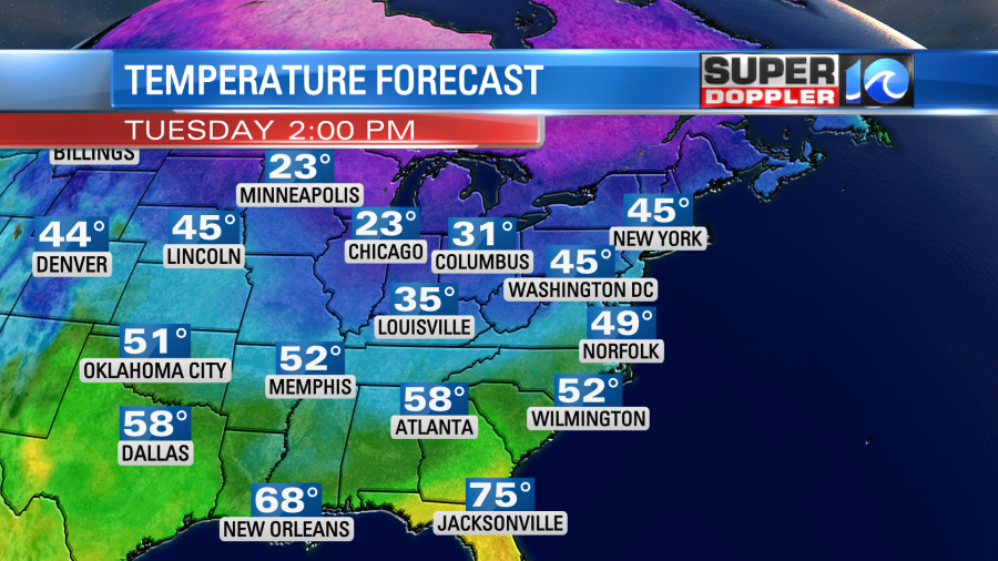
We’ll have a north breeze through the day, but it will decrease a little this afternoon. High temps will only rise to the upper 40s.

We’ll have a mix of sun and clouds with more sun to the north and more clouds to the south. There won’t be any rain except for an isolated shower over the Outer Banks.
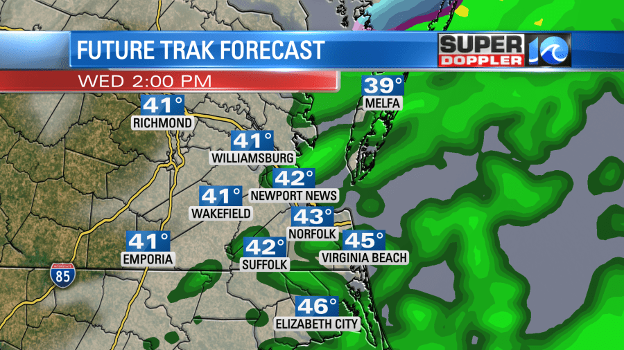
Overnight the front will stay to our south with a weak area of low pressure forming along the boundary. Moisture will push back north up over the cold air mass in place. This could create a few showers after midnight. However, tomorrow the front will edge north slightly as low pressure moves along the front. We will stay on the cold side of the front. This effect will bring us lots of rain showers in the morning. At least over a large part of the area.

There could even be a few heavy showers. While we do need the rain, this could slow down the morning commute. Then scattered rain showers will go on-and-off through the day. There will even be a melting wintry mix up around Richmond during the midday and the afternoon. This will turn into scattered rain showers as it moves east. I can’t rule out a couple of sleet pellets mixing in with the rain north of the metro tomorrow, but whatever falls will melt on contact. Having said that, our high temps will only be in the mid 40s(ish).

It is going to be a pretty nasty day. At least the winds wont’ be too strong. They will be light and out of the north.
We’ll be cool & dry on Thursday with highs near 50. then we’ll warm up to the 60s on Friday. There may be some isolated showers as moisture returns. We’ll run up to the 70s on Saturday. We might even aim for the mid 70s. then we’ll cool down again on Sunday.
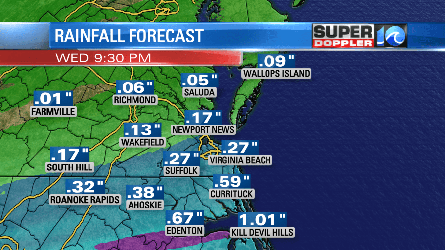
The rain totals for the next 36 hours won’t add up to too much, but at least we’ll have it finally add up to something in the rain gauge. I think we are aiming for a quarter of an inch up to an inch between the metro and northeast North Carolina. We’ll likely have lesser amounts form Yorktown northward.

We’ll have another shot at accumulating rain on Sunday. Stay tuned for updates!
Meteorologist: Jeremy Wheeler


