Yesterday morning there was a tropical disturbance with a moderate to high chance of formation in the central Atlantic. Now today that feature has already become tropical storm Elsa.
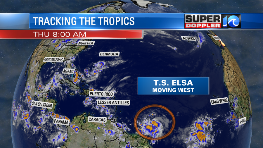
This is the earliest “E” named storm on record. I hate to say it, but if this keeps up then we could have a year just as busy as 2020’s tropical season. God I hope not! Anyway, the system is moving due west at over 20mph. The forecast track takes it more to the northwest over the next couple of days. Then it has it moving towards Haiti, Jamaica, and then Cuba by the weekend.
After that point there is a lot of uncertainty. However, the official forecast sends it towards the southern Florida region. The models are very split after Cuba, and I don’t know if they are picking up on the short-term westward momentum very well. Here are several of the track models:
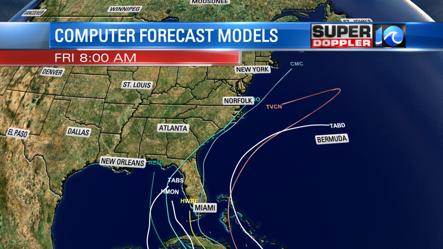
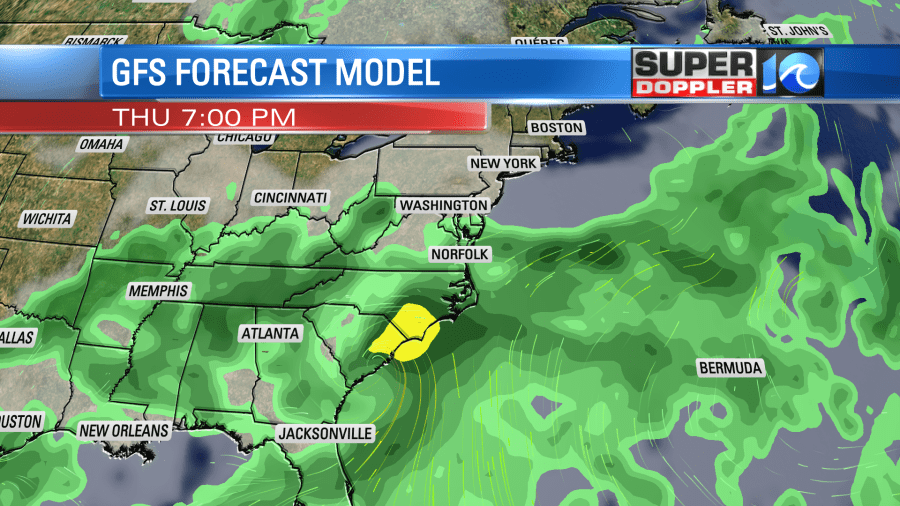
The GFS model does have it going over land and moving up into the southeastern U.S. It is much slower and has a more westerly route.
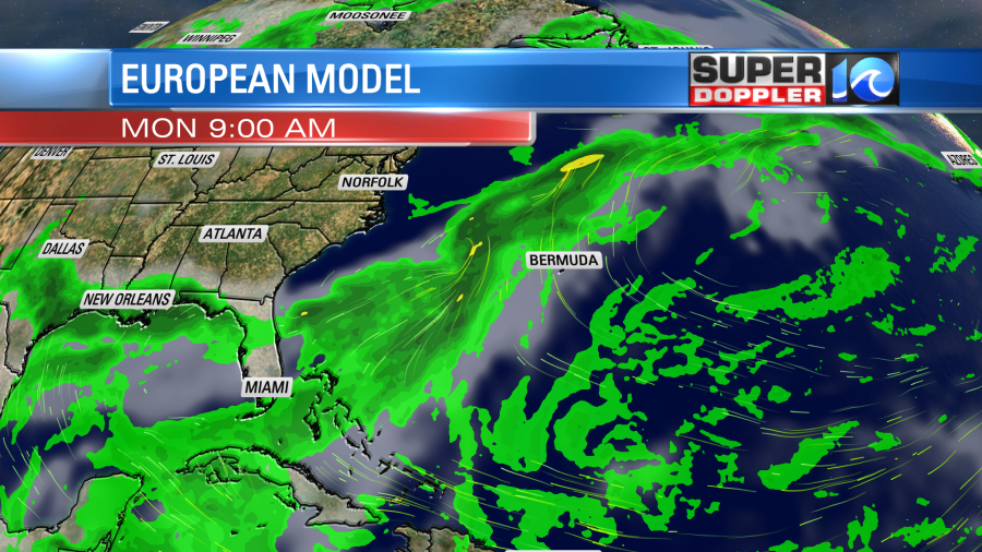
Yet the Euro has it completely missing the U.S. and staying offshore to the east.
Basically, it’s too early to have a good forecast for this system. We’ll have a better idea of the trend in the next 24 hours. Stay tuned for updates!
Locally high pressure is offshore, but it is sliding a little farther away.
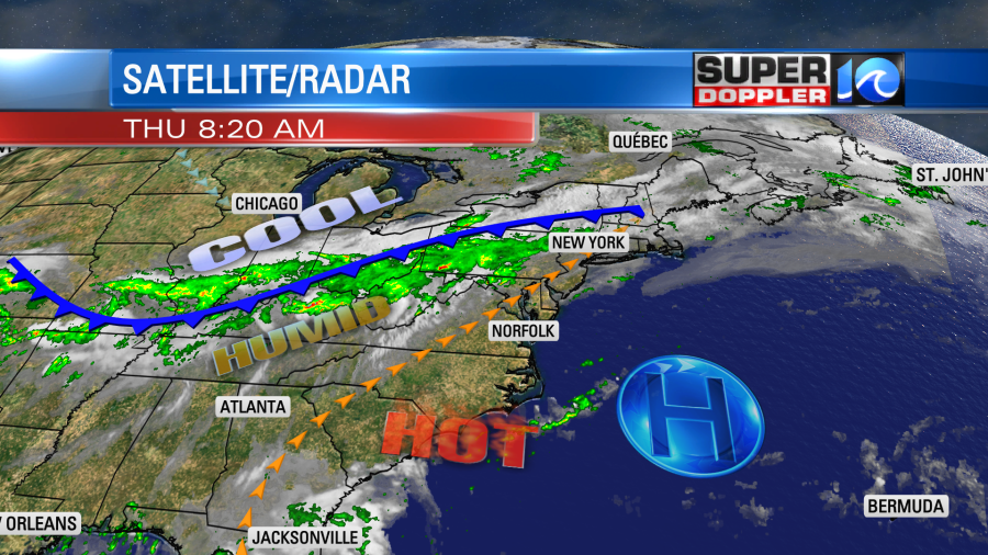
There is a cool front in the Midwest that is slowly sinking to the south. There are some showers and storms southeast of the front. We’ll have partly cloudy skies in our region today. There will be some isolated showers and storms popping up this afternoon. However, the chance for rain will increase between the late afternoon and early evening.
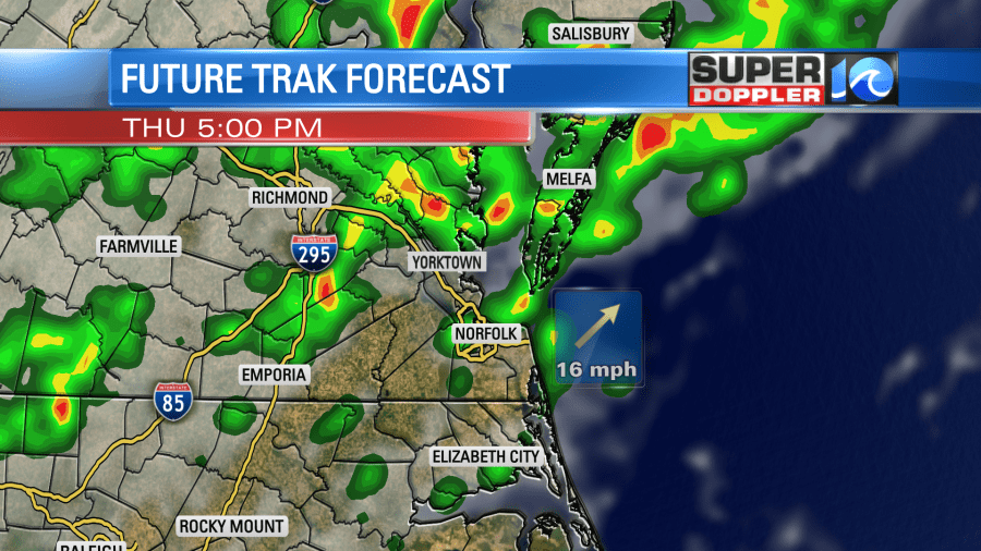
There may be a few strong to severe storms during that time. We even have a slight risk for severe weather over parts of the region with a marginal risk over the Southside.
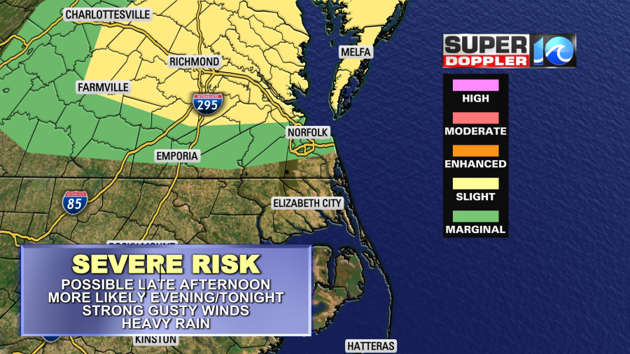
The main threat will be strong gusty winds. The general wind will be out of the southwest at 10-15mph with gusts to 25mph anyway. So winds could gust higher in some of the storms. Heavy rain will also be possible. High temps will be in the low-mid 90s today but the heat index will once again be near 100 for many. some of the storms may cool down a few areas.
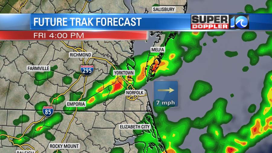
Tomorrow the cool front will steadily slide southward through the day. We’ll have showers and storms ahead of it and near it. So it might not be a complete washout, but rain is likely on-and-off through the day. The front will finally come through in the early evening. This will be the last round of showers and storms.
It will be cooler tomorrow but still pretty humid. High temps will be closer to 80 degrees. Winds will be out of the southwest then west. There will still be a few showers Friday night into Saturday morning. After that we’ll start drying out. Most of Saturday looks good with partly cloudy skies and highs in the low 80s. There may be some isolated showers Saturday night, but then we’ll be dry for on Sunday for the 4th of July. We’ll be partly cloudy with highs in the 80s.
The rain may add up in the rain bucket again. Some locations will see 1-2″ of rain with a few spots getting 3″ or more. However, not everyone will get those amounts. Lighter amounts will be between a half inch and an inch.
Check back for updates on the weather. Looks like we’ll be busy for a little while.
Meteorologist: Jeremy Wheeler