This last weekend pretty much turned into a washout. The thick tropical moisture from Delta moved up into our region early, and it took over the forecast. The remnants of Delta are passing to our south today. There is also a stationary front to our north and a warm & cold front to our south.
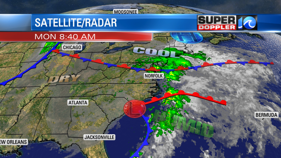
There is still a good amount of humidity in the region, but some slightly drier air will nudge in from the west. This should limit our rain showers a bit today. So they will be much more scattered. It will be mixed in with pockets of drizzle as well.

We did pick up a lot of rain over the last 2 days. Most locations had about 1-2″.
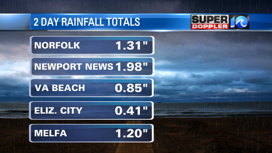
Going forward we’ll only see another couple tenths of an inch. A few locations could see a half an inch.
Winds will be out of the east and then north at 8-12mph. We started off pretty warm this morning Temps were in the upper 60s to low 70s to start the day. We’ll top off near 80 this afternoon.
Tomorrow the remnant low will push northeast and offshore. A cool front will swing through behind it. We’ll have a mix of sun and clouds with only an isolated shower or two. High temps will be in the upper 70s. It should be pretty nice out for most of the day. A second cold front will move through by Wednesday. This will cool us down more, and it will finally dry us out.
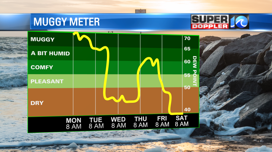
High temps will be in the lower 70s with sunshine. It will be awesome out! We’ll be dry and mild on Thursday. Moisture will return on Friday as a stronger cold front moves into the region. High temps will be in the upper 60s. Behind that cool front we’ll have some real Fall weather arrive. High temps will only be in the low-mid 60s Saturday and Sunday. Low temps will be in the 40s and 50s, and they may even drop to the solid 40s one morning. We’ll see. There’s a low chance that we’ll have some 30s inland, but I don’t think we’ll have frost Probably….
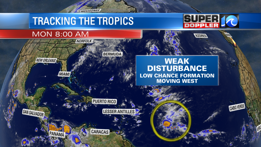
The tropics have quieted down, but there is still one tropical disturbance in the Atlantic. It is east of the Lesser Antilles. It is moving generally west, and only has a low chance of formation in the short term.
So stay tuned for updates.
Meteorologist: Jeremy Wheeler