
Today is going to be another hot and humid day, but a cool front will try to bring us a brief cool down soon. As of this writing the cool front was still off to the west, and there was a warm front well to the north.
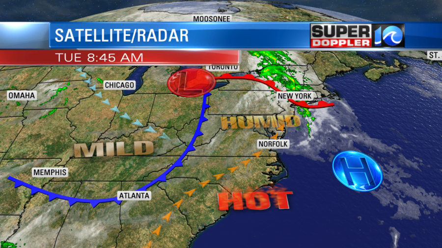
There was a mix of sun and clouds this morning, but temps were rising fast. Today high temps will aim for near 90 before the front really sinks in. The heat index will be in the upper 90s to near 100 in many locations. We’ll have a southwest breeze, then it will turn out of the north. Temps may drop a bit by the late afternoon. There will be some isolated showers and/or storms in the region.
Tomorrow will be better in terms of heat and humidity. High temps will be in the mid-upper 80s. The dew points will drop to the upper 50s to low 60s. So the heat index will only be in the upper 80s to near 90.

We’ll be partly cloudy tomorrow, and it will be a pretty nice day. We’ll already heat up again on Thursday. Highs will be back to near 90. The heat index will be back in the upper 90s. Temps will basically stay near 90 through the weekend. There won’t be much rain for the next 7 days. There may be some stray showers here-or-there. We could get some isolated showers later today, but the next chance for a few showers isn’t until next Monday as a cool front arrives.
In national news…I posted an article about a heat wave in Europe this week. Today I am posting about some cold weather. Apparently, they just had snow fall over the higher elevations of Colorado. This fell on the first day of Summer (which isn’t unheard of, but rare). This recent snow has helped that region reach record snowpack levels. Also, Denver has been very cool for the past month. Really since Winter. They haven’t hit 90 degrees yet this year. Here are 2 articles with more information on the subject. Snow in Colorado. Cool in Denver.
Meteorologist: Jeremy Wheeler


