It started off chilly this morning, but strong sunshine is going to warm us up today. A giant area of high pressure is locked in to our west.

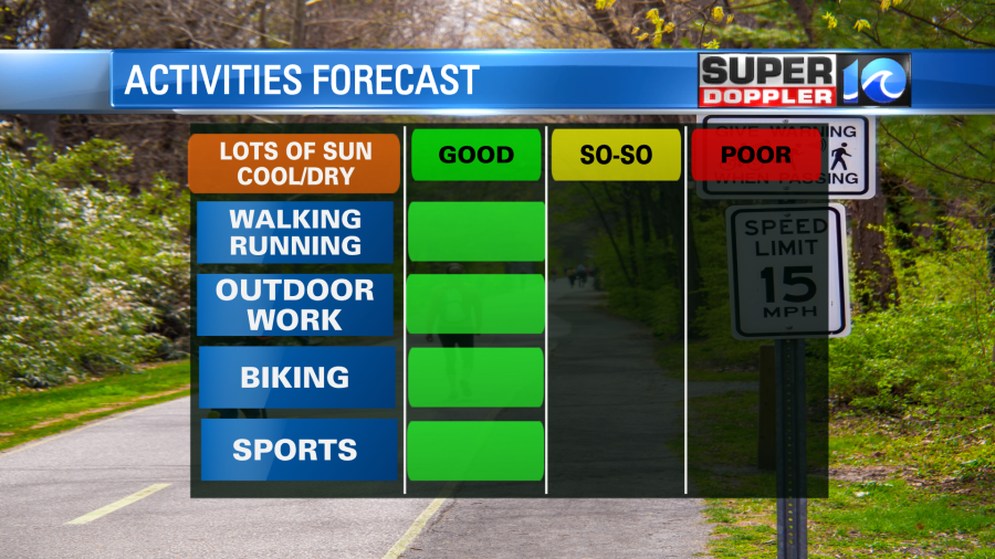
We won’t have as much wind as we had yesterday. That made it chilly at times. Today the wind will be out of the northwest at 5-10mph. We’ll have lots of sun through the entire day. So temps will warm to the low 70s with a couple of upper 60s near the shore. It is very dry out, and the ragweed pollen is low. So it is a big green light for outdoor activities today.
We’ll have similar weather tomorrow, but it will be more of a light west wind. Temps will drop to the 40s and 50s in the morning. Then strong sunshine will warm us up to the upper 70s in the afternoon. It will be a good day to dress in layers. We’ll warm up even more on Thursday as the surface winds start to pick up out of the south.
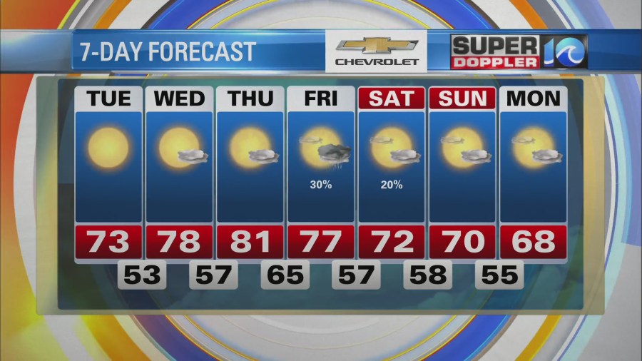
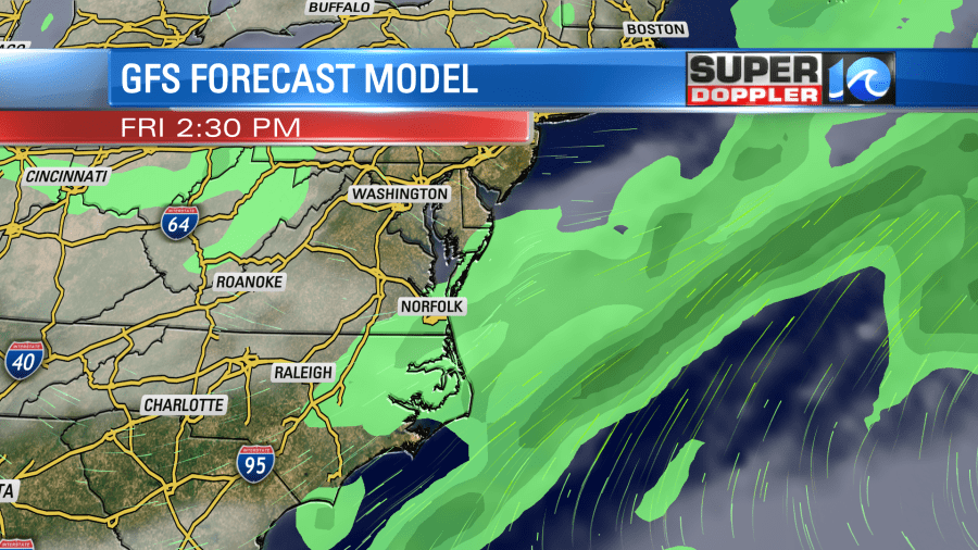
High temps will be near 80 degrees. That is about 10 degrees above average. A cold front is still forecast to move into the area on Friday. Moisture will increase ahead of the front, but it won’t be tropical.
Hopefully, it will rise enough to squeeze out a few rain showers. The latest models aren’t showing too much rain in the region, but we still have some time for updates. Here is the latest GFS model. Keep in mind that is a bit “blocky” this far out.
Regardless, we will cool down over the weekend. High temps will drop to the upper 60s to low 70s. Until then enjoy the nice Fall weather!
Meteorologist: Jeremy Wheeler