We tried our best… I tried my best….We knew yesterday’s temps would be tricky. Well, they were. If you missed the forecast, then remember that a cold front was expected to move into the region and stall out inland. So much cooler air seeped into the region from the northeast. It produced a widely mixed batch of temperatures. Take a look!
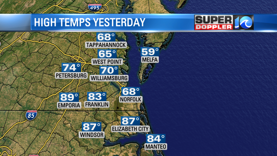
A few showers and storms fired up in the afternoon, but they fell apart as they moved east into the cooler air mass. I even noticed the cool air mass breeze through as I was doing yard work in the afternoon. It felt awesome actually. I think the temp fell 5-10 degrees in 5 minutes. Then it was even a bit chilly in the evening. Last night the front started moving north as a warm front. So we had some scattered showers and storms to the north of it between 7 and 10pm.
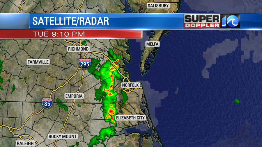
This was briefly heavy, but it put down about a tenth of an inch or two.
Today that boundary will lift north as a warm front. We’ll be in the warm sector all day. So the temperature forecast is much easier. High temps will rise to the mid-upper 80s. We’ll be in the 70s on the Eastern Shore.

The heat and humidity could be enough to make it feel like the 90s in some places with the heat index. Luckily there will be a breeze. Winds will be out of the southwest at 10-15mph with gusts to 25mph. So it won’t feel too muggy with that feature. However, a few showers and storms will be popping up this afternoon. There will be higher chance for rain and storms during the day today compared to yesterday. Then a cluster of showers and storms will move into the metro area during the evening.
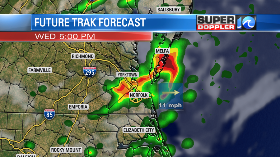
These storms will have some heavy rain and gusty winds for a time. It could cause a few problems during the evening commute. There is a marginal risk for severe weather over the region. There could be some small hail as well, but the threat for tornadoes is very low.
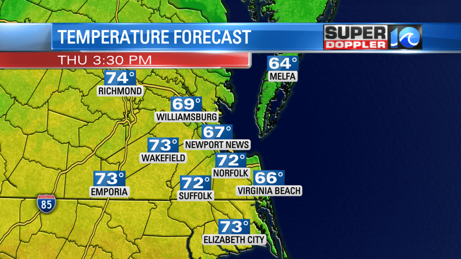
Tomorrow we’ll be cooler and more stable. We’ll have a mix of sun and clouds in the region. Other than a couple of sprinkles in the evening we won’t have any rain. High temps will be closer to 70 degrees.
On Friday we’ll finally have a different type of system moving into the area. A big area of low pressure will slide in from the west. There will be a significant upper level low moving in as well. Now the models have been trending later with the system and the rain lately. Yesterday it looked like Friday would be a near-washout with rain continuing into Saturday. Now it looks like the rain will move in later on Friday. Our model has some scattered showers and storms in the afternoon with more by the evening.
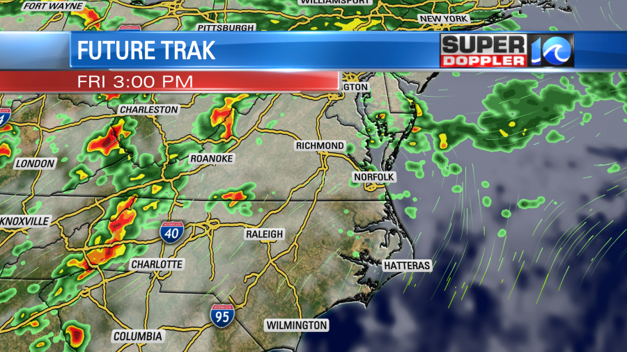
The European model and NAM model have the rain more towards the late afternoon/evening.
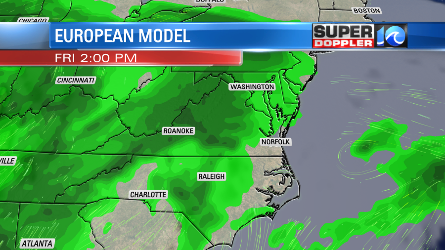
However, the GFS has rain from the late morning onward.
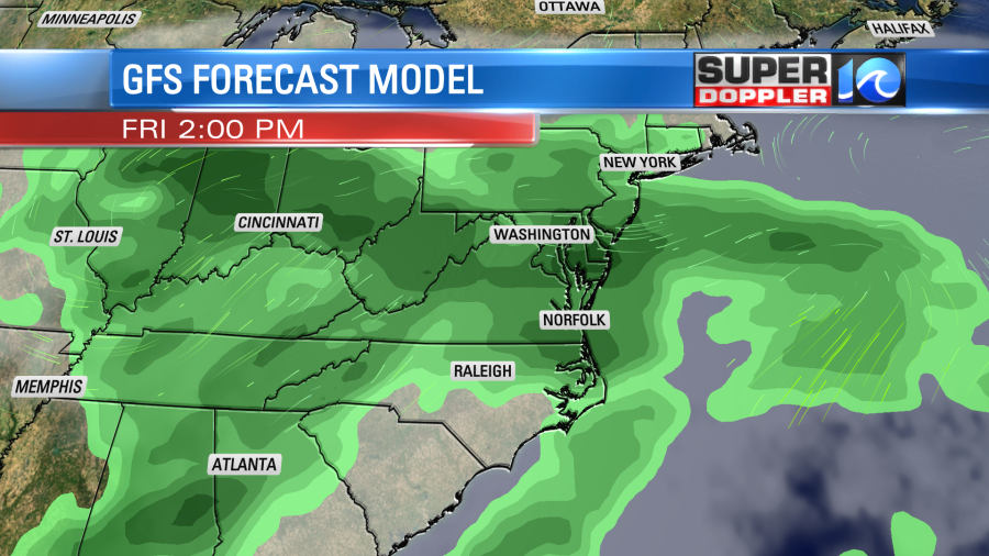
Big systems do tend to move slower. So I wouldn’t be surprised if the bulk of the rain comes in during the evening. However, I still think we could have some scattered showers and/or storms in the afternoon. As mentioned, it looks like Saturday will be very wet. It could possibly be a washout. We’ll see.
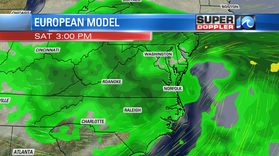
It will be cool with highs in the low-mid 60s. Then we’ll be near 60 on Mother’s Day. There will be more scattered showers with lots of clouds. (Sorry moms). High temps will be near 60.
At least we are looking at a good chance for some much-needed rain. Too bad it’s over Mother’s Day weekend. Stay tuned for updates!
Meteorologist: Jeremy Wheeler


