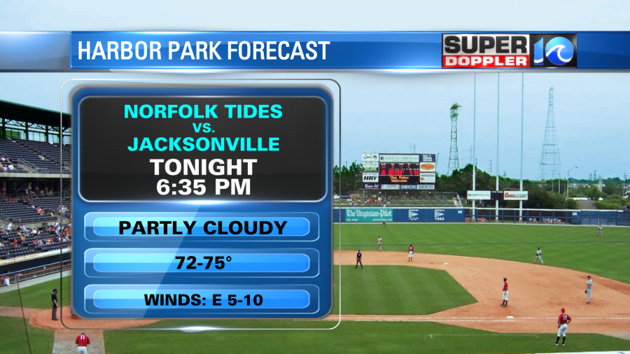
The Norfolk tides are back today. It’s been a long time! Luckily we have great weather for the home opener this evening. We’ll have fair skies. Temps will be in the 70s during the game.

Good luck to the Tides! They play Jacksonville at 6:35pm.
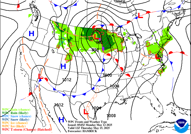
The whole area will have some nice weather today. We have high pressure to our northeast with a stationary front to our west.

The Front is creating a lot of showers to our west all the way to the central U.S. However, the high pressure system should keep the rain out of our region. We’ll have mostly to partly sunny skies today. High temps will rise to the mid-upper 70s with a few 80s inland. There is still a light wind out of the east, but it should stay fairly weak. It will be cooler near the shore as water temps are in the 60s.
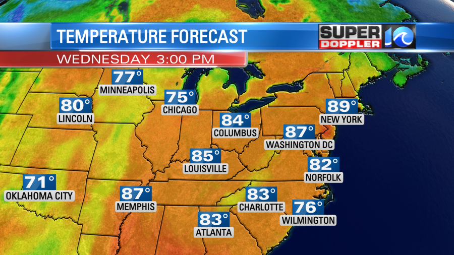
Tomorrow we’ll have more warming. Not just here but over the eastern half of the U.S. AND Canada.

It will be unusually warm in eastern Canada as temps will reach the 80s there. We’ll be in the 80s here, but that is close to our average highs. I’m calling for low-mid 80s (just a bit above our model). Luckily the humidity is still fairly low, and it should stay low to moderate for a few days.

We’ll heat up a little more on Thursday with highs in the mid 80s. Possibly upper 80s inland. Then the forecast gets tricky.
From Friday into Saturday there will be some cooler air offshore (just to our northeast and east). This cooler air could get fairly close to our area. It could even move inland. This is according to the latest GFS model and the Weather Prediction Center.

So for now I’m playing the middle ground and calling for high temps in the low-mid 80s this weekend. I’ve got partly cloudy skies with a low chance for a showers on Saturday. A 30% chance on Sunday. Stay tuned for updates. We’ll have more confidence that part of the forecast as it gets closer….Probably!
In U.S. news…There was some major flooding across parts of the deep south yesterday. Parts of Texas and Louisiana picked up about 7-14 inches of rain in a short time-span. This produced flash flooding that was even comparable to recent hurricanes. The Lake Charles (Louisiana) area in particular just can’t catch a break. It didn’t look like there were any huge weather systems there. There was a weak low and a couple of moderate outflow boundaries. However, there was a lot of moisture in that region. Here is the article with more information: Texas And Louisiana Flooding.
Meteorologist: Jeremy Wheeler


