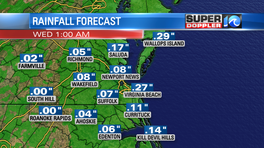
Some folks this morning were talking about the rain this weekend. There were showers and drizzle all over the place. However, some locations barely had any measurable rainfall. For instance Norfolk International Airport only picked up about a tenth of an inch while my weather watcher, Donna in southern Virginia Beach, had almost an inch of rain just from yesterday while it was much lighter on the north end. Newport News airport had 0.52″. Melfa only had 0.03″. However, there were some areas that had a lot of rain. The Outer Banks picked up about 3-5″. Hatteras had 5.68″ over the course of 3 days. There were even reports of some minor flooding down that way. The rainfall number in Norfolk may really shock some folks as there was a large amount of tidal flooding there yesterday. More on that in a moment.
All of this comes from a weak area of low pressure that has basically parked itself near Hatteras, NC.
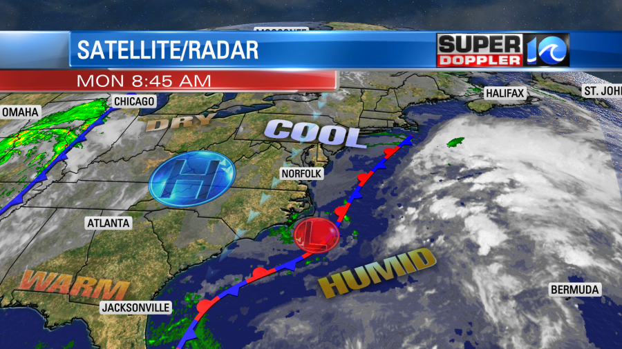
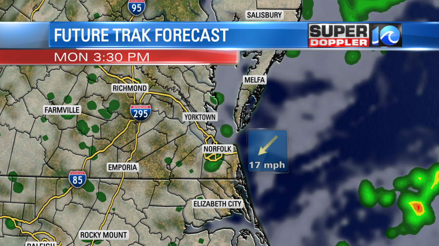
This feature isn’t large. It isn’t strong. However, it does have a lot of moisture wrapping up into it. It is sitting along a stationary front. Today the low will meander near the southern Outer Banks. We’ll have cloudy skies with some pockets of drizzle. There will be a few showers as well, but the day will be far form a washout. The wind will be out of the north/northeast at 10-15mph with gusts to 20mph.
High temps will be held down in the lower 70s this afternoon. It will be cool with the breeze. Otherwise, without that it would be a fairly mild and humid day for this time of year.
We’ll have lots of clouds tonight with more patchy drizzle and isolated showers. Lows will be in the 60s.
Tomorrow the low will edge a little farther offshore. High pressure will slide just a bit closer to the region.
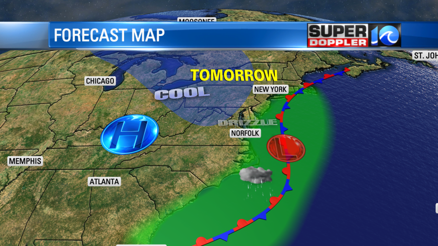
So that won’t clear us out, but it might allow for some peeks of sun to make it through. However, enough moisture should push back west to give us some more scattered drizzle with some isolated showers. The models do disagree on how much precip there will be. That tends to happen when you have a lot of very light precip. By Wednesday the low will finally kick out, and high pressure will build in. We’ll be warm and dry Wednesday through Friday. High temps will be in the upper 70s to low 80s.
I don’t want to jinx it, but we may have a sizable cool down by the second half of next weekend. I’ll talk more about that in tomorrow’s weather blog.
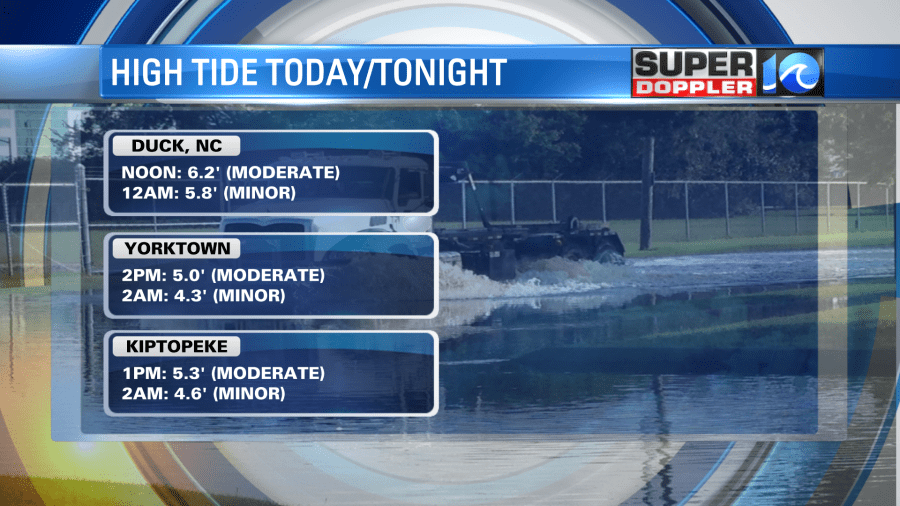
Tidal flooding will be an issue today. There are Coastal Flood Warnings up for areas along the coast and Bay. This goes until 4pm.

There will be some minor to moderate tidal flooding between about 1 and 3pm.
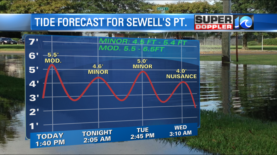
There will be some moderate tidal flooding in a few other locations as well.
Rain totals will be very light going forward. It should be a tenth of an inch or less, but a few lucky locations could see a quarter of an inch.
In other parts of the country there will be some pretty active weather. Storms occurred yesterday in the central U.S. Several tornadoes hit the state of Oklahoma. There will be some more storms today in the Midwest.

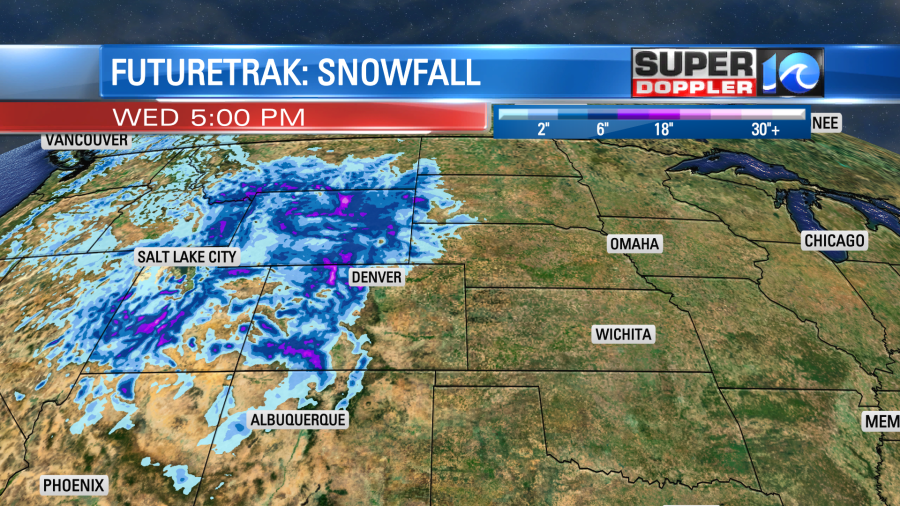
There is also going to be some snow in the western U.S. over the next couple of days. Some of it will be heavy over the Rockies.
It’s about that time. However, it should also be about that time for cooler weather to arrive in the eastern U.S.
Meteorologist: Jeremy Wheeler