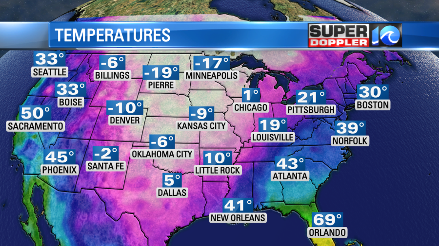
This weekend was pretty miserable. It’s been cold, and cloudy, and rainy for days. Today will still be damp and chilly, but at least the widespread rain has moved out. Before I get to the local weather though…I want to set up the big picture. There is a huge amount of cold air over the central United States. These frigid temps are reaching all the way to the Gulf Coast.
The huge area of cold is creating a large dip in the jet stream.
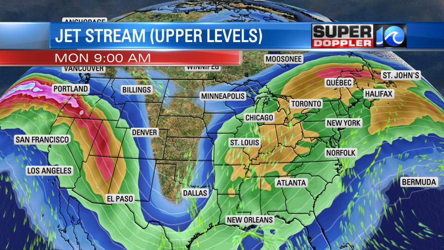
This has allowed several storm systems to form over the southern U.S. and move to the northeast. So locally we have had a of rain over the past several days. The colder temps have produced a lot of wintry weather to our north and west. Today we have a stationary front to our south. There is one area of low pressure moving offshore. This is what brought us the large area of rain late yesterday.
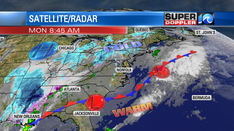
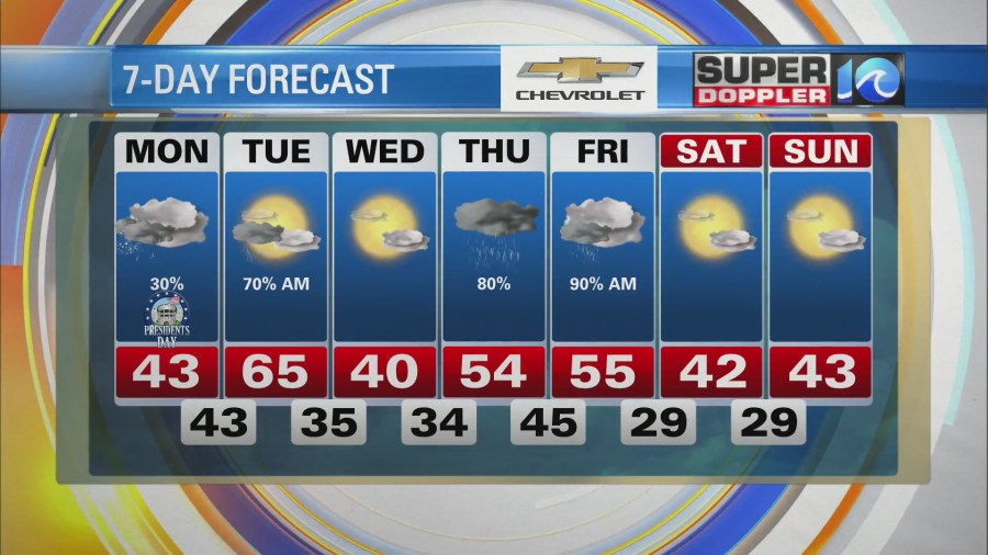
There is another low forming over Georgia. High pressure is way off to the northwest. We are in between systems today, but the large upper level trough is still pulling in a lot of moisture into our region. So we’ll be cloudy all day. We’ll have some drizzle at times with some spotty rain showers. High temps will only be in the low 40s with upper 30s north of the metro.
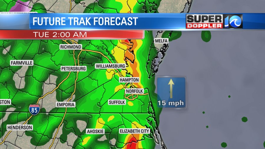
Late tonight the low will creep up from the south along with a warm front. We’ll have scattered rain showers picking up through the evening. We’ll have a large area of rain overnight. Then we’ll actually have a chance for a few thunderstorms after midnight.
Tomorrow the low will slowly push out to sea. There will be scattered rain showers in the morning, but we’ll have a mix of sun and clouds during the afternoon. A cold front will be moving through the region, but it will move pretty slowly. So high temps will reach the mid 60s before some slight cooling late. It should be very nice outside.
We’ll be dry and chilly on Wednesday with high pressure briefly in the region. High temps will be in the upper 30s to low 40s, but at least we’ll have some sunshine. Then rain and clouds will dominate the weather on Thursday. High temps at least will climb to the 50s. Well be in the 50s on Friday with a few showers in the morning. Then we should dry out from Friday afternoon into next weekend. So the light is at the end of the tunnel, but it will be a while longer until we get a long stretch of dry/mild conditions. At least it looks like the long-term patter will change a bit by next weekend. Stay tuned.
Meteorologist: Jeremy Wheeler