Looking across the country it’s no surprise that many of the western states are still in a severe or exceptional drought.
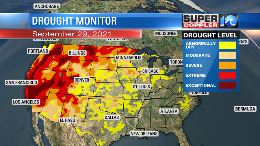
The drought is one of the worst on record in many locations. It has led to more water restrictions and wildfires. A La Nina weather pattern is expected to set up, and this could make the drought out there even worse.
The Midwest is slowly getting drier. Meanwhile we have some dry areas in the eastern U.S, but we’re not nearly as bad as the west.
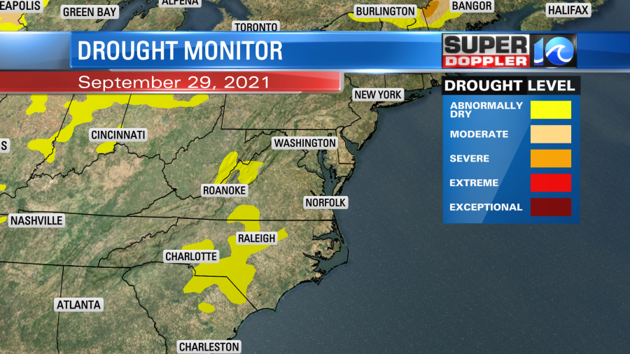
You can see a few “Abnormally Dry” patches in western Virginia and central North Carolina. We had so much rain here for a long time, but lately we have trended towards a drier pattern. We haven’t had much rain in the last 10 days.
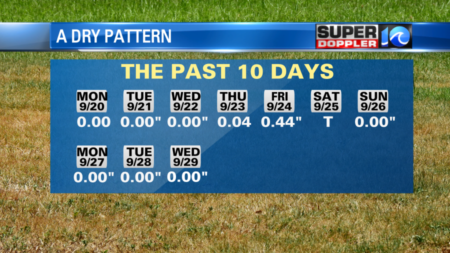
We are down about 2.25″ for the month and over 5″ for the year.
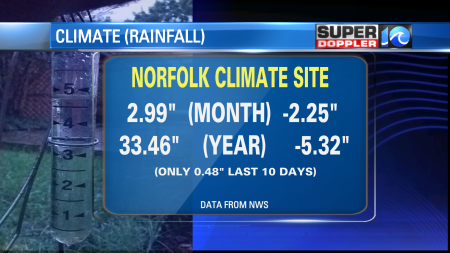
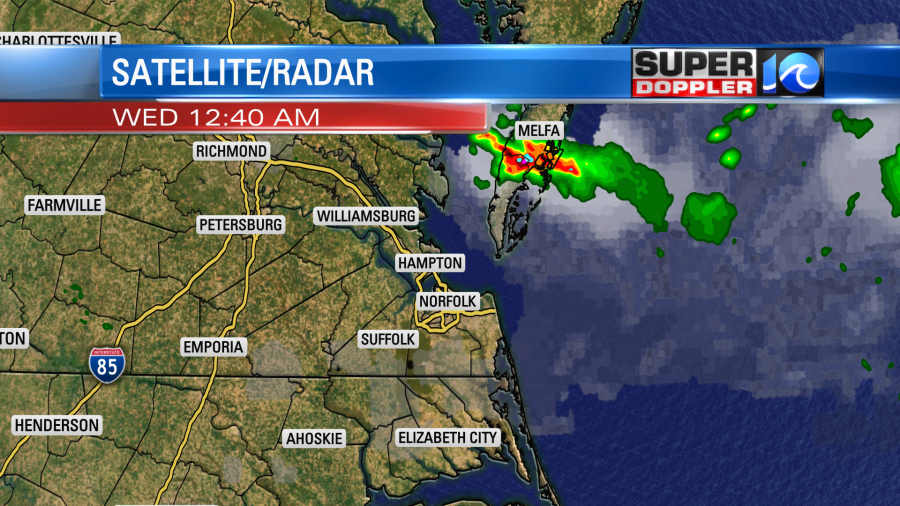
So it’s possible that the drought could extend east over the next couple of weeks. We’ll see. There may be a big batch of rain around the middle of next week, but it will be pretty dry over the next few days. There were a few showers and storms last night, but they mainly fell over the Middle Peninsula and Eastern Shore.
A cold front had dropped into the area overnight. This is sinking to our south today.
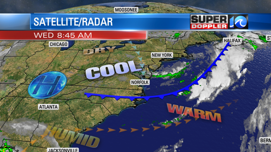
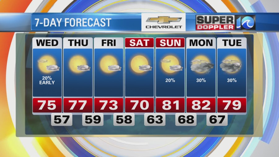
After some clouds this morning we’ll dry out and clear out this afternoon. High temps will be in the mid 70s. the humidity will drop sharply.
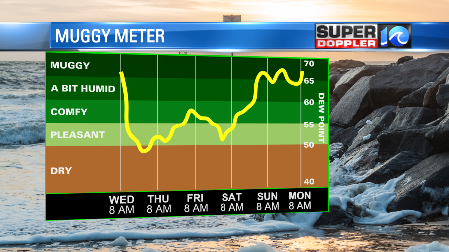
It should be very nice out this afternoon, but the breeze may be a bit strong out of the north at times. We’ll be cool and dry over the next few days. High temps will be in the 70s with lows mainly in the 50s. It should be pleasant through Saturday. Sunday will be a little warmer with highs in the low 80s. There may be some isolated showers. There may be a few showers early next week, but some of the long range models show a larger area of rain by next Wednesday. We’ll see.
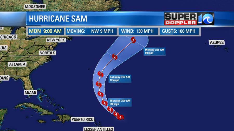
Hurricane Sam is still churning over the central Atlantic. It is definitely going to be a long-lived storm. It is a category 4 hurricane with sustained winds around 130mph.
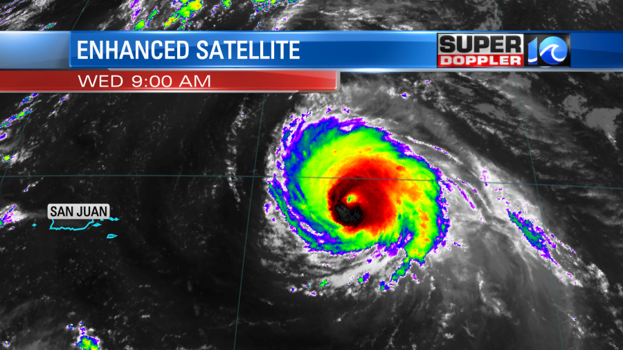
Luckily the forecast still keeps it out to sea and east of Bermuda.
There is only really one other area that is likely to develop into another system. A tropical disturbance in the eastern Atlantic has a high chance of formation as it moves to the west/northwest.
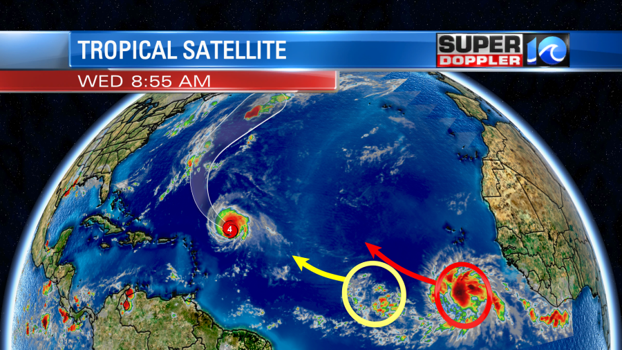
It is actually impeding the disturbance that is a little more to the west. Both are far out to sea.
Finally, I ran into an interesting article about hurricane forecasting. Recently, the Department of Energy’s Pacific Northwest National Laboratory developed a new model that uses Artificial Intelligence (AI) to predict hurricane intensity. They did a study that showed a lot of promise in increasing the accuracy of rapid intensification. Here is the article with more information: AI used for hurricane prediction.
Meteorologist: Jeremy Wheeler