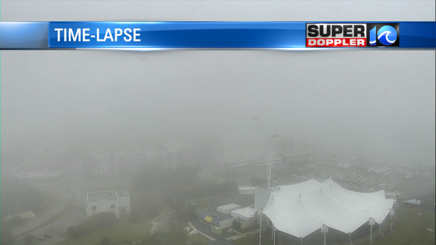
We started off the morning with some very thick and widespread fog.
The dry air has departed, and the moisture has rolled in. I called for this to happen earlier this week. It’s not coming up from the south. Instead it’s a marine layer coming in off of the Atlantic. High pressure is to our northwest, but it’s not close enough to clear us out.
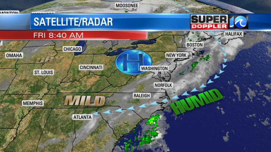
The wind is out of the east/northeast, and that will continue today. After the fog burns off, then we’ll still have lots of clouds. We’ll also have some isolated showers between the late morning and the evening. They should be spotty and light. High temps will only climb to near 70. It’s above average, but not by much. As we go into the weekend we’ll have some pretty quiet weather. High pressure will still be around. However, we’ll still have a general onshore breeze. So we’ll have some fog in the mornings and a mix of sun and clouds in the afternoons. There may be a stray shower or two, but it’s a low chance. There will be a slightly better chance for rain across the Outer Banks. High temps will be in the low 70s. We’ll have quiet/mild weather on Monday. Then the deeper moisture will move in from the south by the middle of next week.
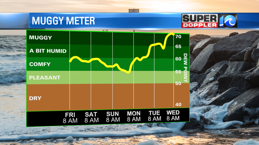
This will increase our rain chances Tuesday into Wednesday. The wind will be more southerly. So it will be warm and muggy with high temps closer to 80 degrees. Some of this humidity could indirectly be from Eta.
This morning Eta was officially still a tropical depression. Though it looked like it was a tropical storm on satellite.
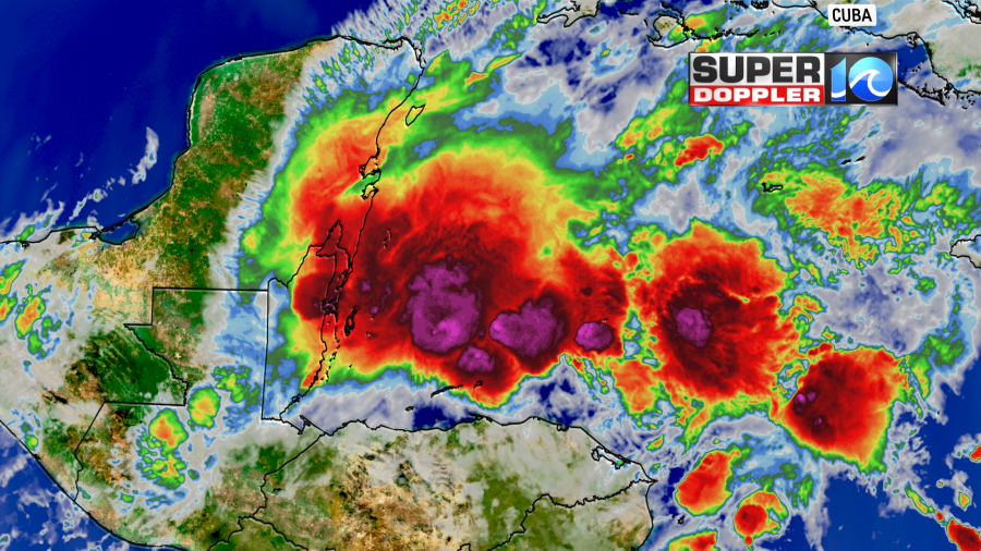
The system will move north-northeast over warm water today. It will be a tropical storm as it heads towards central Cuba tomorrow. It is forecast to cross land and then head close to southern Florida. After that point it will probably move to the west.

There is still a lot of uncertainty in the forecast after Cuba. Some models have it hanging out around south Florida for a while. Some have it staying just south of Florida and moving west.
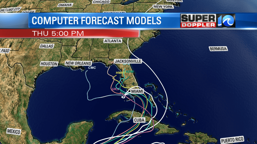
The GFS and Euro haven’t changed their tune much since yesterday. They both still send it through central Cuba. They take it over or close to south Florida for a time. Then they have it meandering west/northwest.
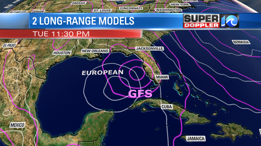
The system could work northward after Wednesday. However, the water temps are cooler along the Florida coast now. Plus, the wind shear would likely increase by that time. So it probably wouldn’t strengthen. It might even weaken. We’ll see. We may get some of the moisture indirectly into the middle of next week. This could enhance our local rainfall. we’ll see. This is still a ways out in time and distance. So a lot could change.
While all of this is going on, there is some news that I found interesting. They have a huge mass of cold air pouring over Alaska today. It continues from yesterday. Temperatures there are already well below zero. Though this probably won’t last for too long. It is early, but it’s not the coldest mid-November ever. Here is the story: Subzero cold in Alaska.
Meteorologist: Jeremy Wheeler