
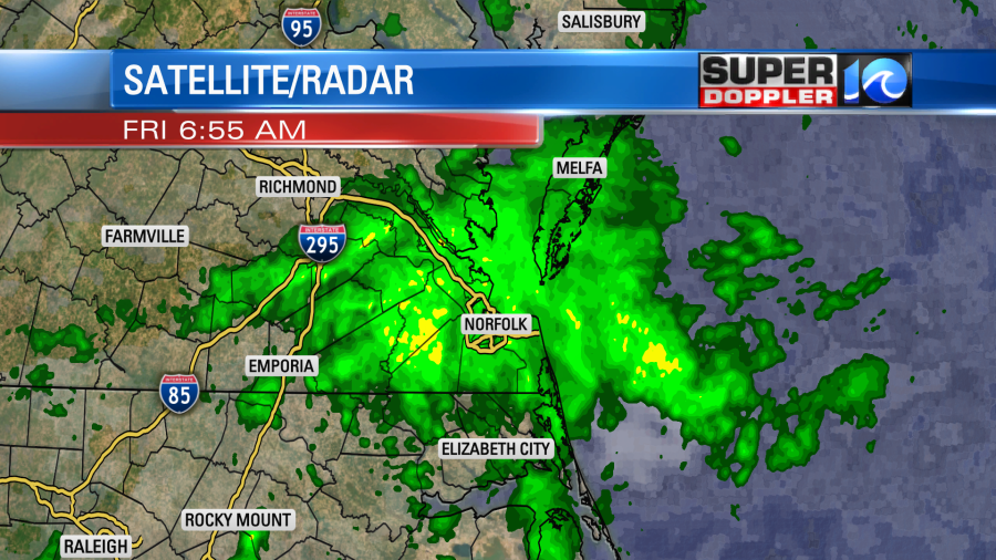
We started off this morning with some very wet weather. There was a big area of rain right over the heart of the viewing area, and it caused many problems for the morning commute.
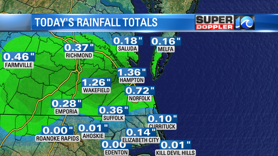
Since midnight we picked up anywhere from a tenth of an inch up to a little more than an inch.
The rain is from several features. The main feature is a weak area of low pressure just to our southwest.
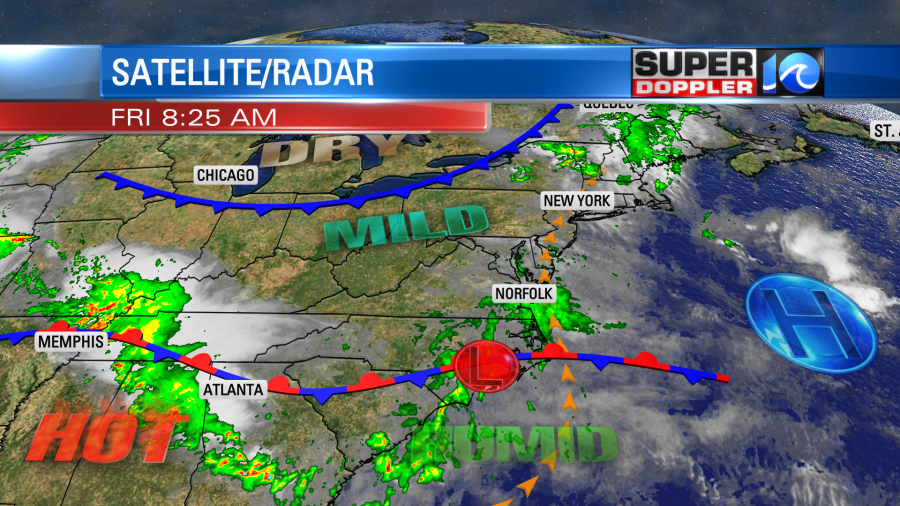
It is creeping east along a stationary front. We also have lots of moisture pumping up into the region. Finally, there is a weak upper level disturbance that is rolling through the region as well. Therefore…we’ll be cloudy all day with scattered rain showers at times. While it was a large/solid area of rain this morning. Showers should be more scattered during the afternoon.
The clouds and rain will likely keep the temperatures down despite a light south wind. High temps will only be in the upper 70s to near 80 this afternoon.
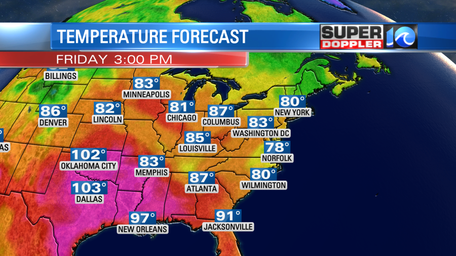
That’s about 10 degrees below average, and it’s pretty rare to have that in August.
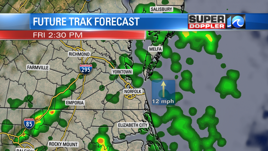
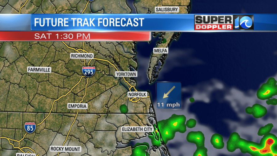
Scattered rain showers will continue into the evening, but should taper off by the mid-evening. Tomorrow the weak surface low will slide offshore, but very slowly. So we’ll still have some isolated showers over southeast Virginia, but there will be a higher chance for scattered showers over northeast North Carolina.
We’ll have more sunshine tomorrow. We’ll have a mix of sun and clouds through the day. So high temps will be able to warm up to the mid-upper 80s. It will be pretty muggy. Sunday is looking good. The surface low will be out to sea. We’ll be partly cloudy with highs in the upper 80s. We’ll heat up to the low 90s early next week with some scattered showers and storms each day.
It’s quiet in the tropics for now.
Meteorologist: Jeremy Wheeler