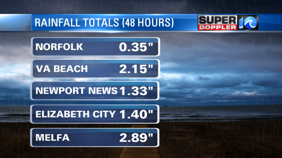
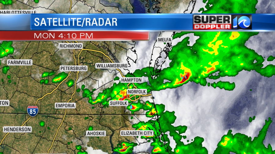
A cool front slowly dropped south into the region yesterday. It is the same front that caused flash flooding in the Washington D.C. area. It did bring us some much needed rainfall to our area. Here are some of the 48 hour totals:

I was surprised to see such a low amount over Norfolk compared to other locations nearby. Perhaps the rain from yesterday blew over the gauge. It was definitely heavy for some.

Now the rain and the front are dropping well to our south. We will be treated to some very nice weather today as high pressure builds in from the north. Winds will be out of the northeast which will keep pulling down drier air into the region.

Dew points have dropped down to the low-mid 60s. They might drop solidly to the low 60s by the late afternoon. That’s very comfortable for this time of year. Especially with the northeast breeze going. We’ll have lots of sunshine from start to finish. High temps will be in the low-mid 80s. Get out and enjoy it while you can!
We’ll be dry and mild again tomorrow. Skies will be mostly sunny. Highs will be in the mid 80s. By Thursday the heat and humidity will return. Highs will be in the low 90s. Dew points will rise to the 70s again.
There will be a few showers and storms possible later in the day. We’ll see even more showers and storms on Friday with hot and humid conditions. Highs will be in the 90s. Then we’ll have a slight cool down on Saturday. Highs will be in the upper 80s.
We are still watching the tropics. The cool front that is dropping to our south will stall out over the Gulf Coast states. This will let an area of low pressure form and move over the water. A tropical system is likely to form either Thursday or Friday over the eastern Gulf.

The models then have it drifting westward and have it affecting either Louisiana or Texas by next weekend. We’ll update you on that over the next couple of days. Stay tuned!
Meteorologist: Jeremy Wheeler


