We are lucky that we didn’t have yesterday’s storms happening today for the holiday. There were some heavy downpours and strong storms during the mid afternoon Monday with another round in the evening.
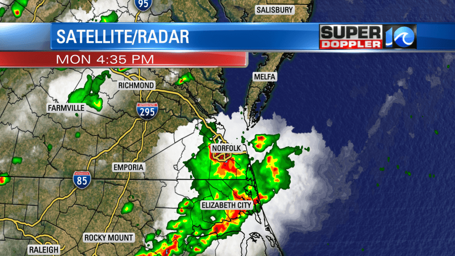
After the storms ended there were several reports of tree damage that came in.
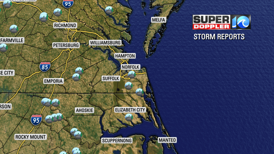
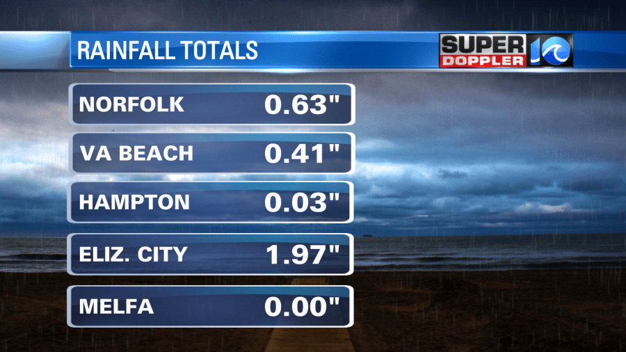
Rain amounts varied. It dumped at my house for a while, but I don’t have the total. However, there was almost 2 inches in Elizabeth City. There was a half inch up to an inch over parts of the Southside.
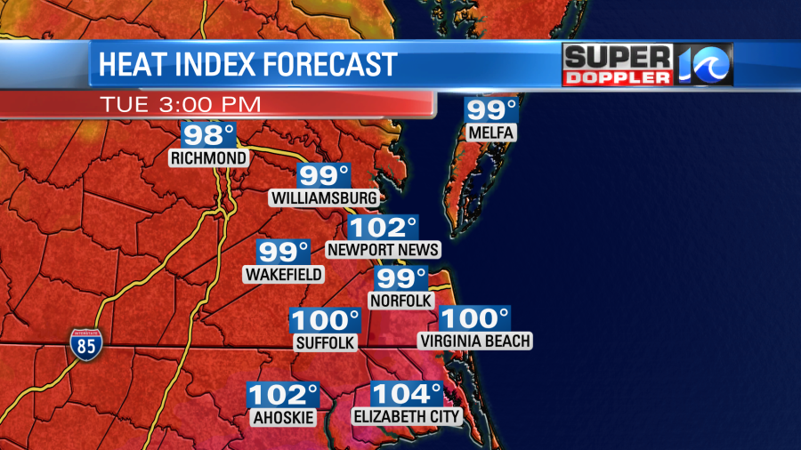
High temps made it into the upper 90s in Norfolk, but most temps were in the mid 90s before the storms flared up. Today we will still be hot and humid, but most locations should be just below Heat Advisory criteria (a heat index of 105 to 109 degrees). However, we will still have a heat index in the lower 100s.
High temps will be in the mid 90s this afternoon. There will be some upper 90s inland.
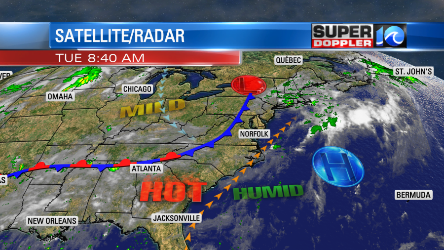
There is a cool front to the west. However, this front will not make it here today. It is almost stalled out.
We’ll be partly cloudy for most of the day with some isolated showers or storms during the afternoon. The chance for rain is only 20%. This same chance continues in the evening.

Most fireworks and drone shows should be fine, but a couple could have a delay. Even though the chance for storms is low today, any storms that do form could have some heavy rain and gusty winds for a brief time.
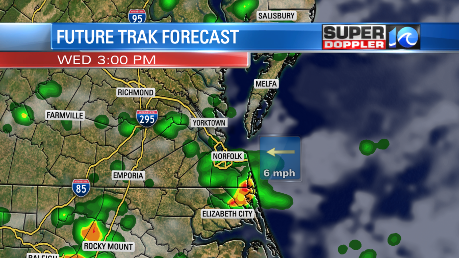
Tomorrow we’ll have a mix of sun and clouds with scattered showers and storms during the afternoon. It will be a higher chance for rain due to the cool front coming in and stalling out.
High temps won’t be much cooler though. They will still be near 90 degrees.
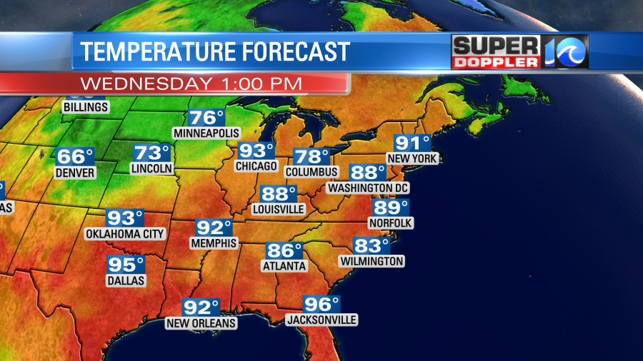
The heat index will be in the upper 90s.
We will be a bit cooler and less humid on Thursday. High temps will be in the upper 80s. There will be some more scattered showers and storms in the afternoon.
Things look quiet and seasonable on Friday. Highs will be in the upper 80s. We’ll be partly cloudy with some isolated showers or storms. Then we’ll have typical Summer weather next weekend. We’ll be partly cloudy with scattered afternoon showers and storms. Highs will be in the 80s.
Meteorologist: Jeremy Wheeler


