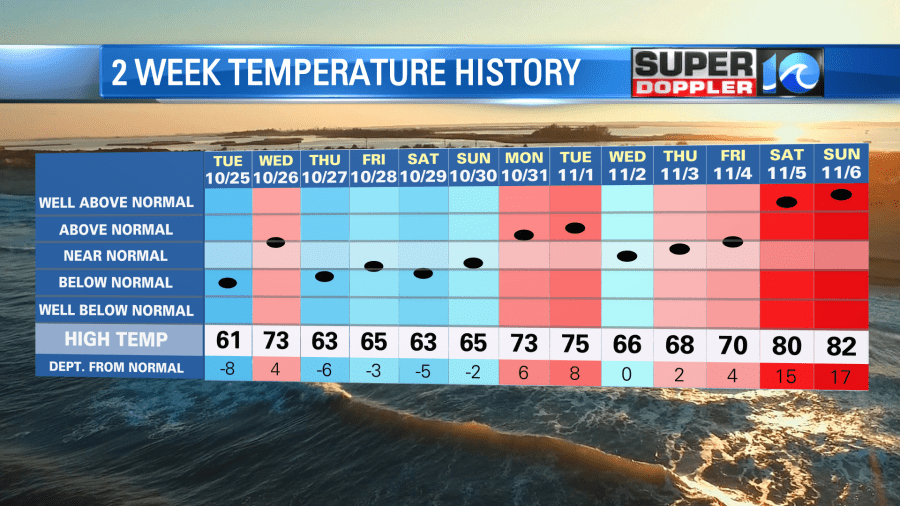
We are coming off of a warm November weekend. High temps were in the 80s both days. We didn’t break any records, but we were well above average.
I had family in town from Chicago. We went to the parks both days, but both days we cut it a bit short as it was hot in the sun and it was pretty humid. The breeze did help at times. We even went to the beach at Ft. Monroe. (We didn’t swim). Water temps are in the low-mid 60s.
Today we will start to transition to some cooler/drier weather. A cold front is moving closer to our area. High pressure is offshore.
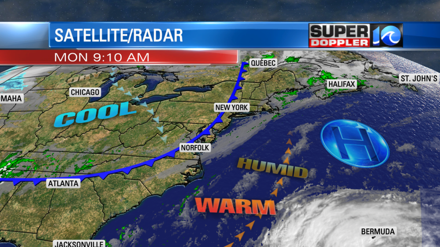
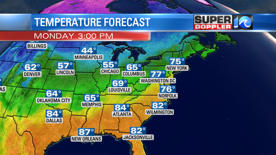
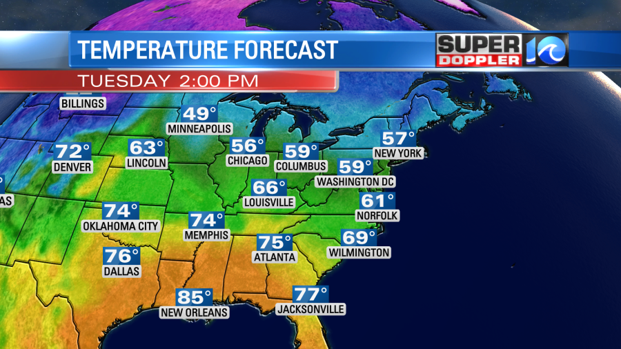
The cold front will slowly slide to the southeast today. The wind will change direction from southwest to northerly. However, it won’t be a strong wind. Plus, we’ll have a mix of sun and clouds for a while. So high temps will still be able to make it into the mid-upper 70s.
Humidity will drop (thankfully). Dew points will sink to the 40s by the evening.
There will be some isolated showers along the front. This will start up a bit before midday. They will go until the late afternoon. By the early evening they will drop down into northeast North Carolina.
By tomorrow we’ll have some much colder and windy conditions for Election Day. The cold front will drop far to the south with high pressure building in. Subtropical storm Nicole will be strengthening near the northern Bahamas. (More on that in a moment). The difference in pressure between the sizable systems will create a strong northeast wind over our region. They will run at 10-20mph with gusts to 30mph.
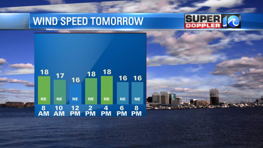
The dry air and high pressure will create a lot of sunshine, but the wind will keep the temps way down. Highs will only be near 60 degrees Tuesday afternoon.
This will be a little chilly for voters for Election Day that have to stand in line outside for a while. Temps will be in the 50s most of the day.
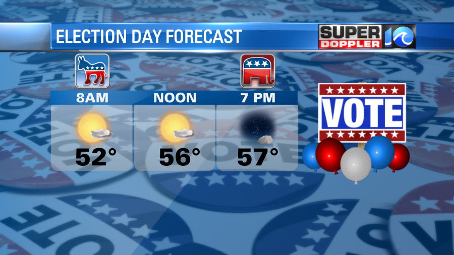
Though that may be better than standing out in 80 degree weather and humid conditions.
There could be some nuisance to minor tidal flooding tomorrow into Wednesday. However, I don’t think it will cause too many issues. We will watch for the potential for some ocean overwash along the Outer Banks.
We’ll still be cool on Wednesday but high pressure will move a bit east as Nicole moves west. This should provide us with less wind and some slight warming. However, highs will stay in the 60s. We’ll be near 70 on Thursday with a mix of sun and clouds. Then we may get a lot of rain next weekend. It will depend on the track of Nicole.
Subtropical storm Nicole officially formed this morning during the 5am update. The bulk of the thunderstorms are away from the center. So that is the main reason for being (sub)tropical.
The system is forecast to bounce west for the next couple of days. As it moves over the warm Atlantic waters it will likely change into a tropical system. That could happen as early as today. It will then make landfall somewhere over eastern Florida. The possible path takes it as far south as Miami and as far north as Cape Canaveral.
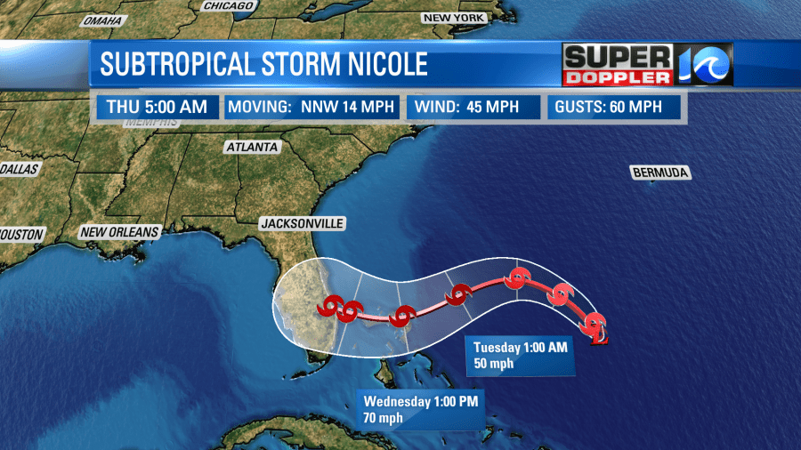
You’ll notice that it is forecast to be a strong tropical storm before landfall, but it could become a hurricane briefly.
After that point it is expected to track to the northwest. It could move over the Gulf of Mexico for a time. That would be into Friday. Between Friday and Saturday the system is expected to turn to the northeast.
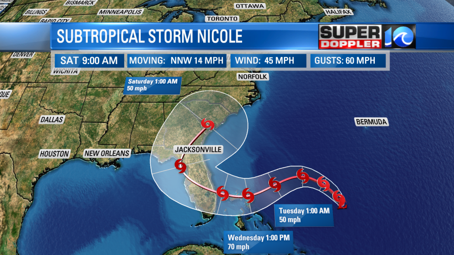
by that point there is a lot of uncertainty in the forecast path. The models are pretty split.
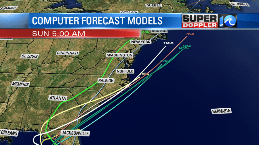
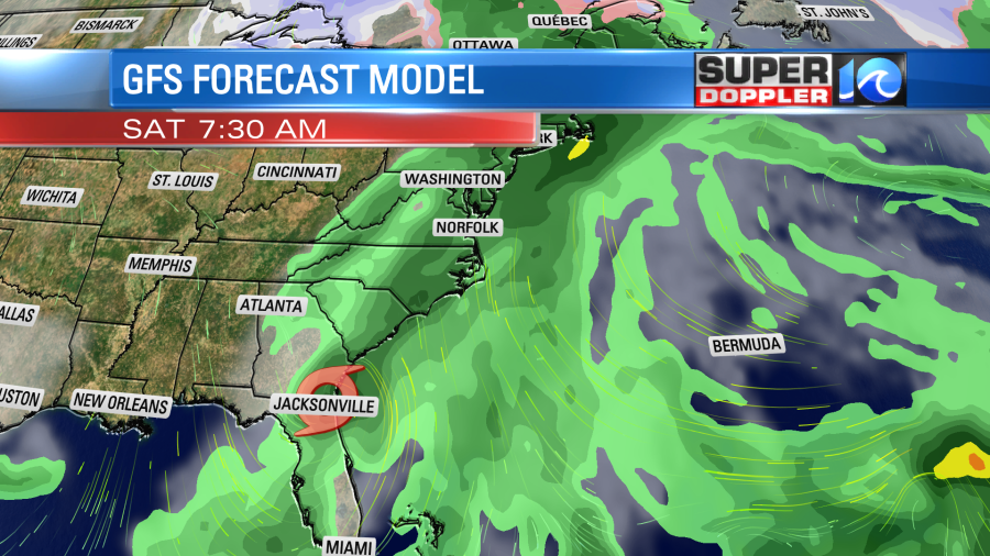
It could possibly move along the coast. It could move inland and weaken quite a bit. If it stays offshore, then it could maintain some strength. However, we would probably be on the weaker side of the storm. Regardless of the path I do think that the moisture from Nicole will push northward into our region. Even when the storm is still far to our south. So at the moment rain is likely for the weekend.
There will likely be a lot of changes to this part of the forecast as it depends on a few synoptic weather features over the U.S. like a couple of fronts and an area of high pressure. So check back for updates over the next couple of days.
Meteorologist: Jeremy Wheeler