Lately some folks lately have been wondering if they need to build an arc (a biblical boat) due to all of the rain that has been falling. We had about 1-2″ of rain yesterday and overnight.
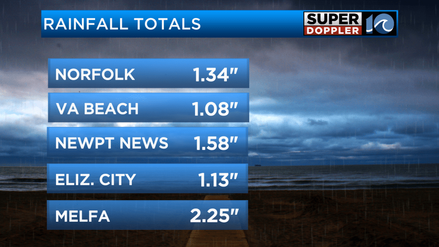
There was more reported over the Eastern Shore. I would say that there were several locations that were closer to 2″ in-between the readings that I’ve shown.
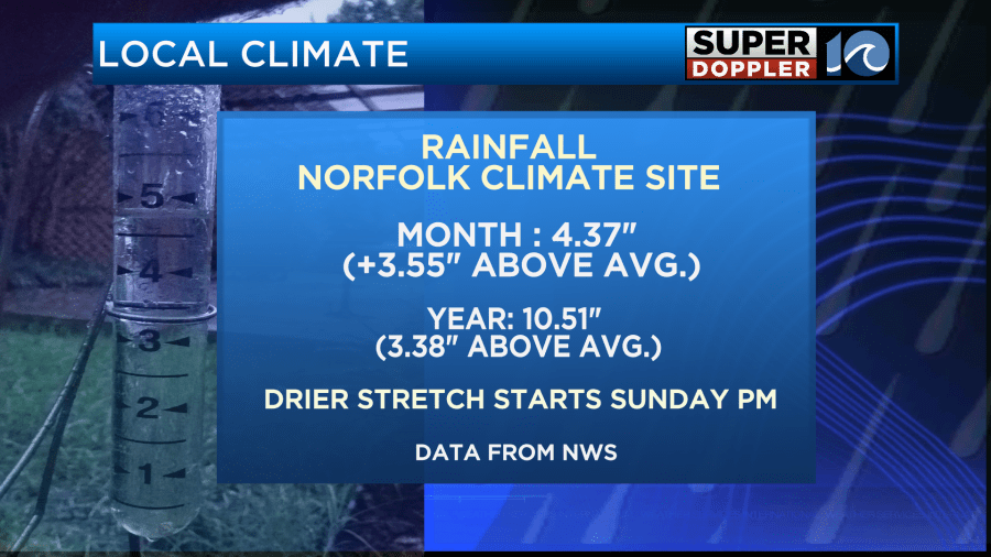
We are now over three and a half inches above the average rainfall for the month.
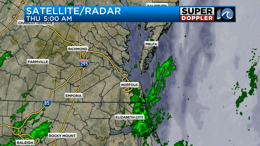
This morning there were some more scattered light showers, but the weather wasn’t nearly as bad as yesterday.
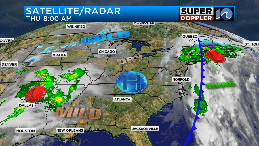
A cold front and an area of low pressure were moving offshore. High pressure is now edging in from the west.
We’ll be mostly cloudy for a while today, but we will hopefully have a little more sunshine this afternoon. The rain will definitely be gone from the mid-morning onward. We’ll have a north breeze at 8-12mph. High temps will be in the upper 50s to low 60s.

High pressure will build into the area tomorrow. This will make for a pretty nice start to the weekend. Skies will be partly cloudy. High temps will be in the 50s.

This will give us a chance to dry out briefly. Unfortunately, rain will return on Saturday. Now the broader models have the rain moving in more towards the midday and afternoon hours. However, the higher resolution models have the precip starting in the morning.
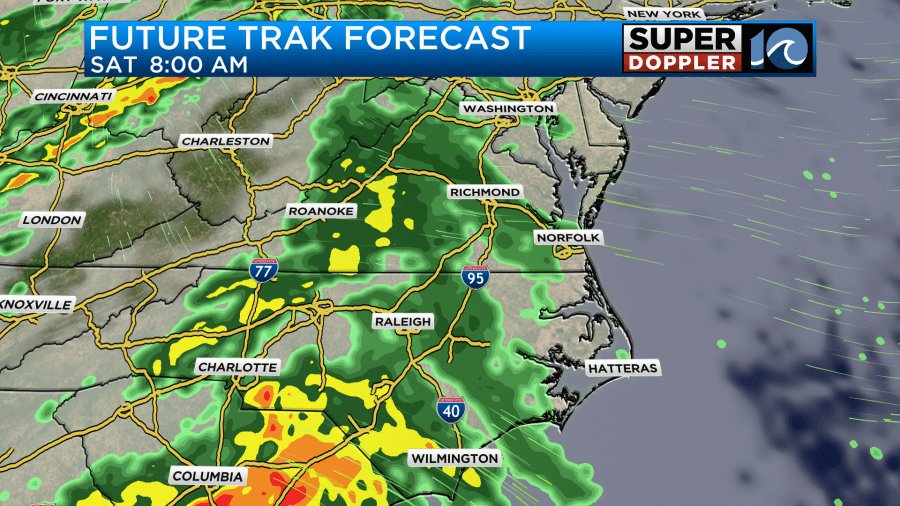

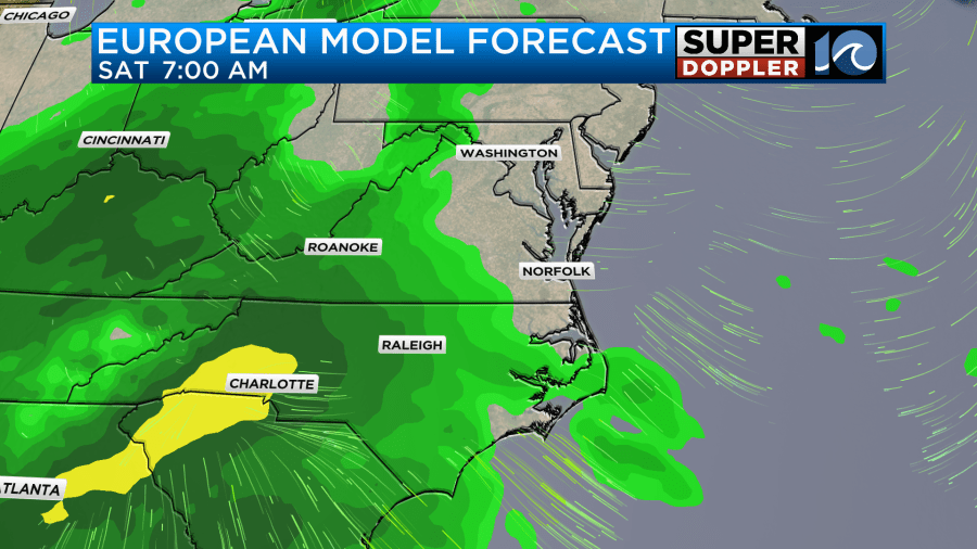
It looks to me like the morning precip will be very light or even more of a drizzle. So that may be why there is a difference. I am calling for some light rain or drizzle Saturday morning with a pickup in the precip during the afternoon. Either way there will be an increasing chance for rain through the day, and it could become briefly heavy.
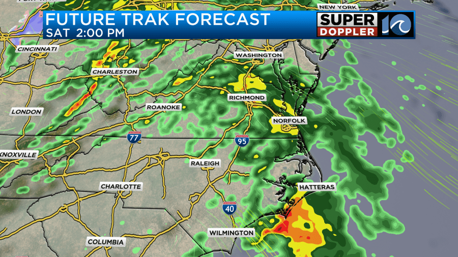
This will be as an area of low pressure slides east through the region. High temps will be near 60 degrees. There will be more scattered showers Saturday night into Sunday morning. Then we will dry out. In fact… We should have a long stretch of dry weather starting on Sunday and lasting through at least the middle of next week. Thank God!
Meteorologist: Jeremy Wheeler


