A cold front moved through the region late yesterday. Before the front arrived the majority of the area reached high temperatures in the 60s, but there were a few 70s. We had a lot of rain in the region, but luckily it didn’t add up to too much in the rain gauges.
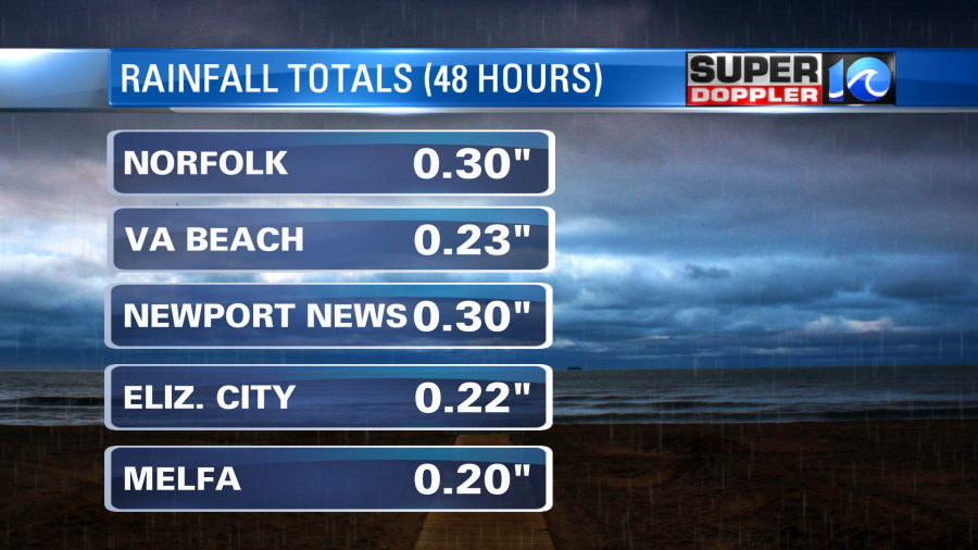
Most of us had about a quarter of an inch. Today we will dry out. However, there are some clouds still hanging over the region this morning. The cold front is well to our south now.
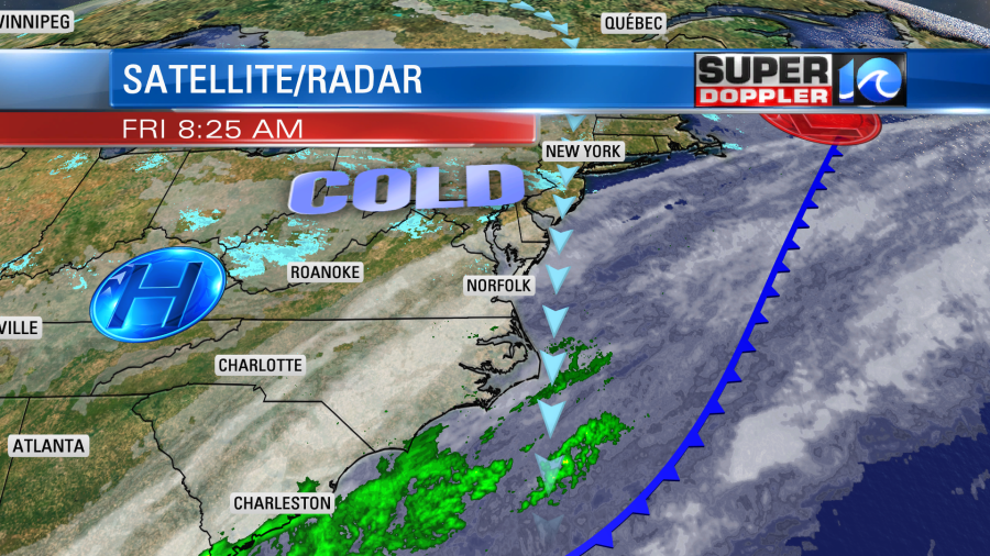
High pressure will gradually build in at the surface. We’ll have a northerly wind through the day. It will run at 5-15mph with higher gusts near the shore. The clouds should break up through the day as drier air moves in near the surface and undercuts the mid-level moisture. High temps will only be able to rise up to the mid 40s this afternoon. It will be chilly for this Valentine’s Day. It will be cold this evening for any dinners on the town. Temps will be falling to the 30s with a north breeze. Then overnight we’ll have mostly clear skies and temps in the 20s. Bring in the potted plants if you put them out recently.
Tomorrow we’ll have fair skies with a northeast wind. It will much colder than our recent mild temperatures. Highs will only be near 40 degrees in the afternoon. Then we’ll be dry and warmer on Sunday. High temps will return to the 50s. Skies will be partly cloudy. We’ll be dry and cool on Monday. Then we’ll warm up on Tuesday to the 60s. However, there will be more clouds and possibly some isolated showers.
Have a good weekend!
Meteorologist: Jeremy Wheeler