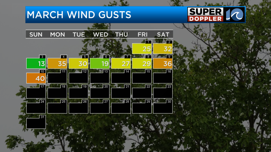
Lately people have been talking about the wind. It has been very wind so far in March, and I feel like February was breezy most of the time as well. Look at how many days recently we had with gusts to 30mph or higher:
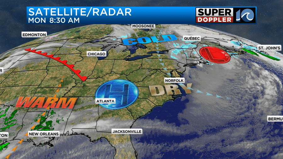
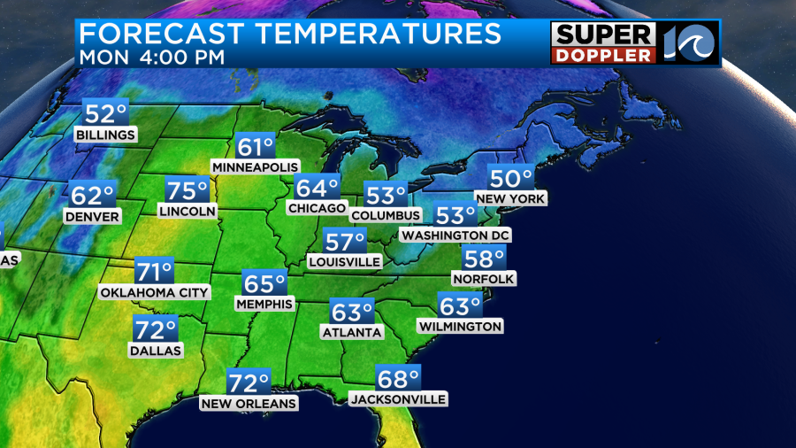
This morning we started off with more windy conditions along with mostly clear skies and chilly temps. There were gusts to 30-35mph near the shore with gusts over 40mph on the Eastern Shore. There were even some gusts to 50mph over Tangier Island. The winds were produced by a strong area of high pressure building in from the west with a strong area of low pressure in the northeast.
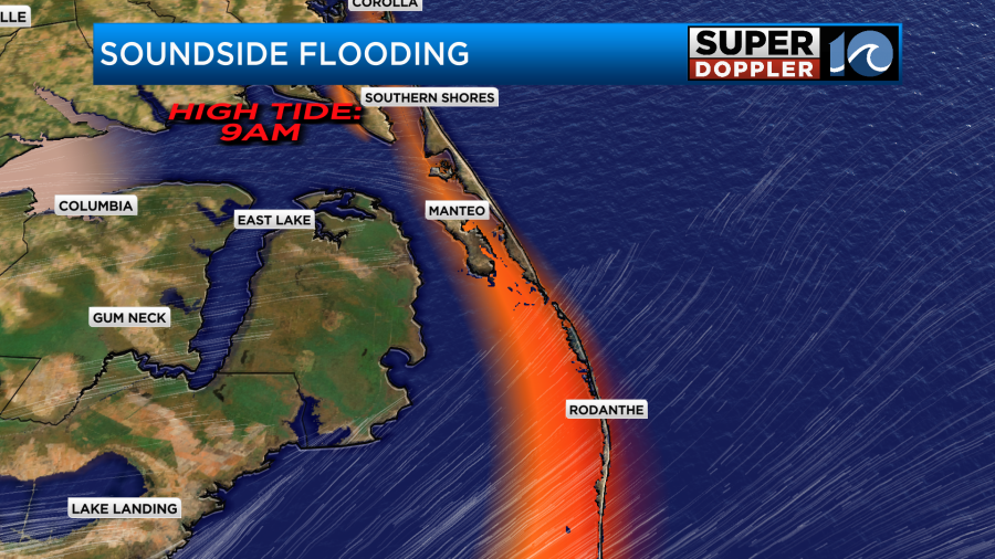
The low in the northeast has created a lot of snow showers, wind, and tidal flooding. We did have some tidal flooding coming from the sound-side of the Outer Banks already. That will continue this morning, but it should subside by the afternoon.
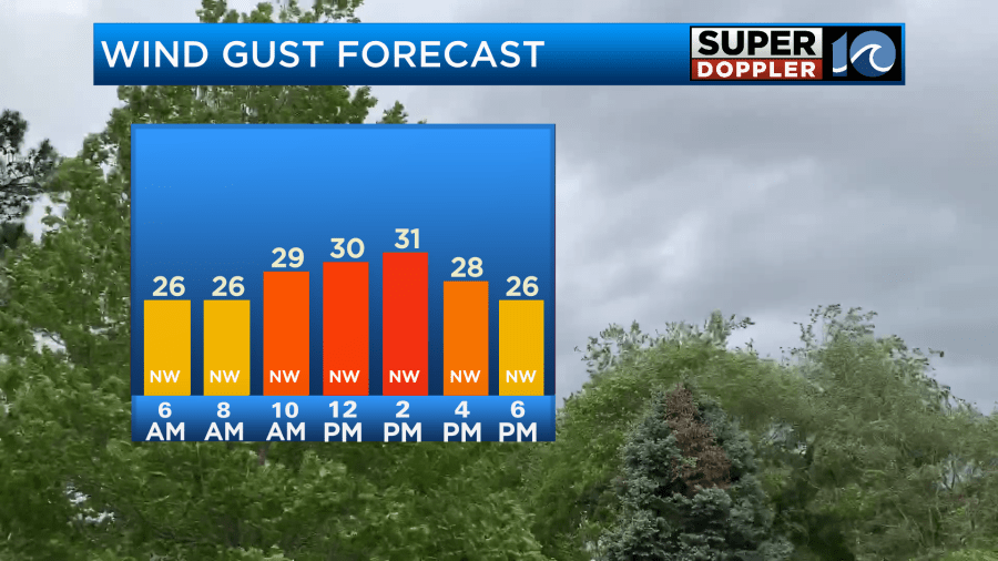
Winds will gust up to around 30mph with higher gusts on the Eastern Shore.
We’ll be sunny or mostly sunny all day. High temps will be able to reach the upper 50 with a few 60s inland and south.
Tonight we’ll have clear skies and light winds. Temps will drop quite a bit. We’ll be in the upper 30s to low 40s in the metro, but we’ll likely drop to the mid 30s inland.
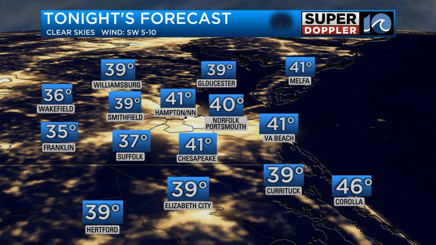
There will probably be some frost in some inland locations. So be sure to bring in the potted plants if you started putting them out. After the morning chill tomorrow we’ll have some awesome weather. Temps will quickly rise under strong sunshine. We’ll only have a light west/southwest wind. So high temps will make it to the upper 60s to near 70 degrees.

We’ll have some awesome weather tomorrow and for the rest of the week. High temps will keep on warming. We’ll be in the upper 70s by Friday.
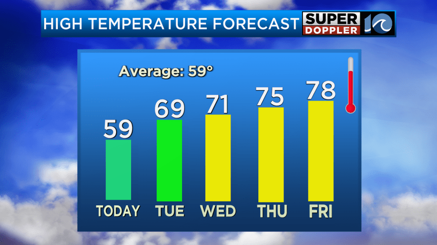
There will be a few late day showers on Friday, but they may wait until the evening. This will be ahead of a cold front that will cool us down next weekend. I’ll talk more about that in tomorrow’s weather blog.
Meteorologist: Jeremy Wheeler


