The quiet weather over the weekend will roll into today. However, pretty soon we are going to be dealing with some breezy conditions and possibly some tidal flooding as well. Let’s talk about it.
High pressure is to our northwest. Meanwhile an area of low pressure has been rolling across the deep south.
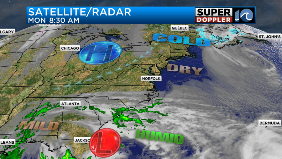
This has been causing some more rain and flooding across the deep south. However, it’s still not nearly as bad as areas along the west coast.
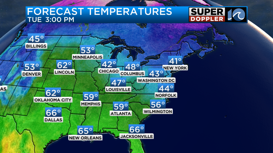
The area of low pressure will move offshore today, and it will start to strengthen. For now high pressure is stronger. So we’ll have lots of sunshine through the day. There will be a light northeast breeze running at 8-12mph (which isn’t bad). High temps will rise to near 50 degrees.

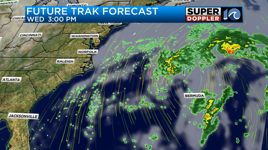
By tomorrow the low will strengthen quite a bit. High pressure will anchor to our northwest.
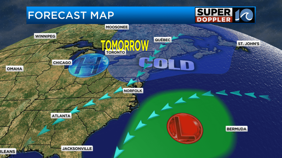
Luckily, the bulk of the rain will stay offshore with the low. Other than a couple of sprinkles, I think we’ll stay dry. However, the difference in pressure (gradient) between the high and the low will create a strong northeast breeze.
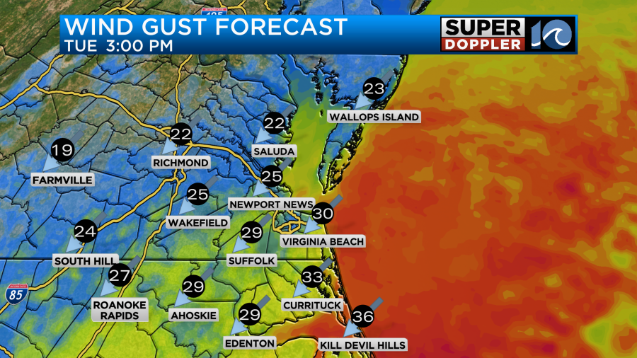
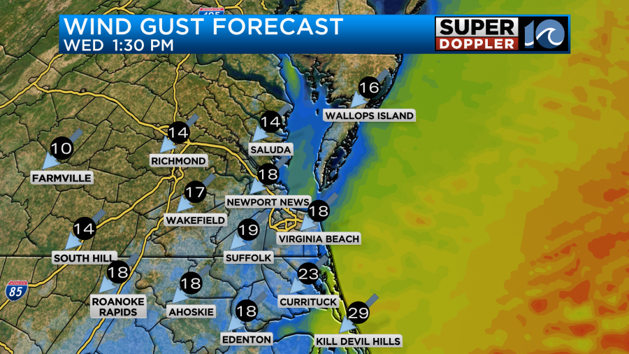
Winds will run at 10-15mph with gusts up to 25mph for most areas. However, there will be some gusts between 30-35mph near the coast. Especially, over the Outer Banks.
We will have some scattered clouds, but there should be enough sun to let us slowly climb out of the 30s into the 40s.
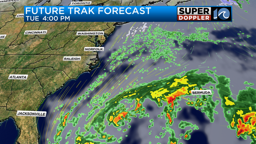
The problem is that the wind will create wind chills in the 20s in the morning and 30s in the afternoon. That will be cold for folks working outside and for kids at the bus stops. By Wednesday the low will move farther out to sea, but it will also be bigger and stronger.
The pressure gradient will still be up between the high and the low. So winds will only slowly taper off through the day.
High temps will be in the 40s again. We’ll have fair skies.
Since the winds will be up for a couple of days out of the northeast we’ll likely have some minor tidal flooding in the region.
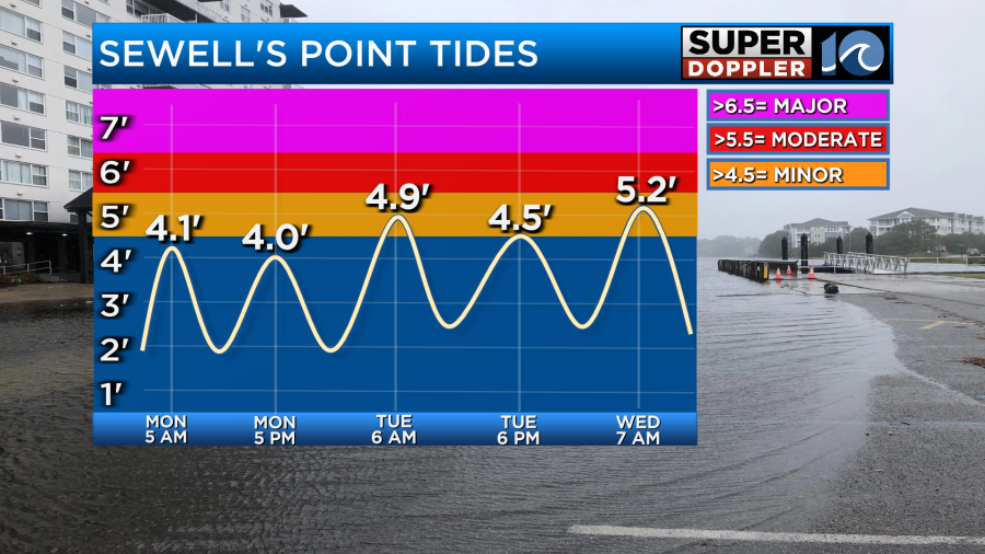
Minor tidal flooding is expected tomorrow morning and Wednesday morning. The Wednesday morning high tide could even reach moderate levels. However, it could also go down a little. My gut says it will drop a bit before we get there, but we’ll see. So check back for updates about that parts of the forecast.
Either way we should have some very nice weather Thursday into the weekend. High temps will be in the 50s on Thursday with lots of sunshine. We’ll be in the 60s Friday and Saturday with partly cloudy skies. I’ll talk more about that time frame in tomorrow’s weather blog.
Meteorologist: Jeremy Wheeler