UPDATE: A tropical storm warning has been issued for our area. Ricky Matthews has the latest updates on midday Thursday.
Today is going to wrap up a recent string of nice days. Enjoy it while you can because the next 2 days are going to be messy.
Today we have high pressure in the region, but it starting to drift to the north. At the same time a weak area of low pressure is forming along a stationary front off the coast of Florida.
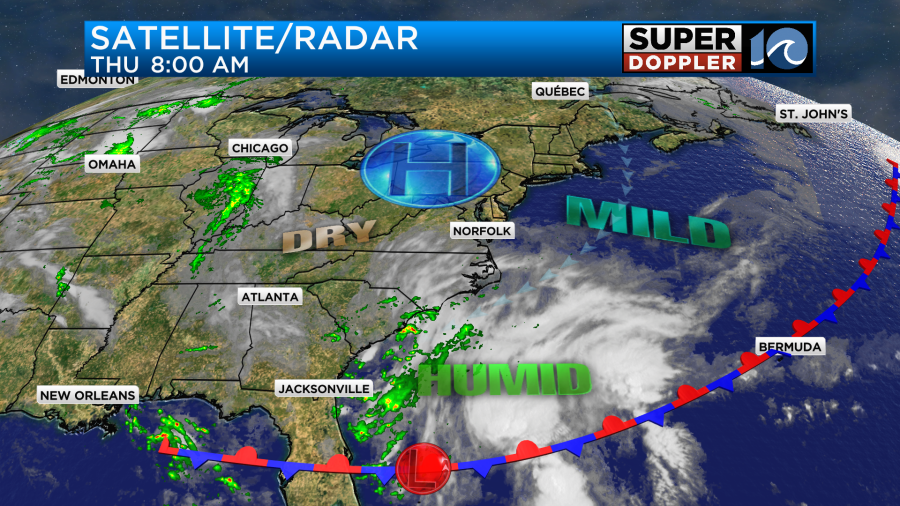
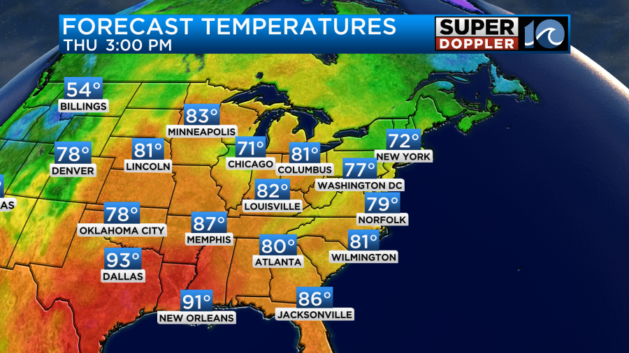
That low will play a big part in our forecast over the next 24-48 hours. In the meantime today we’ll have partly cloudy skies for a while with a little more clouds by the afternoon. I can’t rule out a sprinkle or two later today, but most of us will not see it. We’ll have a light northeast breeze at 8-12mph. High temps will be in the upper 70s to low 80s.
The northeast breeze will maintain the low-moderate humidity. So it should feel pleasant through the day. Tonight we’ll have mostly cloudy skies with a stray shower late. Winds will still be light. However, tomorrow the rain and wind will increase through the day. The area of low pressure will still be to our south, but it will push a lot of moisture up into our region. Also as the low strengthens and slowly moves north it will create a pressure gradient with the high to the north. This will increase the wind.
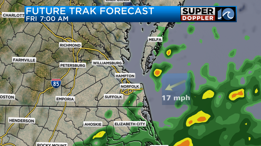
By Friday morning our model already shows a handful of showers in the region.
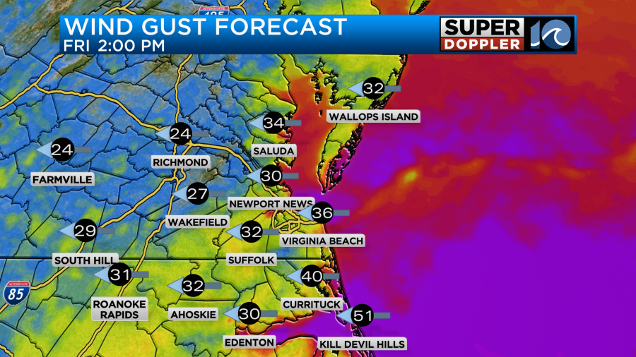
The wind will be a little breezy, but not too bad. By the afternoon the wind gusts could be between 30-35mph near the shore with gusts to 50mph over the Outer Banks.
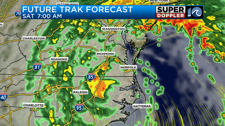
Future Trak has a LOT of rain in the afternoon and evening.
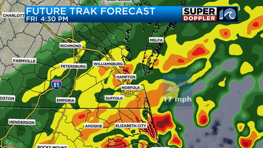
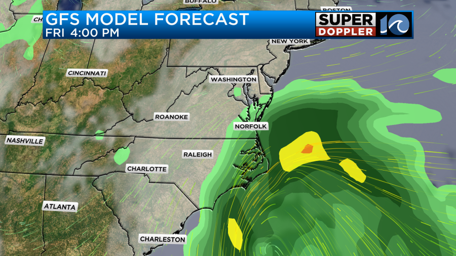
If it’s right, then we could have some flooding just from the heavy rain and isolated thunderstorms. Meanwhile, the GFS model has some rain late Friday, but not nearly as much.
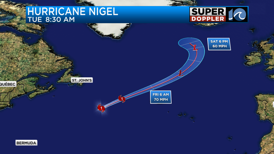
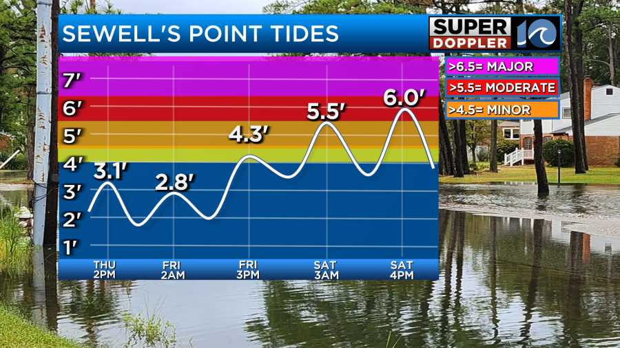
Along with that we may have some nuisance to minor tidal flooding on Friday, but it shouldn’t be too bad. At the same time waves will be increasing along the oceanfront from hurricane Nigel (offshore).
This could create some ocean overwash Friday night into Saturday. The tidal forecast has increased on Saturday. We could possibly see some solid moderate tidal flooding.
This could change though as we get closer. It is not locked in just yet. You can click here for the latest tidal forecasts from the National Weather Service: Tide forecasts.
Even if it were just some minor tidal flooding it could lead to poor drainage. So that will also be a big factor when it comes to the timing of the rain on Saturday. Almost all of the models bring the low through the area on Saturday. However, they really disagree on the timing of the rain. Our Future Trak model has the rain decreasing on Saturday. Take a look at our Future Trak model:
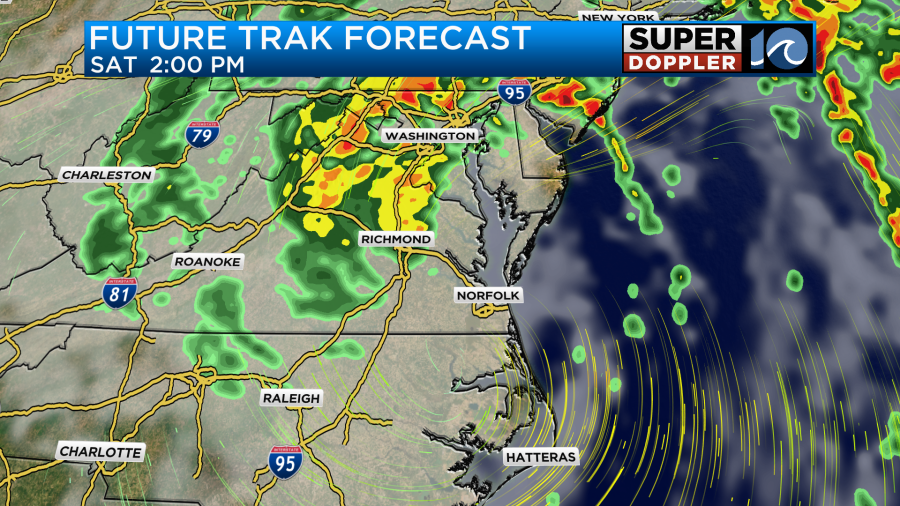
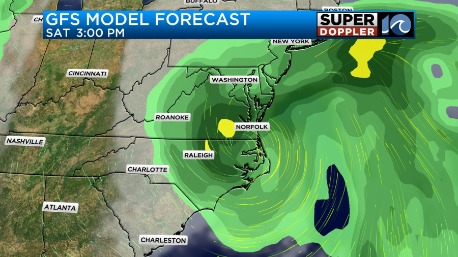
I seems like it has a dry slot, but I think it looks misleading. I think it is hinting at some drizzle or light rain lingering for a while. Meanwhile the GFS model has most of the rain during the day Saturday.
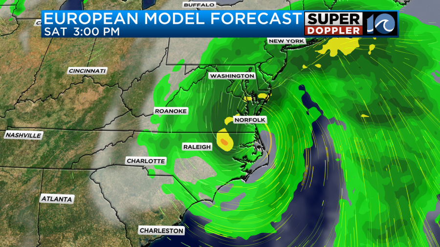
The Euro model is a bit of a blend of the two, but definitely leans toward the GFS model for Saturday’s rain.
So which model is right? Well, here’s a few thoughts on that. First, the initial rain will likely be caused by overunning, and you almost always rush an overunning rain by 2-6 hours. The reason is that it tends to happen in a thin layer at first as the warm/moisture air gets pushed up over a taller/cooler air mass. The higher resolution models do a better job at catching that than the global models like the GFS. So maybe it will be light at first, but we’ll probably have at least some rain Friday morning. The other thought is a question. What type of system will this be? Will be be subtropical with some warm air wrapped into the middle? Or will it be more of a non-tropical low that has more cooler air wrapping into the center? That would allow a lot of light rain and drizzle to surround a large part of the storm. So I am blending the different models for now. I think we’ll have a few scattered showers by Friday morning with an increasing chance through the day. It may not be as heavy as our model shows by the afternoon, but it probably will become heavy by the evening and overnight. I do think we’ll have a lot of rain on Saturday, and more than our model shows. However, there probably will be a decrease in the rain Saturday. At least later in the day. All the models have drying on Sunday after a few early showers, but some linger the rain longer than others. I’ll have more on that in tomorrow’s weather blog. Either way high temps will be cool this weekend. They will be in the low 70s both Friday and Saturday, and they may even be in the upper 60s one of the days if the rain stays heavy. We’ll see. We’ll probably be in the low-mid 70s on Sunday.
I’ve mentioned before that we need some rain. Well…we could get 2-3″ of rain in the region with some spots getting 4-5″.
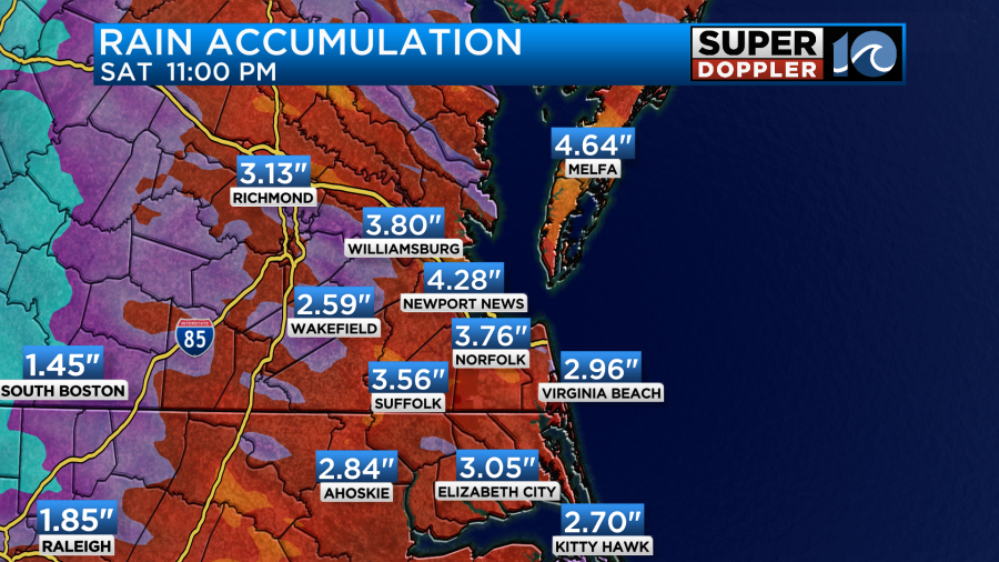
The models are in decent agreement about those amounts.
We are still watching that tropical disturbance in the eastern Atlantic. It is moving generally west, and it has a good chance of forming over the next few days.
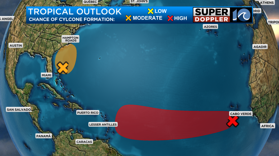
We’ll keep an eye on it. Be sure to check back for updates.
Meteorologist: Jeremy Wheeler